TopoQuest Logo
Do you find TopoQuest useful?
Help keep TopoQuest running and adding new maps/features by donating!
Bitcoin:  19c7KJd3qBynnjoSw5npx9KScwjBe4ifkT
Litecoin:  LXs6TkuXGGXo1vDsWCkWVdjQX94eUKd6ui
Home View Maps Find Maps Find Places Resources & Links


Prosser, Washington Topographic Map

USGS Map Title: Prosser, WA
USGS Map MRC: 46119B7
DRG (GeoTIFF) Download: o46119b7.tif


Neighboring USGS Topographic Map Quads:


  Grandview, WA  
46119C8
 

  Sagebrush Ridge, WA  
46119C7
 

  Snipes Creek, WA  
46119C6
 

  Mabton East, WA  
46119B8
 

  Prosser, WA  
46119B7
 

  Whitstran, WA  
46119B6
 

  Prosser SW, WA  
46119A8
 

  Prosser SE, WA  
46119A7
 

  Lenzie Ranch, WA  
46119A6


Map MRC Location:

N47°
W120°
N47°
W119°
H8 H7 H6 H5 H4 H3 H2 H1
G8 G7 G6 G5 G4 G3 G2 G1
F8 F7 F6 F5 F4 F3 F2 F1
E8 E7 E6 E5 E4 E3 E2 E1
D8 D7 D6 D5 D4 D3 D2 D1
C8 C7 C6 C5 C4 C3 C2 C1
B8 B7 B6 B5 B4 B3 B2 B1
A8 A7 A6 A5 A4 A3 A2 A1
N46°
W120°
N46°
W119°

Prosser, WA USGS 1:24K Topographic Map Preview:
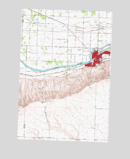
Prosser, WA USGS Topographic Map
Click on map above to begin viewing in our Map Viewer.

This topographic map contains these locations and features:
Feature Name Type Latitude Longitude GNIS ID View Map
ApricotPopulated PlaceN46.2365°W119.8575°1510784View Map
ByronPopulated PlaceN46.1879°W119.8745°1510854View Map
City of ProsserCivilN46.2066°W119.7660°2411497View Map
Farrand ParkParkN46.2037°W119.7764°1531867View Map
Horse Heaven HillsRidgeN46.1332°W119.8678°1513653View Map
KACA-FM (Prosser)TowerN46.1865°W119.7548°1534536View Map
KACA-FM (Prosser)TowerN46.2012°W119.7628°1534537View Map
KARY-AM (Prosser)TowerN46.2340°W119.8148°1534501View Map
KARY-FM (Grandview)TowerN46.2340°W119.8148°1534526View Map
Kinneyville (historical)Populated PlaceN46.2076°W119.7923°1514763View Map
Mabton East LateralCanalN46.1832°W119.8495°1513939View Map
Mabton Feeder LateralCanalN46.2293°W119.8706°1506401View Map
North ProsserPopulated PlaceN46.2321°W119.7684°1511192View Map
ProsserPopulated PlaceN46.2068°W119.7689°1512582View Map
Prosser AirportAirportN46.2125°W119.7920°1533900View Map
Prosser DamDamN46.2132°W119.7728°1532990View Map
Prosser Fire District 3 Station 310BuildingN46.2091°W119.7747°2619717View Map
Prosser Heights Elementary SchoolSchoolN46.2119°W119.7522°1507643View Map
Prosser High SchoolSchoolN46.2037°W119.7663°1515543View Map
Prosser Hospital HeliportAirportN46.2082°W119.7636°1533901View Map
Prosser Memorial HospitalHospitalN46.2081°W119.7641°2625481View Map
Prosser Memorial Hospital Emergency Medical ServicesBuildingN46.2078°W119.7638°2643443View Map
Prosser Police DepartmentBuildingN46.2063°W119.7694°2721964View Map
Prosser Post OfficePost OfficeN46.2042°W119.7704°2781684View Map
Prosser West LateralCanalN46.1926°W119.7928°1510571View Map
Prosser West LateralCanalN46.1932°W119.7898°1507645View Map

Note: Coordinates in the location and feature list above are referenced to NAD83 datum.


Copyright (C) 2008-2025 Ryan Niemi / Sunset Dynamics ... All Rights Reserved