TopoQuest Logo
Do you find TopoQuest useful?
Help keep TopoQuest running and adding new maps/features by donating!
Bitcoin:  19c7KJd3qBynnjoSw5npx9KScwjBe4ifkT
Litecoin:  LXs6TkuXGGXo1vDsWCkWVdjQX94eUKd6ui
Home View Maps Find Maps Find Places Resources & Links


Puddin Mountain, Idaho Topographic Map

USGS Map Title: Puddin Mountain, ID
USGS Map MRC: 45114A6
DRG (GeoTIFF) Download: o45114a6.tif


Neighboring USGS Topographic Map Quads:


  Papoose Peak, ID  
45114B7
 

  Aggipah Mountain, ID  
45114B6
 

  Mount McGuire, ID  
45114B5
 

  Dave Lewis Peak, ID  
45114A7
 

  Puddin Mountain, ID  
45114A6
 

  Hoodoo Meadows, ID  
45114A5
 

  Bear Creek Point, ID  
44114H7
 

  Aparejo Point, ID  
44114H6
 

  Yellowjacket, ID  
44114H5


Map MRC Location:

N46°
W115°
N46°
W114°
H8 H7 H6 H5 H4 H3 H2 H1
G8 G7 G6 G5 G4 G3 G2 G1
F8 F7 F6 F5 F4 F3 F2 F1
E8 E7 E6 E5 E4 E3 E2 E1
D8 D7 D6 D5 D4 D3 D2 D1
C8 C7 C6 C5 C4 C3 C2 C1
B8 B7 B6 B5 B4 B3 B2 B1
A8 A7 A6 A5 A4 A3 A2 A1
N45°
W115°
N45°
W114°

Puddin Mountain, ID USGS 1:24K Topographic Map Preview:
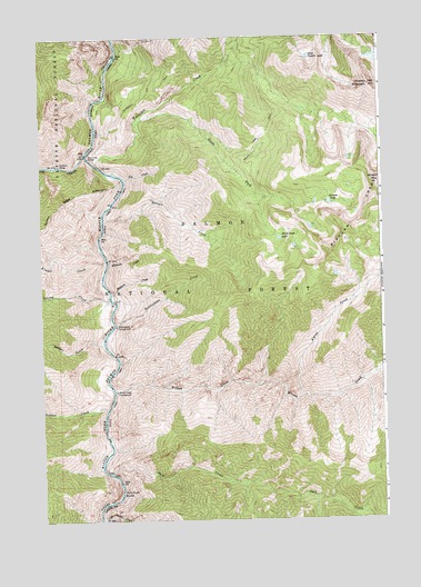
Puddin Mountain, ID USGS Topographic Map
Click on map above to begin viewing in our Map Viewer.

This topographic map contains these locations and features:
Feature Name Type Latitude Longitude GNIS ID View Map
Alpine CreekStreamN45.0316°W114.6551°376571View Map
Big CreekStreamN45.0957°W114.7165°377483View Map
Big Creek BridgeBridgeN45.0952°W114.7143°377487View Map
Bighorn BridgeBridgeN45.0927°W114.7354°377618View Map
Bobtail CreekStreamN45.0780°W114.7062°377981View Map
Elk Bar CampgroundLocaleN45.1205°W114.7229°394560View Map
Fox CreekStreamN45.0905°W114.6831°381989View Map
Idaho Primitive AreaParkN45.0482°W114.6390°399497View Map
Jack CreekStreamN45.0121°W114.7252°383800View Map
Jack Creek RapidsRapidsN45.0066°W114.7222°383807View Map
Kimmel CreekStreamN45.0669°W114.7076°384225View Map
Plateau LakeLakeN45.0820°W114.6443°388599View Map
Rattlesnake CreekStreamN45.0491°W114.7051°389139View Map
Rattlesnake Creek CampgroundLocaleN45.0482°W114.7045°389151View Map
Sammy GulchValleyN45.0438°W114.7129°389877View Map
Soldier CreekStreamN45.0257°W114.7148°390821View Map
South Fork LakeLakeN45.0728°W114.6628°390962View Map
South Fork TrailTrailN45.1060°W114.6448°391046View Map
South Fork Waterfall CreekStreamN45.1063°W114.6773°391051View Map
Survey CreekStreamN45.0560°W114.7073°391687View Map
Survey Creek CampgroundLocaleN45.0552°W114.7251°394564View Map
Waterfall CreekStreamN45.0924°W114.7298°392941View Map
Waterfall Creek BridgeBridgeN45.0927°W114.7298°394559View Map
West Puddin LakeLakeN45.1198°W114.6510°375833View Map
Williams CreekStreamN45.0666°W114.7059°393460View Map
Wilson CreekStreamN45.0332°W114.7243°393547View Map
Wilson Creek CampgroundLocaleN45.0305°W114.7081°400367View Map
Wilson MountainSummitN45.0880°W114.6251°397313View Map
Woolard CreekStreamN45.0574°W114.7054°393692View Map

Note: Coordinates in the location and feature list above are referenced to NAD83 datum.


Copyright (C) 2008-2025 Ryan Niemi / Sunset Dynamics ... All Rights Reserved