TopoQuest Logo
Do you find TopoQuest useful?
Help keep TopoQuest running and adding new maps/features by donating!
Bitcoin:  19c7KJd3qBynnjoSw5npx9KScwjBe4ifkT
Litecoin:  LXs6TkuXGGXo1vDsWCkWVdjQX94eUKd6ui
Home View Maps Find Maps Find Places Resources & Links


Pukwana NE, South Dakota Topographic Map

USGS Map Title: Pukwana NE, SD
USGS Map MRC: 43099H1
DRG (GeoTIFF) Download: o43099h1.tif


Neighboring USGS Topographic Map Quads:


  North of Shelby, SD  
44099A2
 

  Dry Run, SD  
44099A1
 

  Gannvalley, SD  
44098A8
 

  Shelby, SD  
43099H2
 

  Pukwana NE, SD  
43099H1


  Pukwana, SD  
43099G2
 

  Pukwana SE, SD  
43099G1


Map MRC Location:

N44°
W100°
N44°
W99°
H8 H7 H6 H5 H4 H3 H2 H1
G8 G7 G6 G5 G4 G3 G2 G1
F8 F7 F6 F5 F4 F3 F2 F1
E8 E7 E6 E5 E4 E3 E2 E1
D8 D7 D6 D5 D4 D3 D2 D1
C8 C7 C6 C5 C4 C3 C2 C1
B8 B7 B6 B5 B4 B3 B2 B1
A8 A7 A6 A5 A4 A3 A2 A1
N43°
W100°
N43°
W99°

Pukwana NE, SD USGS 1:24K Topographic Map Preview:
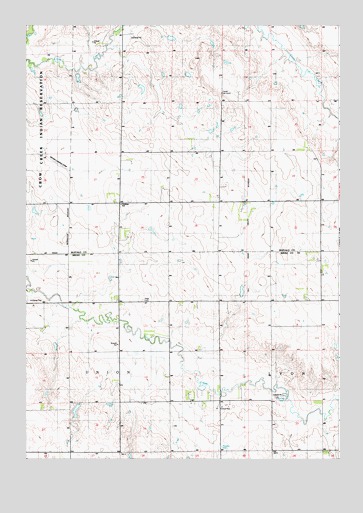
Pukwana NE, SD USGS Topographic Map
Click on map above to begin viewing in our Map Viewer.

This topographic map contains these locations and features:
Feature Name Type Latitude Longitude GNIS ID View Map
Beal DamDamN43.9417°W99.0754°1259130View Map
Chmela DamDamN43.9883°W99.0654°1259135View Map
Estherdale (historical)LocaleN43.9972°W99.0837°1263306View Map
Gruenig DamDamN43.9283°W99.1070°1259148View Map
Kovanda SchoolSchoolN43.8775°W99.0668°1255974View Map
Mayer Landing Strip (historical)AirportN43.9603°W99.1129°1266631View Map
Pershing SchoolSchoolN43.9483°W99.0870°1266553View Map
Prairie Belle SchoolSchoolN43.9631°W99.0279°1257193View Map
Robinson School (historical)SchoolN43.9494°W99.0484°1263307View Map
Sladek DamDamN43.8767°W99.0804°1263177View Map
Township of El DoradoCivilN43.9861°W99.0170°1267993View Map
Township of PershingCivilN43.9861°W99.0170°1267992View Map
Township of UnionCivilN43.8909°W99.1073°1268184View Map
Unorganized Territory of Southeast BuffaloCivilN43.9778°W99.0169°1267571View Map
Vega CemeteryCemeteryN43.9208°W99.0787°1258739View Map
Vega SchoolSchoolN43.9125°W99.0890°1258740View Map
Victory SchoolSchoolN43.9622°W99.0887°1258752View Map
Wells DamDamN43.8900°W99.1020°1260120View Map

Note: Coordinates in the location and feature list above are referenced to NAD83 datum.


Copyright (C) 2008-2025 Ryan Niemi / Sunset Dynamics ... All Rights Reserved