TopoQuest Logo
Do you find TopoQuest useful?
Help keep TopoQuest running and adding new maps/features by donating!
Bitcoin:  19c7KJd3qBynnjoSw5npx9KScwjBe4ifkT
Litecoin:  LXs6TkuXGGXo1vDsWCkWVdjQX94eUKd6ui
Home View Maps Find Maps Find Places Resources & Links


Purdy Hill, Texas Topographic Map

USGS Map Title: Purdy Hill, TX
USGS Map MRC: 30099G2
DRG (GeoTIFF) Download: o30099g2.tif


Neighboring USGS Topographic Map Quads:


  Katemcy, TX  
30099H3
 

  Spice Rock, TX  
30099H2
 

  Fredonia, TX  
30099H1
 

  Grit, TX  
30099G3
 

  Purdy Hill, TX  
30099G2
 

  Fly Gap, TX  
30099G1
 

  Turtle Creek, TX  
30099F3
 

  Mason, TX  
30099F2
 

  Art, TX  
30099F1


Map MRC Location:

N31°
W100°
N31°
W99°
H8 H7 H6 H5 H4 H3 H2 H1
G8 G7 G6 G5 G4 G3 G2 G1
F8 F7 F6 F5 F4 F3 F2 F1
E8 E7 E6 E5 E4 E3 E2 E1
D8 D7 D6 D5 D4 D3 D2 D1
C8 C7 C6 C5 C4 C3 C2 C1
B8 B7 B6 B5 B4 B3 B2 B1
A8 A7 A6 A5 A4 A3 A2 A1
N30°
W100°
N30°
W99°

Purdy Hill, TX USGS 1:24K Topographic Map Preview:
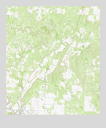
Purdy Hill, TX USGS Topographic Map
Click on map above to begin viewing in our Map Viewer.

This topographic map contains these locations and features:
Feature Name Type Latitude Longitude GNIS ID View Map
Behrens CemeteryCemeteryN30.8049°W99.2048°1351804View Map
Bullhead TankReservoirN30.8575°W99.1678°1353287View Map
Crosby CemeteryCemeteryN30.7580°W99.2431°1355394View Map
Dog BranchStreamN30.7766°W99.1320°1356114View Map
Ellison CemeteryCemeteryN30.8202°W99.1498°1356935View Map
Gamel SpringSpringN30.7585°W99.2420°1998450View Map
Jones CemeteryCemeteryN30.8035°W99.1956°1360383View Map
Koocks BranchStreamN30.7527°W99.2317°1360747View Map
Little Willow CreekStreamN30.7524°W99.1292°1361503View Map
Mason Historic DistrictLocaleN30.7549°W99.2251°2031971View Map
Mason Mountain Wildlife Management AreaParkN30.8449°W99.2134°2029829View Map
Mitchell CreekStreamN30.8241°W99.1487°1362993View Map
New Gooch CemeteryCemeteryN30.7535°W99.2209°1363713View Map
Old Gooch CemeteryCemeteryN30.7541°W99.2223°1364425View Map
Polk CemeteryCemeteryN30.8238°W99.1581°1365542View Map
Purdy HillSummitN30.8268°W99.2053°1365863View Map
Reynolds-Seaquist HouseBuildingN30.7527°W99.2328°2031671View Map
Vater CemeteryCemeteryN30.7510°W99.1564°1370604View Map
West Comanche CreekStreamN30.7641°W99.2356°1371098View Map

Note: Coordinates in the location and feature list above are referenced to NAD83 datum.


Copyright (C) 2008-2025 Ryan Niemi / Sunset Dynamics ... All Rights Reserved