TopoQuest Logo
Do you find TopoQuest useful?
Help keep TopoQuest running and adding new maps/features by donating!
Bitcoin:  19c7KJd3qBynnjoSw5npx9KScwjBe4ifkT
Litecoin:  LXs6TkuXGGXo1vDsWCkWVdjQX94eUKd6ui
Home View Maps Find Maps Find Places Resources & Links


Pyote East, Texas Topographic Map

USGS Map Title: Pyote East, TX
USGS Map MRC: 31103E1
DRG (GeoTIFF) Download: o31103e1.tif


Neighboring USGS Topographic Map Quads:


  Wink South, TX  
31103F2
 

  Pyote NE, TX  
31103F1
 

  China Ranch, TX  
31102F8
 

  Pyote West, TX  
31103E2
 

  Pyote East, TX  
31103E1
 

  Monahans, TX  
31102E8
 

  China Lake, TX  
31103D2
 

  China Lake NE, TX  
31103D1
 

  7 L Ranch, TX  
31102D8


Map MRC Location:

N32°
W104°
N32°
W103°
H8 H7 H6 H5 H4 H3 H2 H1
G8 G7 G6 G5 G4 G3 G2 G1
F8 F7 F6 F5 F4 F3 F2 F1
E8 E7 E6 E5 E4 E3 E2 E1
D8 D7 D6 D5 D4 D3 D2 D1
C8 C7 C6 C5 C4 C3 C2 C1
B8 B7 B6 B5 B4 B3 B2 B1
A8 A7 A6 A5 A4 A3 A2 A1
N31°
W104°
N31°
W103°

Pyote East, TX USGS 1:24K Topographic Map Preview:
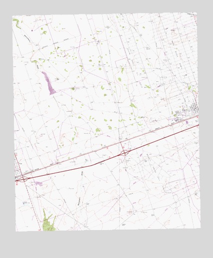
Pyote East, TX USGS Topographic Map
Click on map above to begin viewing in our Map Viewer.

This topographic map contains these locations and features:
Feature Name Type Latitude Longitude GNIS ID View Map
Bull WellWellN31.5082°W103.0318°1353273View Map
East WellWellN31.5207°W103.0029°1356735View Map
East WellWellN31.5468°W103.0479°1356736View Map
Gensler Elementary SchoolSchoolN31.5696°W103.0040°2009595View Map
Half h WindmillLocaleN31.5824°W103.0854°1358646View Map
Monument PondReservoirN31.5844°W103.1009°1864251View Map
Monument Pond DamDamN31.5785°W103.0988°1864250View Map
North WellWellN31.5399°W103.0379°1364167View Map
North WindmillLocaleN31.6174°W103.0596°1364188View Map
Pyote Post OfficePost OfficeN31.5349°W103.1215°2731905View Map
Recorder WindmillLocaleN31.6051°W103.0352°1366095View Map
Sand WellWellN31.5401°W103.0760°1367657View Map
South Sealy Oil FieldOilfieldN31.5943°W103.0429°1368767View Map
Tie RanchLocaleN31.6151°W103.0154°1369925View Map
Town of PyoteCivilN31.5381°W103.1225°2412514View Map
Town of WickettCivilN31.5673°W103.0059°2413485View Map
Ward CountyCivilN31.5095°W103.1024°1384023View Map
West WellWellN31.5404°W103.0757°1371261View Map
WickettPopulated PlaceN31.5701°W103.0010°1371487View Map
Wickett City HallBuildingN31.5693°W103.0011°2753335View Map
Wickett City Marshal's OfficeBuildingN31.5693°W103.0011°2750240View Map
Wickett Post OfficePost OfficeN31.5694°W103.0009°2731259View Map
Wickett South Oil FieldOilfieldN31.5315°W103.0293°1371488View Map
Wickett Volunteer Fire DepartmentBuildingN31.5690°W103.0008°2552119View Map

Note: Coordinates in the location and feature list above are referenced to NAD83 datum.


Copyright (C) 2008-2025 Ryan Niemi / Sunset Dynamics ... All Rights Reserved