TopoQuest Logo
Do you find TopoQuest useful?
Help keep TopoQuest running and adding new maps/features by donating!
Bitcoin:  19c7KJd3qBynnjoSw5npx9KScwjBe4ifkT
Litecoin:  LXs6TkuXGGXo1vDsWCkWVdjQX94eUKd6ui
Home View Maps Find Maps Find Places Resources & Links


Pyramid SW, Nevada Topographic Map

USGS Map Title: Pyramid SW, NV
USGS Map MRC: 40119A6
DRG (GeoTIFF) Download: o40119a6.tif


Neighboring USGS Topographic Map Quads:


  Astor Pass, NV  
40119B7
 

  The Needle Rocks, NV  
40119B6
 

  Pyramid NE, NV  
40119B5
 

  Spanish Flat, NV  
40119A7
 

  Pyramid SW, NV  
40119A6


  Dogskin Mountain, NV  
39119H7
 

  Tule Peak, NV  
39119H6
 

  Sutcliffe, NV  
39119H5


Map MRC Location:

N41°
W120°
N41°
W119°
H8 H7 H6 H5 H4 H3 H2 H1
G8 G7 G6 G5 G4 G3 G2 G1
F8 F7 F6 F5 F4 F3 F2 F1
E8 E7 E6 E5 E4 E3 E2 E1
D8 D7 D6 D5 D4 D3 D2 D1
C8 C7 C6 C5 C4 C3 C2 C1
B8 B7 B6 B5 B4 B3 B2 B1
A8 A7 A6 A5 A4 A3 A2 A1
N40°
W120°
N40°
W119°

Pyramid SW, NV USGS 1:24K Topographic Map Preview:
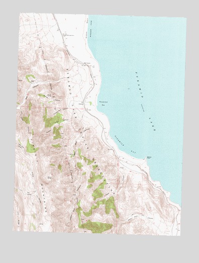
Pyramid SW, NV USGS Topographic Map
Click on map above to begin viewing in our Map Viewer.

This topographic map contains these locations and features:
Feature Name Type Latitude Longitude GNIS ID View Map
Barrel SpringSpringN40.0775°W119.7284°838611View Map
Big CanyonLocaleN40.0963°W119.7016°838720View Map
Big CanyonValleyN40.0880°W119.7107°847151View Map
Big Canyon RanchLocaleN40.0849°W119.7410°838724View Map
Bristol (historical)LocaleN40.0407°W119.6685°846164View Map
George Washington RockPillarN40.1127°W119.7188°840630View Map
Hornet CanyonValleyN40.0444°W119.7082°846177View Map
Hornet SpringSpringN40.0309°W119.7232°841067View Map
Jigger Bobb CanyonValleyN40.0585°W119.6880°845194View Map
Left Hand CanyonValleyN40.0719°W119.7485°841605View Map
Little ValleyValleyN40.0416°W119.7391°841739View Map
Ninemile BayBayN40.0494°W119.6685°842476View Map
Poison CanyonValleyN40.0741°W119.7016°842902View Map
PyramidPopulated PlaceN40.0749°W119.7019°843007View Map
Pyramid Post Office (historical)Post OfficeN40.0749°W119.7019°864389View Map
Sharps CanyonValleyN40.0760°W119.7021°843606View Map
Thunderbolt BayBayN40.0744°W119.6874°844311View Map
Thunderbolt CanyonValleyN40.0741°W119.7016°844312View Map
Warrior PointCapeN40.0444°W119.6535°844651View Map
Water Hole CanyonValleyN40.0052°W119.6324°847218View Map
Wizards BeachBeachN40.1191°W119.7013°845012View Map
Wizards CoveBayN40.1241°W119.6957°845013View Map
Wood CanyonValleyN40.0405°W119.6674°845023View Map

Note: Coordinates in the location and feature list above are referenced to NAD83 datum.


Copyright (C) 2008-2024 Ryan Niemi / Sunset Dynamics ... All Rights Reserved