TopoQuest Logo
Do you find TopoQuest useful?
Help keep TopoQuest running and adding new maps/features by donating!
Bitcoin:  19c7KJd3qBynnjoSw5npx9KScwjBe4ifkT
Litecoin:  LXs6TkuXGGXo1vDsWCkWVdjQX94eUKd6ui
Home View Maps Find Maps Find Places Resources & Links


Quinton, Oregon Topographic Map

USGS Map Title: Quinton, OR
USGS Map MRC: 45120F5
DRG (GeoTIFF) Download: o45120f5.tif


Neighboring USGS Topographic Map Quads:


  Luna Butte, WA  
45120G6
 

  Luna Gulch, WA  
45120G5
 

  Goodnoe Hills, WA  
45120G4
 

  Rufus, OR  
45120F6
 

  Quinton, OR  
45120F5
 

  Sundale NW, OR  
45120F4
 

  Wasco, OR  
45120E6
 

  Klondike, OR  
45120E5
 

  McDonald, OR  
45120E4


Map MRC Location:

N46°
W121°
N46°
W120°
H8 H7 H6 H5 H4 H3 H2 H1
G8 G7 G6 G5 G4 G3 G2 G1
F8 F7 F6 F5 F4 F3 F2 F1
E8 E7 E6 E5 E4 E3 E2 E1
D8 D7 D6 D5 D4 D3 D2 D1
C8 C7 C6 C5 C4 C3 C2 C1
B8 B7 B6 B5 B4 B3 B2 B1
A8 A7 A6 A5 A4 A3 A2 A1
N45°
W121°
N45°
W120°

Quinton, OR USGS 1:24K Topographic Map Preview:
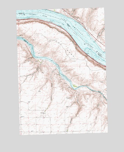
Quinton, OR USGS Topographic Map
Click on map above to begin viewing in our Map Viewer.

This topographic map contains these locations and features:
Feature Name Type Latitude Longitude GNIS ID View Map
Albert Philippi ParkParkN45.7057°W120.5992°1116801View Map
Biglow CanyonValleyN45.6904°W120.5723°1117691View Map
Biglow Post Office (historical)Post OfficeN45.6429°W120.5928°1164918View Map
Box CanyonValleyN45.7026°W120.6042°1118005View Map
Draper CanyonValleyN45.6637°W120.5106°1120076View Map
Early (historical)Populated PlaceN45.6929°W120.5698°1136937View Map
Early Post Office (historical)Post OfficeN45.6929°W120.5698°1165192View Map
Emigrant (historical)LocaleN45.6276°W120.5512°1129776View Map
Emigrant CanyonValleyN45.6696°W120.5409°1120498View Map
Fox CanyonValleyN45.6993°W120.5903°1120934View Map
GoodnoePopulated PlaceN45.7160°W120.5139°1510998View Map
Goodnoe Treaty Fishing Access SiteReserveN45.7162°W120.5148°2434180View Map
Hook (historical)LocaleN45.7360°W120.5762°1167729View Map
Indian Rapids (historical)RapidsN45.7429°W120.6178°1163980View Map
J U CanyonValleyN45.7412°W120.5492°1505770View Map
NarrowsValleyN45.6615°W120.5059°1160614View Map
Pasture Point Treaty Fishing Access SiteReserveN45.7067°W120.5010°2434187View Map
Philippi Park MarinaHarborN45.7067°W120.6013°2700144View Map
Quinook Post Office (historical)Post OfficeN45.6935°W120.5103°1164622View Map
QuintonLocaleN45.7043°W120.5284°1158565View Map
Sand Spring CanyonValleyN45.7171°W120.5153°1508097View Map
Squally Hook RapidsRapidsN45.7318°W120.5553°1163981View Map
The NookRidgeN45.7123°W120.5576°1127989View Map
Tumwater FallsFallsN45.6585°W120.5027°1160615View Map

Note: Coordinates in the location and feature list above are referenced to NAD83 datum.


Copyright (C) 2008-2024 Ryan Niemi / Sunset Dynamics ... All Rights Reserved