TopoQuest Logo
Do you find TopoQuest useful?
Help keep TopoQuest running and adding new maps/features by donating!
Bitcoin:  19c7KJd3qBynnjoSw5npx9KScwjBe4ifkT
Litecoin:  LXs6TkuXGGXo1vDsWCkWVdjQX94eUKd6ui
Home View Maps Find Maps Find Places Resources & Links


Radium, Colorado Topographic Map

USGS Map Title: Radium, CO
USGS Map MRC: 39106H5
DRG (GeoTIFF) Download: o39106h5.tif


Neighboring USGS Topographic Map Quads:


  Lynx Pass, CO  
40106A6
 

  Gore Pass, CO  
40106A5
 

  Kremmling, CO  
40106A4
 

  McCoy, CO  
39106H6
 

  Radium, CO  
39106H5
 

  Sheephorn Mountain, CO  
39106H4
 

  State Bridge, CO  
39106G6
 

  Lava Creek, CO  
39106G5
 

  Piney Peak, CO  
39106G4


Map MRC Location:

N40°
W107°
N40°
W106°
H8 H7 H6 H5 H4 H3 H2 H1
G8 G7 G6 G5 G4 G3 G2 G1
F8 F7 F6 F5 F4 F3 F2 F1
E8 E7 E6 E5 E4 E3 E2 E1
D8 D7 D6 D5 D4 D3 D2 D1
C8 C7 C6 C5 C4 C3 C2 C1
B8 B7 B6 B5 B4 B3 B2 B1
A8 A7 A6 A5 A4 A3 A2 A1
N39°
W107°
N39°
W106°

Radium, CO USGS 1:24K Topographic Map Preview:
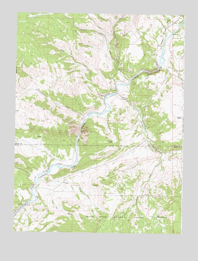
Radium, CO USGS Topographic Map
Click on map above to begin viewing in our Map Viewer.

This topographic map contains these locations and features:
Feature Name Type Latitude Longitude GNIS ID View Map
AzureLocaleN39.9955°W106.5081°175761View Map
Beaver CreekStreamN39.9925°W106.5531°173167View Map
Blacktail CreekStreamN39.9628°W106.5395°173136View Map
Champion MineMineN39.9305°W106.5342°181051View Map
Corduroy CanyonValleyN39.9627°W106.5008°1947618View Map
Cottonwood CreekStreamN39.9214°W106.5156°175767View Map
Dry Gulch SpringSpringN39.9269°W106.5525°175762View Map
East Saint Louis MineMineN39.9803°W106.5648°181094View Map
French CreekStreamN39.9964°W106.5498°173135View Map
Garden GulchValleyN39.9042°W106.5978°197260View Map
Harrman GulchValleyN39.9627°W106.5011°1947619View Map
Little Blacktail CreekStreamN39.9742°W106.5500°173166View Map
Little Cottonwood ReservoirReservoirN39.8847°W106.5195°175766View Map
McPhee GulchValleyN39.9065°W106.6060°175768View Map
Mitchell MineMineN39.9669°W106.5428°1735669View Map
No Name MineMineN39.9469°W106.5173°1684170View Map
RadiumLocaleN39.9528°W106.5586°175763View Map
Rancho Del RioLocaleN39.8942°W106.6075°175769View Map
Red GorgeValleyN39.9178°W106.5782°175760View Map
Red Gorge MineMineN39.9761°W106.5589°1684171View Map
Rock Gap DamDamN39.9467°W106.5006°199422View Map
Rock Gap Dam ReservoirReservoirN39.9467°W106.5006°199423View Map
Rock Hat ClaimMineN39.8992°W106.6136°1735883View Map
Sheep CreekStreamN39.9519°W106.5581°175765View Map
Sheephorn CemeteryCemeteryN39.9301°W106.5256°1947617View Map
Sheephorn CreekStreamN39.9547°W106.5503°175759View Map
Trail CreekStreamN39.9419°W106.5709°175764View Map
YarmonyLocaleN39.8894°W106.6198°202322View Map
Yarmony CreekStreamN39.9419°W106.5709°1947630View Map

Note: Coordinates in the location and feature list above are referenced to NAD83 datum.


Copyright (C) 2008-2025 Ryan Niemi / Sunset Dynamics ... All Rights Reserved