TopoQuest Logo
Do you find TopoQuest useful?
Help keep TopoQuest running and adding new maps/features by donating!
Bitcoin:  19c7KJd3qBynnjoSw5npx9KScwjBe4ifkT
Litecoin:  LXs6TkuXGGXo1vDsWCkWVdjQX94eUKd6ui
Home View Maps Find Maps Find Places Resources & Links


Rainbow Falls, Washington Topographic Map

USGS Map Title: Rainbow Falls, WA
USGS Map MRC: 46123F2
DRG (GeoTIFF) Download: o46123f2.tif


Neighboring USGS Topographic Map Quads:


  Cedarville, WA  
46123G3
 

  Oakville, WA  
46123G2
 

  Rochester, WA  
46123G1
 

  Doty, WA  
46123F3
 

  Rainbow Falls, WA  
46123F2
 

  Adna, WA  
46123F1
 

  Pe Ell, WA  
46123E3
 

  Boistfort, WA  
46123E2
 

  Curtis, WA  
46123E1


Map MRC Location:

N47°
W124°
N47°
W123°
H8 H7 H6 H5 H4 H3 H2 H1
G8 G7 G6 G5 G4 G3 G2 G1
F8 F7 F6 F5 F4 F3 F2 F1
E8 E7 E6 E5 E4 E3 E2 E1
D8 D7 D6 D5 D4 D3 D2 D1
C8 C7 C6 C5 C4 C3 C2 C1
B8 B7 B6 B5 B4 B3 B2 B1
A8 A7 A6 A5 A4 A3 A2 A1
N46°
W124°
N46°
W123°

Rainbow Falls, WA USGS 1:24K Topographic Map Preview:
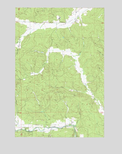
Rainbow Falls, WA USGS Topographic Map
Click on map above to begin viewing in our Map Viewer.

This topographic map contains these locations and features:
Feature Name Type Latitude Longitude GNIS ID View Map
Bunker DivisionCivilN46.7043°W123.2026°1939460View Map
Dell CreekStreamN46.6345°W123.2068°1504435View Map
Garret CreekStreamN46.6362°W123.1724°1505088View Map
Hope CreekStreamN46.6337°W123.1901°1505597View Map
Lewis County Fire District 12 Riverside Fire Authority Station 6BuildingN46.7358°W123.2067°2643261View Map
Lewis County Fire District 16 Station 2BuildingN46.6366°W123.1805°2643835View Map
Marcuson CreekStreamN46.6320°W123.2365°1506467View Map
Mays (historical)Populated PlaceN46.6359°W123.1768°1514889View Map
MeskillPopulated PlaceN46.6382°W123.1710°1511145View Map
Meskill PitMineN46.6315°W123.1649°1506637View Map
Nicholson CreekStreamN46.6359°W123.1676°1506978View Map
North Fork Lincoln CreekStreamN46.7312°W123.2149°1507055View Map
Prairie CreekStreamN46.6709°W123.1454°1507615View Map
Rainbow Falls State ParkParkN46.6287°W123.2310°1507702View Map
Shaw CreekStreamN46.7020°W123.1638°1508258View Map
South Fork Lincoln CreekStreamN46.7312°W123.2149°1508532View Map
Wildcat CreekStreamN46.7168°W123.2449°1509514View Map

Note: Coordinates in the location and feature list above are referenced to NAD83 datum.


Copyright (C) 2008-2025 Ryan Niemi / Sunset Dynamics ... All Rights Reserved