TopoQuest Logo
Do you find TopoQuest useful?
Help keep TopoQuest running and adding new maps/features by donating!
Bitcoin:  19c7KJd3qBynnjoSw5npx9KScwjBe4ifkT
Litecoin:  LXs6TkuXGGXo1vDsWCkWVdjQX94eUKd6ui
Home View Maps Find Maps Find Places Resources & Links


Abbott Lake, Montana Topographic Map

USGS Map Title: Abbott Lake, MT
USGS Map MRC: 48112D2
DRG (GeoTIFF) Download: o48112d2.tif


Neighboring USGS Topographic Map Quads:


  Cut Bank SE, MT  
48112E3
 

  Boru Spring, MT  
48112E2
 

  Ethridge, MT  
48112E1
 

  Rock City, MT  
48112D3
 

  Abbott Lake, MT  
48112D2
 

  Cactus Flat, MT  
48112D1
 

  Valier West, MT  
48112C3
 

  Valier East, MT  
48112C2
 

  Belgian Hill, MT  
48112C1


Map MRC Location:

N49°
W113°
N49°
W112°
H8 H7 H6 H5 H4 H3 H2 H1
G8 G7 G6 G5 G4 G3 G2 G1
F8 F7 F6 F5 F4 F3 F2 F1
E8 E7 E6 E5 E4 E3 E2 E1
D8 D7 D6 D5 D4 D3 D2 D1
C8 C7 C6 C5 C4 C3 C2 C1
B8 B7 B6 B5 B4 B3 B2 B1
A8 A7 A6 A5 A4 A3 A2 A1
N48°
W113°
N48°
W112°

Abbott Lake, MT USGS 1:24K Topographic Map Preview:
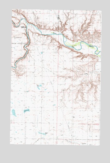
Abbott Lake, MT USGS Topographic Map
Click on map above to begin viewing in our Map Viewer.

This topographic map contains these locations and features:
Feature Name Type Latitude Longitude GNIS ID View Map
30N04W06CDBB01 WellWellN48.3819°W112.1789°1635233View Map
Abbott CouleeValleyN48.4516°W112.1289°768102View Map
Abbott LakeLakeN48.4064°W112.2276°768103View Map
Abbott Lake (historical)Populated PlaceN48.4097°W112.2292°1748811View Map
Abbott Lake School (historical)SchoolN48.4097°W112.2292°768104View Map
Abbott RidgeRidgeN48.4025°W112.1475°768105View Map
AN CanalCanalN48.3841°W112.1364°805886View Map
Bullhead DropCanalN48.3811°W112.2023°769382View Map
Bullhead School (historical)SchoolN48.3808°W112.1434°769383View Map
Bullhead SpringsSpringN48.3786°W112.1689°769384View Map
Cut BankCliffN48.4944°W112.2337°770394View Map
Cut Bank CreekStreamN48.4866°W112.2267°770399View Map
Stetler LakesLakeN48.4297°W112.2090°777201View Map
Sullivan BridgeBridgeN48.4869°W112.2253°777292View Map
Two Medicine RiverStreamN48.4864°W112.2278°792559View Map
Wilkins RanchLocaleN48.4789°W112.2034°778504View Map
Willow RoundsLocaleN48.4461°W112.1253°778554View Map

Note: Coordinates in the location and feature list above are referenced to NAD83 datum.


Copyright (C) 2008-2025 Ryan Niemi / Sunset Dynamics ... All Rights Reserved