TopoQuest Logo
Do you find TopoQuest useful?
Help keep TopoQuest running and adding new maps/features by donating!
Bitcoin:  19c7KJd3qBynnjoSw5npx9KScwjBe4ifkT
Litecoin:  LXs6TkuXGGXo1vDsWCkWVdjQX94eUKd6ui
Home View Maps Find Maps Find Places Resources & Links


Rattlesnake Mountain, Nevada Topographic Map

USGS Map Title: Rattlesnake Mountain, NV
USGS Map MRC: 39115F7
DRG (GeoTIFF) Download: o39115f7.tif


Neighboring USGS Topographic Map Quads:


  West of Christina Peak, NV  
39115G8
 

  Christina Peak, NV  
39115G7
 

  Cold Creek Ranch, NV  
39115G6
 

  North of Eureka, NV  
39115F8
 

  Rattlesnake Mountain, NV  
39115F7
 

  Buck Mountain West, NV  
39115F6
 

  Eureka, NV  
39115E8
 

  Diamond Peak, NV  
39115E7
 

  West of Beck Pass, NV  
39115E6


Map MRC Location:

N40°
W116°
N40°
W115°
H8 H7 H6 H5 H4 H3 H2 H1
G8 G7 G6 G5 G4 G3 G2 G1
F8 F7 F6 F5 F4 F3 F2 F1
E8 E7 E6 E5 E4 E3 E2 E1
D8 D7 D6 D5 D4 D3 D2 D1
C8 C7 C6 C5 C4 C3 C2 C1
B8 B7 B6 B5 B4 B3 B2 B1
A8 A7 A6 A5 A4 A3 A2 A1
N39°
W116°
N39°
W115°

Rattlesnake Mountain, NV USGS 1:24K Topographic Map Preview:
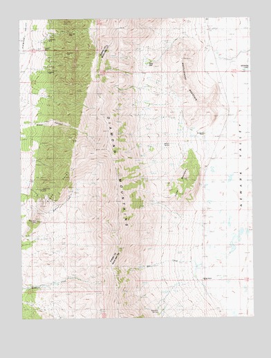
Rattlesnake Mountain, NV USGS Topographic Map
Click on map above to begin viewing in our Map Viewer.

This topographic map contains these locations and features:
Feature Name Type Latitude Longitude GNIS ID View Map
Black PointSummitN39.6838°W115.8512°838867View Map
Black Point MineMineN39.6738°W115.8651°853546View Map
Carp Post Office (historical)Post OfficeN39.7377°W115.8609°864333View Map
Cedar MountainSummitN39.6766°W115.7903°839388View Map
Champion MineMineN39.7358°W115.8503°839413View Map
Curtis MineMineN39.7383°W115.8484°857422View Map
Diamond City (historical)Populated PlaceN39.7377°W115.8609°858323View Map
Diamond Mining DistrictCivilN39.7383°W115.8484°856496View Map
Diamond MountainsRangeN39.7440°W115.8383°847307View Map
Eldridge RanchLocaleN39.6408°W115.7778°854914View Map
Fairy DellValleyN39.7322°W115.8045°855804View Map
Green CanyonValleyN39.7063°W115.8670°840804View Map
Hidden Treasure MineMineN39.7383°W115.8484°857420View Map
Keller MineMineN39.7383°W115.8484°857423View Map
Mammoth MineMineN39.7383°W115.8484°857424View Map
Mau CreekStreamN39.6510°W115.7795°841970View Map
Patriot MineMineN39.7383°W115.8484°857421View Map
Phillipsburg MineMineN39.7421°W115.8595°842793View Map
Rattlesnake MountainSummitN39.7327°W115.7878°843092View Map
Robinson SpringsSpringN39.6271°W115.8024°854964View Map
Silver Bell MineMineN39.7449°W115.8489°853547View Map
Standard Copper MineMineN39.6666°W115.8681°853545View Map
Strawberry (historical)Populated PlaceN39.7013°W115.7759°850885View Map
Strawberry Post Office (historical)Post OfficeN39.7013°W115.7759°864273View Map
Strawberry RanchLocaleN39.7019°W115.7762°844047View Map
Willow SpringSpringN39.6963°W115.8060°844939View Map

Note: Coordinates in the location and feature list above are referenced to NAD83 datum.


Copyright (C) 2008-2025 Ryan Niemi / Sunset Dynamics ... All Rights Reserved