TopoQuest Logo
Do you find TopoQuest useful?
Help keep TopoQuest running and adding new maps/features by donating!
Bitcoin:  19c7KJd3qBynnjoSw5npx9KScwjBe4ifkT
Litecoin:  LXs6TkuXGGXo1vDsWCkWVdjQX94eUKd6ui
Home View Maps Find Maps Find Places Resources & Links


Rawlins, Wyoming Topographic Map

USGS Map Title: Rawlins, WY
USGS Map MRC: 41107G2
DRG (GeoTIFF) Download: o41107g2.tif


Neighboring USGS Topographic Map Quads:


  Rendle Hill, WY  
41107H3
 

  Rawlins NW, WY  
41107H2
 

  Lone Haystack Mountain, WY  
41107H1
 

  Rawlins Peak, WY  
41107G3
 

  Rawlins, WY  
41107G2
 

  Sinclair, WY  
41107G1
 

  Coal Mine Ridge, WY  
41107F3
 

  Smith Draw West, WY  
41107F2
 

  Smith Draw East, WY  
41107F1


Map MRC Location:

N42°
W108°
N42°
W107°
H8 H7 H6 H5 H4 H3 H2 H1
G8 G7 G6 G5 G4 G3 G2 G1
F8 F7 F6 F5 F4 F3 F2 F1
E8 E7 E6 E5 E4 E3 E2 E1
D8 D7 D6 D5 D4 D3 D2 D1
C8 C7 C6 C5 C4 C3 C2 C1
B8 B7 B6 B5 B4 B3 B2 B1
A8 A7 A6 A5 A4 A3 A2 A1
N41°
W108°
N41°
W107°

Rawlins, WY USGS 1:24K Topographic Map Preview:
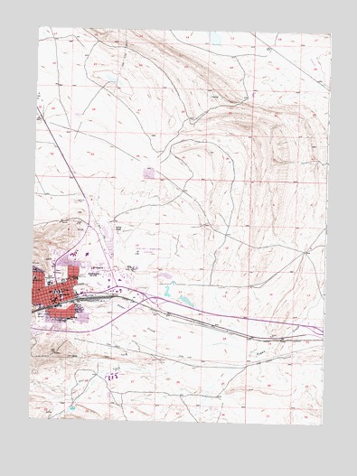
Rawlins, WY USGS Topographic Map
Click on map above to begin viewing in our Map Viewer.

This topographic map contains these locations and features:
Feature Name Type Latitude Longitude GNIS ID View Map
Carbon County Fire Department RawlinsBuildingN41.7967°W107.2079°2673631View Map
Carbon County Museum CemeteryCemeteryN41.7910°W107.2470°2774478View Map
Carbon County Sheriff's Office RawlinsBuildingN41.7901°W107.2405°2752629View Map
Charlie Claim Group MineMineN41.7622°W107.1481°1726021View Map
City of RawlinsCivilN41.7849°W107.2265°2411524View Map
Coal CreekStreamN41.7747°W107.1764°1586805View Map
Hay GulchValleyN41.7527°W107.2334°1596833View Map
Highlands Estate Shopping CenterLocaleN41.7911°W107.2387°1764047View Map
KFNR-TV (Rawlins)TowerN41.7708°W107.2409°1608956View Map
KIQZ-FM (Rawlins)TowerN41.7711°W107.2381°1608935View Map
Martinez Max Sand and Gravel PitMineN41.7933°W107.2270°1726020View Map
Mountainview SchoolSchoolN41.7950°W107.2489°1591815View Map
Pershing SchoolSchoolN41.7819°W107.2339°1592679View Map
RawlinsPopulated PlaceN41.7911°W107.2387°1593213View Map
Rawlins CemeteryCemeteryN41.7969°W107.2389°1593214View Map
Rawlins Fire Department Station OneBuildingN41.7925°W107.2403°2673472View Map
Rawlins Fire Department Station TwoBuildingN41.7845°W107.2257°2673511View Map
Rawlins Fire Department Training CenterBuildingN41.7849°W107.2257°2673512View Map
Rawlins Municipal Airport/Harvey FieldAirportN41.7998°W107.2072°1605620View Map
Rawlins Police DepartmentBuildingN41.7884°W107.2400°2752624View Map
Rawlins Post OfficePost OfficeN41.7868°W107.2405°2767871View Map
Rodeo ParkParkN41.7950°W107.2276°1593619View Map
Saint Joseph SchoolSchoolN41.7911°W107.2381°1593783View Map
Selfour RanchLocaleN41.8102°W107.2134°1594090View Map
Sunnyside SchoolSchoolN41.7950°W107.2306°1595210View Map
Wyoming Highway Patrol District 1 Division HBuildingN41.7922°W107.2051°2752607View Map
Wyoming State PenitentiaryBuildingN41.7647°W107.2151°2739816View Map
Wyoming State Penitentiary CemeteryCemeteryN41.7954°W107.2407°2774483View Map

Note: Coordinates in the location and feature list above are referenced to NAD83 datum.


Copyright (C) 2008-2024 Ryan Niemi / Sunset Dynamics ... All Rights Reserved