TopoQuest Logo
Do you find TopoQuest useful?
Help keep TopoQuest running and adding new maps/features by donating!
Bitcoin:  19c7KJd3qBynnjoSw5npx9KScwjBe4ifkT
Litecoin:  LXs6TkuXGGXo1vDsWCkWVdjQX94eUKd6ui
Home View Maps Find Maps Find Places Resources & Links


Raymond, Maine Topographic Map

USGS Map Title: Raymond, ME
USGS Map MRC: 43070H4
DRG (GeoTIFF) Download: o43070h4.tif


Neighboring USGS Topographic Map Quads:


  Casco, ME  
44070A5
 

  Mechanic Falls, ME  
44070A4
 

  Minot, ME  
44070A3
 

  Naples, ME  
43070H5
 

  Raymond, ME  
43070H4
 

  Gray, ME  
43070H3
 

  Sebago Lake, ME  
43070G5
 

  North Windham, ME  
43070G4
 

  Cumberland Center, ME  
43070G3


Map MRC Location:

N44°
W71°
N44°
W70°
H8 H7 H6 H5 H4 H3 H2 H1
G8 G7 G6 G5 G4 G3 G2 G1
F8 F7 F6 F5 F4 F3 F2 F1
E8 E7 E6 E5 E4 E3 E2 E1
D8 D7 D6 D5 D4 D3 D2 D1
C8 C7 C6 C5 C4 C3 C2 C1
B8 B7 B6 B5 B4 B3 B2 B1
A8 A7 A6 A5 A4 A3 A2 A1
N43°
W71°
N43°
W70°

Raymond, ME USGS 1:24K Topographic Map Preview:
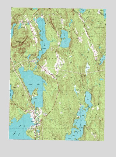
Raymond, ME USGS Topographic Map
Click on map above to begin viewing in our Map Viewer.

This topographic map contains these locations and features:
Feature Name Type Latitude Longitude GNIS ID View Map
Adams HillSummitN43.8818°W70.3905°561086View Map
Ai BrookStreamN43.9217°W70.4542°561111View Map
Bass IslandIslandN43.8751°W70.4178°561707View Map
Bean IslandIslandN43.8837°W70.4153°561785View Map
Bettys NeckCapeN43.9198°W70.4676°562105View Map
Brown HillSummitN43.9165°W70.4846°563050View Map
Browns PointCapeN43.8820°W70.4745°1912222View Map
Christ ChapelChurchN43.9020°W70.4695°1912293View Map
Coffee PondLakeN43.9773°W70.4981°564151View Map
Crescent LakeLakeN43.9723°W70.4575°574052View Map
Crescent LakePopulated PlaceN43.9862°W70.4770°577925View Map
Crescent Lake Seaplane BaseAirportN43.9570°W70.4620°582145View Map
Crow IslandIslandN43.8762°W70.4145°564599View Map
Dollys IslandIslandN43.9134°W70.4687°565202View Map
Dumpling PondLakeN43.9823°W70.4878°565395View Map
East RaymondPopulated PlaceN43.9342°W70.4428°565672View Map
Edwards BrookStreamN43.9898°W70.4595°565798View Map
Edwards Family CemeteryCemeteryN43.9916°W70.4563°2736141View Map
Farwell BogLakeN43.9230°W70.4139°566077View Map
Farwell BrookStreamN43.9065°W70.4073°566078View Map
Gay BrookStreamN43.9770°W70.4267°566726View Map
Glovers WigSummitN43.9361°W70.4043°566853View Map
Grape IslandIslandN43.8987°W70.4014°1912500View Map
Hayden BayBayN43.9009°W70.4081°567813View Map
Hayden BrookStreamN43.9054°W70.4587°567814View Map
Hinds Boys Scout CampLocaleN43.9404°W70.4703°1912564View Map
Hog Meadow PondLakeN43.9995°W70.4683°1912567View Map
Hyde BrookStreamN43.8751°W70.4689°568540View Map
Jordan BayBayN43.8801°W70.4909°568979View Map
Jordan Small Middle SchoolSchoolN43.9371°W70.4449°1912611View Map
Kokatosi CampgroundLocaleN43.9631°W70.4606°1912628View Map
Krams PointCapeN43.8965°W70.4114°569278View Map
Ledge HillSummitN43.9706°W70.4099°569452View Map
Little Sebago LakeReservoirN43.8794°W70.4128°570051View Map
Lyon PointCapeN43.8840°W70.4092°570602View Map
Martin IslandIslandN43.8790°W70.4176°570848View Map
Meadow BrookStreamN43.9417°W70.4926°1912727View Map
Meadow BrookStreamN43.9081°W70.3937°571040View Map
Meadow BrookStreamN43.9531°W70.4026°571041View Map
Moose MeadowSwampN43.9562°W70.4073°571604View Map
Morgan MeadowSwampN43.9451°W70.4001°571664View Map
Mount HungerSummitN43.8762°W70.4370°568453View Map
Mountain Road CemeteryCemeteryN43.9888°W70.4331°2740745View Map
North RaymondPopulated PlaceN43.9804°W70.4045°579575View Map
North Raymond CemeteryCemeteryN43.9737°W70.3976°1912801View Map
Notched PondLakeN43.9522°W70.3782°572523View Map
Nubble BrookStreamN43.9404°W70.4756°576252View Map
Nubble HillSummitN43.9554°W70.4684°572538View Map
Nubble PondLakeN43.9537°W70.4753°572539View Map
Panther PondReservoirN43.9261°W70.4680°572954View Map
Panther Pond DamDamN43.9011°W70.4652°1773649View Map
Panther Pond Seaplane BaseAirportN43.9301°W70.4526°582221View Map
Panther RunStreamN43.8895°W70.4689°572955View Map
Pismire MountainSummitN43.9890°W70.4458°573453View Map
Poland Police DepartmentBuildingN43.9351°W70.4418°2735913View Map
Rattlesnake MountainSummitN43.9670°W70.4853°574051View Map
RaymondPopulated PlaceN43.9015°W70.4703°574058View Map
Raymond Elementary SchoolSchoolN43.9364°W70.4496°2738128View Map
Raymond Fire DepartmentBuildingN43.9032°W70.4790°2553055View Map
Raymond Fire Rescue Department Station 2BuildingN43.9341°W70.4397°2552742View Map
Raymond HillSummitN43.9469°W70.4355°574060View Map
Raymond Hill Baptist Church CemeteryCemeteryN43.9456°W70.4392°2740764View Map
Raymond PondLakeN43.9706°W70.4284°569998View Map
Raymond Post OfficePost OfficeN43.8808°W70.4650°1912947View Map
Raymond Village CemeteryCemeteryN43.9019°W70.4625°2740765View Map
Raymond Village Community ChurchChurchN43.8987°W70.4662°1912948View Map
Raymond Village LibraryBuildingN43.9017°W70.4686°1912949View Map
Riverside CemeteryCemeteryN43.9501°W70.4661°574249View Map
Robinson BrookStreamN43.9912°W70.4578°1912962View Map
Rolfe BrookStreamN43.9445°W70.4851°561030View Map
Saint Raymonds ChurchChurchN43.9526°W70.4642°1913012View Map
Sand BrookStreamN43.9062°W70.4070°574823View Map
Sloanes CoveBayN43.9284°W70.4523°1913058View Map
Spider IslandIslandN43.8884°W70.4059°576048View Map
Sucker BrookStreamN43.9215°W70.4001°576475View Map
SuckervillePopulated PlaceN43.9262°W70.3937°579751View Map
Tarkiln HillSummitN43.9209°W70.4283°576663View Map
Tenny HillSummitN43.9966°W70.4376°576731View Map
Tenny RiverStreamN43.9395°W70.4712°576732View Map
Town of RaymondCivilN43.9267°W70.4589°582692View Map
Treasure IslandIslandN43.8759°W70.4195°577290View Map
Union ChapelChurchN43.9342°W70.4406°1913234View Map
Upper BayLakeN43.8794°W70.4128°577573View Map
Upper NarrowsGapN43.9076°W70.3984°577635View Map
Valley BrookStreamN43.9626°W70.4281°577682View Map
WBLM-FM (Portland)TowerN43.9245°W70.4906°582076View Map
Webbs Mills CemeteryCemeteryN43.9804°W70.4722°2736260View Map
WGME-TV (Portland)TowerN43.9245°W70.4906°582102View Map

Note: Coordinates in the location and feature list above are referenced to NAD83 datum.


Copyright (C) 2008-2024 Ryan Niemi / Sunset Dynamics ... All Rights Reserved