TopoQuest Logo
Do you find TopoQuest useful?
Help keep TopoQuest running and adding new maps/features by donating!
Bitcoin:  19c7KJd3qBynnjoSw5npx9KScwjBe4ifkT
Litecoin:  LXs6TkuXGGXo1vDsWCkWVdjQX94eUKd6ui
Home View Maps Find Maps Find Places Resources & Links


Red Bank Lakes, Oregon Topographic Map

USGS Map Title: Red Bank Lakes, OR
USGS Map MRC: 42119H6
DRG (GeoTIFF) Download: o42119h6.tif


Neighboring USGS Topographic Map Quads:


  Cox Canyon, OR  
43119A7
 

  Dry Valley Rim, OR  
43119A6
 

  Rawhide Canyon, OR  
43119A5
 

  Turpin Knoll, OR  
42119H7
 

  Red Bank Lakes, OR  
42119H6
 

  Rock Camp Draw, OR  
42119H5
 

  Corn Lake, OR  
42119G7
 

  Corporation Rim, OR  
42119G6
 

  Steamboat Point, OR  
42119G5


Map MRC Location:

N43°
W120°
N43°
W119°
H8 H7 H6 H5 H4 H3 H2 H1
G8 G7 G6 G5 G4 G3 G2 G1
F8 F7 F6 F5 F4 F3 F2 F1
E8 E7 E6 E5 E4 E3 E2 E1
D8 D7 D6 D5 D4 D3 D2 D1
C8 C7 C6 C5 C4 C3 C2 C1
B8 B7 B6 B5 B4 B3 B2 B1
A8 A7 A6 A5 A4 A3 A2 A1
N42°
W120°
N42°
W119°

Red Bank Lakes, OR USGS 1:24K Topographic Map Preview:
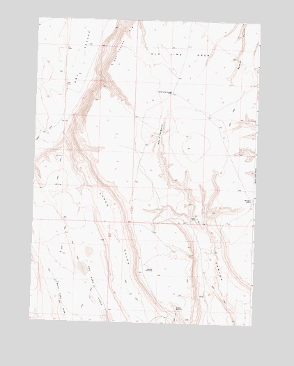
Red Bank Lakes, OR USGS Topographic Map
Click on map above to begin viewing in our Map Viewer.

This topographic map contains these locations and features:
Feature Name Type Latitude Longitude GNIS ID View Map
Bacon Camp Lake WaterholeReservoirN42.8971°W119.7209°1131087View Map
Brushy LakeFlatN42.9265°W119.6272°1118166View Map
Common Bedground WaterholeReservoirN42.9625°W119.6958°1131095View Map
Egan CabinLocaleN42.9190°W119.6608°1120407View Map
Egan Cabin WaterholeReservoirN42.9197°W119.6608°1131096View Map
Hidden ReservoirReservoirN42.8813°W119.6684°1121791View Map
Hole in the GroundBasinN42.9532°W119.6786°1121904View Map
Hole in the Ground LakeLakeN42.9706°W119.6737°1121908View Map
Kit Canyon WaterholeReservoirN42.9219°W119.6905°1131089View Map
Lakehole in the Ground WaterholeReservoirN42.9675°W119.6769°1131091View Map
Lower Bedground WaterholeReservoirN42.9048°W119.6556°1131097View Map
Lynch GulchValleyN42.9538°W119.7344°1123628View Map
Lynch Gulch WaterholeReservoirN42.8777°W119.6901°1131098View Map
Mule Spring Road WaterholeSpringN42.9249°W119.6788°1131090View Map
Old Jims OpenFlatN42.9849°W119.6719°1124967View Map
Packsaddle DrawValleyN42.9725°W119.7489°2784906View Map
Peters WaterholeReservoirN42.9423°W119.6900°1131093View Map
Red Bank LakesFlatN42.8888°W119.7136°1125865View Map
State Game Reservoir Number ElevenReservoirN42.9292°W119.7295°1131094View Map
Sunrise WaterholeSpringN42.8974°W119.6811°1127742View Map
West Bacon WaterholeReservoirN42.8939°W119.7379°1131088View Map
West Draw WaterholeReservoirN42.9075°W119.7480°1131092View Map

Note: Coordinates in the location and feature list above are referenced to NAD83 datum.


Copyright (C) 2008-2025 Ryan Niemi / Sunset Dynamics ... All Rights Reserved