TopoQuest Logo
Do you find TopoQuest useful?
Help keep TopoQuest running and adding new maps/features by donating!
Bitcoin:  19c7KJd3qBynnjoSw5npx9KScwjBe4ifkT
Litecoin:  LXs6TkuXGGXo1vDsWCkWVdjQX94eUKd6ui
Home View Maps Find Maps Find Places Resources & Links


Red Cliff, Colorado Topographic Map

USGS Map Title: Red Cliff, CO
USGS Map MRC: 39106E3
DRG (GeoTIFF) Download: o39106e3.tif


Neighboring USGS Topographic Map Quads:


  Vail West, CO  
39106F4
 

  Vail East, CO  
39106F3
 

  Willow Lakes, CO  
39106F2
 

  Minturn, CO  
39106E4
 

  Red Cliff, CO  
39106E3
 

  Vail Pass, CO  
39106E2
 

  Mount of the Holy Cross, CO  
39106D4
 

  Pando, CO  
39106D3
 

  Copper Mountain, CO  
39106D2


Map MRC Location:

N40°
W107°
N40°
W106°
H8 H7 H6 H5 H4 H3 H2 H1
G8 G7 G6 G5 G4 G3 G2 G1
F8 F7 F6 F5 F4 F3 F2 F1
E8 E7 E6 E5 E4 E3 E2 E1
D8 D7 D6 D5 D4 D3 D2 D1
C8 C7 C6 C5 C4 C3 C2 C1
B8 B7 B6 B5 B4 B3 B2 B1
A8 A7 A6 A5 A4 A3 A2 A1
N39°
W107°
N39°
W106°

Red Cliff, CO USGS 1:24K Topographic Map Preview:
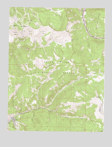
Red Cliff, CO USGS Topographic Map
Click on map above to begin viewing in our Map Viewer.

This topographic map contains these locations and features:
Feature Name Type Latitude Longitude GNIS ID View Map
Battle MountainSummitN39.5636°W106.3281°176154View Map
China BowlBasinN39.5997°W106.3298°176163View Map
Eagle River Fire Protection DistrictBuildingN39.5129°W106.3700°2666972View Map
Foster Combination MineMineN39.5186°W106.3545°1684198View Map
Golden Wedge MineMineN39.5094°W106.3614°1684196View Map
Greenwod CemeteryCemeteryN39.5100°W106.3702°2734649View Map
High Noon RidgeRidgeN39.5969°W106.3567°176160View Map
Hornsilver MineMineN39.5122°W106.3661°176145View Map
Iron Dike MineMineN39.5100°W106.3150°1684197View Map
Iron MountainSummitN39.5036°W106.3689°202363View Map
Kiln CreekStreamN39.5172°W106.3586°176150View Map
Liberty MineMineN39.5169°W106.3614°176151View Map
Lime CreekStreamN39.5228°W106.3364°176153View Map
Mid VailPopulated PlaceN39.6150°W106.3678°176156View Map
Miller CreekStreamN39.5930°W106.2567°176148View Map
Mount of the Holy Cross Recreation SiteLocaleN39.5592°W106.2584°197043View Map
Northeast BowlBasinN39.6119°W106.3481°176157View Map
Ovee-Silurian MineMineN39.5167°W106.3628°1684199View Map
Ptarmigan PointSummitN39.6053°W106.3698°176158View Map
Red CliffPopulated PlaceN39.5122°W106.3681°202362View Map
Red Cliff Post OfficePost OfficeN39.5129°W106.3681°1744561View Map
Shrine MountainSummitN39.5353°W106.2595°176152View Map
Sundown BowlBasinN39.5986°W106.3664°176159View Map
Sunup BowlBasinN39.5989°W106.3478°176161View Map
Tates GulchValleyN39.5210°W106.3440°176147View Map
Teacup BowlBasinN39.5905°W106.3414°176162View Map
Timber CreekStreamN39.5994°W106.2697°176165View Map
Town of Red CliffCivilN39.5091°W106.3700°2412535View Map
Two Elk PassGapN39.5925°W106.2942°176164View Map
Two Elk TrailTrailN39.5855°W106.3334°202876View Map
Vail MountainSummitN39.6061°W106.3564°196425View Map
Wearyman CreekStreamN39.5228°W106.3361°176146View Map
Willow CreekStreamN39.5161°W106.3620°176155View Map
Wingle RidgeRidgeN39.5192°W106.2553°2014026View Map

Note: Coordinates in the location and feature list above are referenced to NAD83 datum.


Copyright (C) 2008-2025 Ryan Niemi / Sunset Dynamics ... All Rights Reserved