TopoQuest Logo
Do you find TopoQuest useful?
Help keep TopoQuest running and adding new maps/features by donating!
Bitcoin:  19c7KJd3qBynnjoSw5npx9KScwjBe4ifkT
Litecoin:  LXs6TkuXGGXo1vDsWCkWVdjQX94eUKd6ui
Home View Maps Find Maps Find Places Resources & Links


Red Cloud, Nebraska Topographic Map

USGS Map Title: Red Cloud, NE
USGS Map MRC: 40098A5
DRG (GeoTIFF) Download: o40098a5.tif


Neighboring USGS Topographic Map Quads:


  Red Cloud NW, NE  
40098B6
 

  Red Cloud NE, NE  
40098B5
 

  Cowles, NE  
40098B4
 

  Inavale, NE  
40098A6
 

  Red Cloud, NE  
40098A5
 

  Amboy, NE  
40098A4
 

  Cora, KS  
39098H6
 

  McCracken Branch, KS  
39098H5
 

  Burr Oak NW, KS  
39098H4


Map MRC Location:

N41°
W99°
N41°
W98°
H8 H7 H6 H5 H4 H3 H2 H1
G8 G7 G6 G5 G4 G3 G2 G1
F8 F7 F6 F5 F4 F3 F2 F1
E8 E7 E6 E5 E4 E3 E2 E1
D8 D7 D6 D5 D4 D3 D2 D1
C8 C7 C6 C5 C4 C3 C2 C1
B8 B7 B6 B5 B4 B3 B2 B1
A8 A7 A6 A5 A4 A3 A2 A1
N40°
W99°
N40°
W98°

Red Cloud, NE USGS 1:24K Topographic Map Preview:
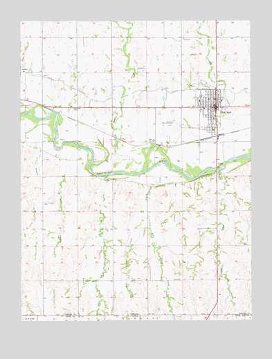
Red Cloud, NE USGS Topographic Map
Click on map above to begin viewing in our Map Viewer.

This topographic map contains these locations and features:
Feature Name Type Latitude Longitude GNIS ID View Map
Assembly of God ChurchChurchN40.0856°W98.5223°1884661View Map
Auld Public LibraryBuildingN40.0908°W98.5198°1884653View Map
Bells Sleepy Valley CampgroundLocaleN40.1028°W98.5192°1884712View Map
Burlington Depot Historical MarkerParkN40.0883°W98.5192°1884723View Map
Cather Childhood Home Historical MarkerParkN40.0875°W98.5212°1884725View Map
Cedar CreekStreamN40.0625°W98.5167°471841View Map
City of Red CloudCivilN40.0864°W98.5222°2396335View Map
Congregational ChurchChurchN40.0911°W98.5203°1884660View Map
East Penny CreekStreamN40.0448°W98.5574°471838View Map
Election District 5CivilN40.0884°W98.5215°1953013View Map
Grace Episcopal Church Historical MarkerParkN40.0883°W98.5192°1884722View Map
Gust CemeteryCemeteryN40.0172°W98.5426°829726View Map
Heritage Care CenterHospitalN40.0914°W98.5162°1884663View Map
Hungry CreekStreamN40.0745°W98.6073°830204View Map
Indian CreekStreamN40.0636°W98.5437°830275View Map
Indian Creek State Wildlife Management AreaParkN40.0639°W98.5267°1884710View Map
Indian Oven RuinsLocaleN40.0886°W98.5967°830287View Map
Lewis DamDamN40.0262°W98.5679°1768075View Map
Lewis ReservoirReservoirN40.0244°W98.5676°1768076View Map
Louisa CreekStreamN40.0608°W98.5770°471839View Map
Main Street ClinicHospitalN40.0883°W98.5198°1884664View Map
Mount Pleasant CemeteryCemeteryN40.0492°W98.6128°831472View Map
Murphy CemeteryCemeteryN40.0745°W98.5526°831538View Map
Penny CreekStreamN40.0653°W98.5484°832038View Map
Red CloudPopulated PlaceN40.0889°W98.5195°832484View Map
Red CloudLocaleN40.0764°W98.5198°1884644View Map
Red Cloud CemeteryCemeteryN40.0806°W98.5267°1884673View Map
Red Cloud City ParkParkN40.0875°W98.5198°1884648View Map
Red Cloud Dental ClinicHospitalN40.0903°W98.5198°1884665View Map
Red Cloud Elementary SchoolSchoolN40.0883°W98.5259°1884672View Map
Red Cloud High SchoolSchoolN40.0922°W98.5195°1884671View Map
Red Cloud Historical MarkerParkN40.0889°W98.5195°1884720View Map
Red Cloud Municipal AirportAirportN40.0833°W98.5403°837693View Map
Red Cloud Police DepartmentBuildingN40.0917°W98.5209°1884656View Map
Red Cloud Post OfficePost OfficeN40.0881°W98.5189°1884652View Map
Red Cloud Vision ClinicHospitalN40.0892°W98.5198°1884666View Map
Red Cloud Volunteer Fire and RescueBuildingN40.0901°W98.5184°1884649View Map
Sacred Heart Catholic ChurchChurchN40.0897°W98.5217°1884662View Map
Saint Juliana Falconieri Catholic Church Historical MarkerParkN40.0883°W98.5192°1884724View Map
School CreekStreamN40.0875°W98.6226°833266View Map
Sibert DamDamN40.0530°W98.6187°1768914View Map
Sibert ReservoirLakeN40.0517°W98.6195°1768915View Map
Simag Grain Incorporated ElevatorLocaleN40.0833°W98.5184°1884650View Map
State CreekStreamN40.0694°W98.5901°471840View Map
State CreekStreamN40.0717°W98.5956°833796View Map
Twin Oaks DamDamN40.0117°W98.5887°1768097View Map
Twin Oaks ReservoirReservoirN40.0117°W98.5880°1768098View Map
United Methodist ChurchChurchN40.0925°W98.5062°1884659View Map
Webster County Chiropractic ClinicHospitalN40.0892°W98.5198°1884667View Map
Webster County ClinicHospitalN40.0914°W98.5281°1884668View Map
Webster County Community HospitalHospitalN40.0915°W98.5281°1884669View Map
Webster County CourthouseBuildingN40.0914°W98.5214°1884654View Map
Webster County Dental ClinicHospitalN40.0892°W98.5198°1884670View Map
Webster County Historical MarkerParkN40.0889°W98.5195°1884719View Map
Webster County Historical MuseumBuildingN40.0892°W98.5276°1884651View Map
Webster County Sheriff's OfficeBuildingN40.0917°W98.5210°1884655View Map
Wesleyan ChurchChurchN40.0950°W98.5189°1884658View Map
West Penny CreekStreamN40.0448°W98.5574°471837View Map
Willa Cather Memorial Prairie Historical MarkerParkN40.0083°W98.5192°1884717View Map
Willa Cather State Historic SiteParkN40.0883°W98.5192°1884721View Map
Zion Lutheran ChurchChurchN40.0933°W98.5273°1884657View Map

Note: Coordinates in the location and feature list above are referenced to NAD83 datum.


Copyright (C) 2008-2025 Ryan Niemi / Sunset Dynamics ... All Rights Reserved