TopoQuest Logo
Do you find TopoQuest useful?
Help keep TopoQuest running and adding new maps/features by donating!
Bitcoin:  19c7KJd3qBynnjoSw5npx9KScwjBe4ifkT
Litecoin:  LXs6TkuXGGXo1vDsWCkWVdjQX94eUKd6ui
Home View Maps Find Maps Find Places Resources & Links


Red Creek Ranch, Wyoming Topographic Map

USGS Map Title: Red Creek Ranch, WY
USGS Map MRC: 41109A1
DRG (GeoTIFF) Download: o41109a1.tif


Neighboring USGS Topographic Map Quads:


  Maxon Ranch, WY  
41109B2
 

  Titsworth Gap, WY  
41109B1
 

  Potter Mountain, WY  
41108B8
 

  Richards Gap, WY  
41109A2
 

  Red Creek Ranch, WY  
41109A1
 

  Four J Rim, WY  
41108A8
 

  Clay Basin, UT  
40109H2
 

  Willow Creek Butte, UT  
40109H1
 

  Beaver Basin, CO  
40108H8


Map MRC Location:

N42°
W110°
N42°
W109°
H8 H7 H6 H5 H4 H3 H2 H1
G8 G7 G6 G5 G4 G3 G2 G1
F8 F7 F6 F5 F4 F3 F2 F1
E8 E7 E6 E5 E4 E3 E2 E1
D8 D7 D6 D5 D4 D3 D2 D1
C8 C7 C6 C5 C4 C3 C2 C1
B8 B7 B6 B5 B4 B3 B2 B1
A8 A7 A6 A5 A4 A3 A2 A1
N41°
W110°
N41°
W109°

Red Creek Ranch, WY USGS 1:24K Topographic Map Preview:
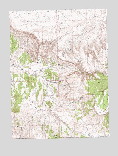
Red Creek Ranch, WY USGS Topographic Map
Click on map above to begin viewing in our Map Viewer.

This topographic map contains these locations and features:
Feature Name Type Latitude Longitude GNIS ID View Map
Alkali SpringsSpringN41.0860°W109.0498°1584784View Map
Basin CreekStreamN41.0002°W109.1148°1585175View Map
Basin CreekStreamN41.0002°W109.1148°1424993View Map
Corral CreekStreamN41.1150°W109.0029°1586990View Map
Dodge MeadowsFlatN41.0330°W109.0954°1587683View Map
John Erickson DamDamN41.0633°W109.0257°1607901View Map
John Erickson ReservoirReservoirN41.0633°W109.0257°1607902View Map
June CreekStreamN41.0708°W109.1196°1590254View Map
Little Red CreekStreamN41.0628°W109.0983°169614View Map
Lizzie Spring CreekStreamN41.0413°W109.0796°1590907View Map
Meadow Gulch RanchLocaleN41.0541°W109.0696°1591437View Map
Petes PlacePopulated PlaceN41.0027°W109.0248°1597457View Map
Red Creek RanchLocaleN41.0675°W109.0871°1593275View Map
Red Creek Ranch AirportAirportN41.0711°W109.0940°2443893View Map
Star Numbers Five and Six MineMineN41.0781°W109.0919°1747115View Map
Telephone CanyonValleyN41.0758°W109.0882°1595343View Map
Tepee CreekStreamN41.0702°W109.1185°1595366View Map

Note: Coordinates in the location and feature list above are referenced to NAD83 datum.


Copyright (C) 2008-2024 Ryan Niemi / Sunset Dynamics ... All Rights Reserved