TopoQuest Logo
Do you find TopoQuest useful?
Help keep TopoQuest running and adding new maps/features by donating!
Bitcoin:  19c7KJd3qBynnjoSw5npx9KScwjBe4ifkT
Litecoin:  LXs6TkuXGGXo1vDsWCkWVdjQX94eUKd6ui
Home View Maps Find Maps Find Places Resources & Links


Red Ives Peak, Idaho Topographic Map

USGS Map Title: Red Ives Peak, ID
USGS Map MRC: 47115A3
DRG (GeoTIFF) Download: o47115a3.tif


Neighboring USGS Topographic Map Quads:


  Conrad Peak, ID  
47115B4
 

  Berge Peak, ID  
47115B3
 

  Torino Peak, MT  
47115B2
 

  Peggy Peak, ID  
47115A4
 

  Red Ives Peak, ID  
47115A3
 

  Sherlock Peak, ID  
47115A2
 

  Pole Mountain, ID  
46115H4
 

  Bacon Peak, ID  
46115H3
 

  Chamberlain Mountain, ID  
46115H2


Map MRC Location:

N48°
W116°
N48°
W115°
H8 H7 H6 H5 H4 H3 H2 H1
G8 G7 G6 G5 G4 G3 G2 G1
F8 F7 F6 F5 F4 F3 F2 F1
E8 E7 E6 E5 E4 E3 E2 E1
D8 D7 D6 D5 D4 D3 D2 D1
C8 C7 C6 C5 C4 C3 C2 C1
B8 B7 B6 B5 B4 B3 B2 B1
A8 A7 A6 A5 A4 A3 A2 A1
N47°
W116°
N47°
W115°

Red Ives Peak, ID USGS 1:24K Topographic Map Preview:
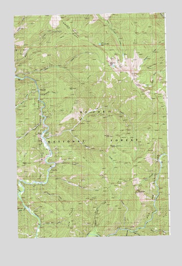
Red Ives Peak, ID USGS Topographic Map
Click on map above to begin viewing in our Map Viewer.

This topographic map contains these locations and features:
Feature Name Type Latitude Longitude GNIS ID View Map
Aqua CreekStreamN47.0333°W115.2588°376687View Map
Bean CreekStreamN47.0033°W115.2710°377063View Map
Beaver CreekStreamN47.0824°W115.3560°377255View Map
Beaver Creek CampgroundLocaleN47.0819°W115.3549°377262View Map
Bedrock CreekStreamN47.0599°W115.3318°377304View Map
Bonehead CreekStreamN47.0799°W115.3549°378019View Map
Broken Leg CreekStreamN47.0013°W115.3138°378245View Map
Broken Leg Forest CabinLocaleN47.0024°W115.3115°399570View Map
Color CreekStreamN47.0341°W115.3496°379578View Map
Copper CreekStreamN47.0680°W115.3524°379704View Map
Copper PointSummitN47.0419°W115.3665°379725View Map
Elbow RidgeRidgeN47.0057°W115.3315°381306View Map
Forage CreekStreamN47.0013°W115.2796°381919View Map
Game CreekStreamN47.0305°W115.3560°382160View Map
Halm CreekStreamN47.0057°W115.3576°382835View Map
Indian CreekStreamN47.0910°W115.3743°383650View Map
Indian PeakSummitN47.0830°W115.3271°383700View Map
Line CreekStreamN47.0416°W115.3426°384693View Map
Myrtle CreekStreamN47.0019°W115.2846°387445View Map
Needle CreekStreamN47.0024°W115.2876°387488View Map
Needle PeakSummitN47.0230°W115.2760°387489View Map
Red Ives CreekStreamN47.0555°W115.3515°389200View Map
Red Ives PeakSummitN47.0563°W115.2979°389199View Map
Red Ives Ranger StationLocaleN47.0580°W115.3526°389201View Map
Red Ives SpringSpringN47.0508°W115.2938°393825View Map
Saint Joe Wild and Scenic RiverParkN47.0613°W115.3532°395907View Map
Scat CreekStreamN47.0260°W115.3729°390004View Map
Simmons LookoutLocaleN47.0844°W115.2754°400408View Map
Simmons PeakSummitN47.0966°W115.2968°390468View Map
Spruce Tree CampgroundLocaleN47.0377°W115.3476°391257View Map
Swimming Bear LakeLakeN47.1081°W115.3045°400413View Map
Timber CreekStreamN47.0177°W115.3696°392146View Map

Note: Coordinates in the location and feature list above are referenced to NAD83 datum.


Copyright (C) 2008-2025 Ryan Niemi / Sunset Dynamics ... All Rights Reserved