TopoQuest Logo
Do you find TopoQuest useful?
Help keep TopoQuest running and adding new maps/features by donating!
Bitcoin:  19c7KJd3qBynnjoSw5npx9KScwjBe4ifkT
Litecoin:  LXs6TkuXGGXo1vDsWCkWVdjQX94eUKd6ui
Home View Maps Find Maps Find Places Resources & Links


Redfield North, South Dakota Topographic Map

USGS Map Title: Redfield North, SD
USGS Map MRC: 44098H5
DRG (GeoTIFF) Download: o44098h5.tif


Neighboring USGS Topographic Map Quads:


  Northville SW, SD  
45098A6
 

  Athol, SD  
45098A5
 

  Gallup, SD  
45098A4
 

  Zell, SD  
44098H6
 

  Redfield North, SD  
44098H5
 

  Ashton, SD  
44098H4
 

  Redfield SW, SD  
44098G6
 

  Redfield South, SD  
44098G5
 

  Frankfort SW, SD  
44098G4


Map MRC Location:

N45°
W99°
N45°
W98°
H8 H7 H6 H5 H4 H3 H2 H1
G8 G7 G6 G5 G4 G3 G2 G1
F8 F7 F6 F5 F4 F3 F2 F1
E8 E7 E6 E5 E4 E3 E2 E1
D8 D7 D6 D5 D4 D3 D2 D1
C8 C7 C6 C5 C4 C3 C2 C1
B8 B7 B6 B5 B4 B3 B2 B1
A8 A7 A6 A5 A4 A3 A2 A1
N44°
W99°
N44°
W98°

Redfield North, SD USGS 1:24K Topographic Map Preview:
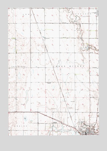
Redfield North, SD USGS Topographic Map
Click on map above to begin viewing in our Map Viewer.

This topographic map contains these locations and features:
Feature Name Type Latitude Longitude GNIS ID View Map
Abigail Gardner Rescue SiteParkN44.9119°W98.5126°1263230View Map
Ada Post Office (historical)Post OfficeN44.9639°W98.5559°1267132View Map
Ashton CemeteryCemeteryN44.9910°W98.5227°1253717View Map
Center School Number 5 (historical)SchoolN44.9811°W98.5087°1263734View Map
Doland Police DepartmentBuildingN44.8779°W98.5189°2755464View Map
German Methodist Church (historical)ChurchN44.9958°W98.5143°1263731View Map
Gordon Post Office (historical)Post OfficeN44.9811°W98.5045°1267131View Map
Greenlawn CemeteryCemeteryN44.8858°W98.5168°1255362View Map
Ironsides SchoolSchoolN44.8869°W98.5637°1255779View Map
Jenner SchoolSchoolN44.9558°W98.5129°1255825View Map
Keller SchoolSchoolN44.9708°W98.5501°1255915View Map
KQKD-AM (Redfield)TowerN44.8980°W98.5068°1259341View Map
Lake RedfieldReservoirN44.8789°W98.5490°1257327View Map
Marlette SchoolSchoolN44.9266°W98.5665°1256330View Map
Mud LakeLakeN44.8910°W98.6020°1256603View Map
Pheasant City Drive-InLocaleN44.8911°W98.5117°2633332View Map
RedfieldPopulated PlaceN44.8758°W98.5187°1265687View Map
Redfield Carnegie LibraryBuildingN44.8783°W98.5181°2723663View Map
Redfield City Fire DepartmentBuildingN44.8760°W98.5200°2580724View Map
Redfield City HallBuildingN44.8760°W98.5188°2725263View Map
Redfield Elementary SchoolSchoolN44.8776°W98.5159°2729448View Map
Redfield High SchoolSchoolN44.8776°W98.5159°2729449View Map
Redfield Junior High SchoolSchoolN44.8776°W98.5159°2729450View Map
Redfield Lake DamDamN44.8780°W98.5293°1260112View Map
Redfield Post OfficePost OfficeN44.8767°W98.5172°2711127View Map
Redfield Rural Fire DepartmentBuildingN44.8760°W98.5197°2580782View Map
Saint Bernard CemeteryCemeteryN44.8858°W98.5143°1257579View Map
School Number 4 (historical)SchoolN44.9783°W98.5545°1263738View Map
South Dakota Developmental CenterHospitalN44.8863°W98.5245°1257326View Map
South Dakota Developmental Center CemeteryCemeteryN44.8861°W98.5190°2779346View Map
Spink County CourthouseBuildingN44.8753°W98.5144°2722900View Map
Spink County Sheriff DepartmentBuildingN44.8751°W98.5144°2755600View Map
Township of Three RiversCivilN44.9409°W98.5333°1267859View Map

Note: Coordinates in the location and feature list above are referenced to NAD83 datum.


Copyright (C) 2008-2025 Ryan Niemi / Sunset Dynamics ... All Rights Reserved