TopoQuest Logo
Do you find TopoQuest useful?
Help keep TopoQuest running and adding new maps/features by donating!
Bitcoin:  19c7KJd3qBynnjoSw5npx9KScwjBe4ifkT
Litecoin:  LXs6TkuXGGXo1vDsWCkWVdjQX94eUKd6ui
Home View Maps Find Maps Find Places Resources & Links


Redland, Oregon Topographic Map

USGS Map Title: Redland, OR
USGS Map MRC: 45122C4
DRG (GeoTIFF) Download: o45122c4.tif


Neighboring USGS Topographic Map Quads:


  Gladstone, OR  
45122D5
 

  Damascus, OR  
45122D4
 

  Sandy, OR  
45122D3
 

  Oregon City, OR  
45122C5
 

  Redland, OR  
45122C4
 

  Estacada, OR  
45122C3
 

  Molalla, OR  
45122B5
 

  Colton, OR  
45122B4
 

  Elwood, OR  
45122B3


Map MRC Location:

N46°
W123°
N46°
W122°
H8 H7 H6 H5 H4 H3 H2 H1
G8 G7 G6 G5 G4 G3 G2 G1
F8 F7 F6 F5 F4 F3 F2 F1
E8 E7 E6 E5 E4 E3 E2 E1
D8 D7 D6 D5 D4 D3 D2 D1
C8 C7 C6 C5 C4 C3 C2 C1
B8 B7 B6 B5 B4 B3 B2 B1
A8 A7 A6 A5 A4 A3 A2 A1
N45°
W123°
N45°
W122°

Redland, OR USGS 1:24K Topographic Map Preview:
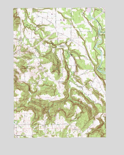
Redland, OR USGS Topographic Map
Click on map above to begin viewing in our Map Viewer.

This topographic map contains these locations and features:
Feature Name Type Latitude Longitude GNIS ID View Map
Bargfeld CreekStreamN45.3382°W122.4423°1117238View Map
Big Sky Ranch Airstrip (historical)AirportN45.3723°W122.4637°1131445View Map
Bonnie Lure State ParkParkN45.3521°W122.3768°1117933View Map
Briscoe ReservoirReservoirN45.3345°W122.4701°1130554View Map
Cedarhurst ParkPopulated PlaceN45.3310°W122.4262°1136133View Map
Clackamas Fire District Number 1 Station 11 RedlandBuildingN45.3430°W122.4903°2576864View Map
Clackamas Fire District Number 1 Station 12 LoganBuildingN45.3441°W122.4232°2576863View Map
Eagle CreekStreamN45.3532°W122.3826°1167853View Map
Estacada Bible FellowshipChurchN45.3417°W122.4192°2439635View Map
Feldheimer Boat RampLocaleN45.3280°W122.3822°2699368View Map
Feldheimer FerryLocaleN45.3290°W122.3804°1120659View Map
Fellows CemeteryCemeteryN45.2577°W122.4145°1130563View Map
Fir Grove School (historical)SchoolN45.3287°W122.4698°1120730View Map
FirgroveLocaleN45.3276°W122.4706°1130556View Map
Fischer's Forest Park Water Pollution Control FacilityLocaleN45.3462°W122.4753°2697163View Map
Fischers MillLocaleN45.3387°W122.4356°1120752View Map
Four CornersLocaleN45.3029°W122.4390°1120914View Map
Goose CreekStreamN45.3743°W122.3923°1121241View Map
Highland Store (historical)LocaleN45.2615°W122.4484°1163862View Map
Little Clear CreekStreamN45.3082°W122.4243°1123155View Map
LoganPopulated PlaceN45.3435°W122.4229°1123354View Map
Logan Post Office (historical)Post OfficeN45.3435°W122.4229°1165554View Map
Lower Highland Bible Church and Sunday SchoolChurchN45.2533°W122.4592°2437330View Map
Lyons View ParkParkN45.3048°W122.4873°1166833View Map
Martin CreekStreamN45.2860°W122.4818°1130555View Map
Massinger CornerLocaleN45.2518°W122.4979°1123832View Map
McGill Airstrip (historical)AirportN45.3373°W122.3976°1131632View Map
Milo McIver State Park Northern Boat RampLocaleN45.3117°W122.3804°2699604View Map
Mint LakeReservoirN45.2782°W122.4988°1166832View Map
Moehnke CemeteryCemeteryN45.2649°W122.4972°1130561View Map
Mosier CreekStreamN45.2887°W122.4251°1124384View Map
North HighlandPopulated PlaceN45.2540°W122.4095°1163869View Map
North Highland School (historical)SchoolN45.2579°W122.4154°1124822View Map
North Logan School (historical)SchoolN45.3737°W122.4218°1124828View Map
Norton Post Office (historical)Post OfficeN45.3262°W122.3984°1165716View Map
Paradise ParkPopulated PlaceN45.3160°W122.3848°1136614View Map
Parson LandingAirportN45.3250°W122.4692°2645974View Map
RedlandPopulated PlaceN45.3435°W122.4929°1125911View Map
Redland CemeteryCemeteryN45.3090°W122.4546°1130559View Map
Redland DivisionCivilN45.3418°W122.4545°1938102View Map
Redland Elementary SchoolSchoolN45.3458°W122.4922°1162168View Map
Redland Post Office (historical)Post OfficeN45.3435°W122.4929°1165839View Map
Root CreekStreamN45.2810°W122.4834°1126286View Map
Sabin Airport (historical)AirportN45.3454°W122.4387°1638968View Map
Saint Philip Benizi Catholic ChurchChurchN45.3422°W122.4908°2439935View Map
Shubel Post Office (historical)Post OfficeN45.2623°W122.4970°1165943View Map
Shubel School (historical)SchoolN45.2596°W122.4979°1637931View Map
Skyhill AirportAirportN45.2874°W122.4511°1131717View Map
Sonshine Christian CenterChurchN45.2653°W122.4089°2437329View Map
Sprague CemeteryCemeteryN45.3022°W122.4761°1130560View Map
Springwater Environmental Sciences SchoolSchoolN45.3668°W122.4665°1123355View Map
Tennys CreekStreamN45.2901°W122.4012°1130700View Map
The HogbackRidgeN45.2776°W122.4545°1127972View Map
ViolaPopulated PlaceN45.2982°W122.4104°1128548View Map
Viola CemeteryCemeteryN45.3027°W122.3966°1130558View Map
Viola Post Office (historical)Post OfficeN45.2982°W122.4104°1166108View Map
Viola Ridge Christian CenterChurchN45.3033°W122.4392°2439890View Map
Warner AirstripAirportN45.2979°W122.4762°1638969View Map

Note: Coordinates in the location and feature list above are referenced to NAD83 datum.


Copyright (C) 2008-2024 Ryan Niemi / Sunset Dynamics ... All Rights Reserved