TopoQuest Logo
Do you find TopoQuest useful?
Help keep TopoQuest running and adding new maps/features by donating!
Bitcoin:  19c7KJd3qBynnjoSw5npx9KScwjBe4ifkT
Litecoin:  LXs6TkuXGGXo1vDsWCkWVdjQX94eUKd6ui
Home View Maps Find Maps Find Places Resources & Links


Reed City North, Michigan Topographic Map

USGS Map Title: Reed City North, MI
USGS Map MRC: 43085H5
DRG (GeoTIFF) Download: o43085h5.tif


Neighboring USGS Topographic Map Quads:


  Luther, MI  
44085A6
 

  Bristol, MI  
44085A5


  Chase, MI  
43085H6
 

  Reed City North, MI  
43085H5


  Whipple Lake, MI  
43085G6
 

  Reed City South, MI  
43085G5


Map MRC Location:

N44°
W86°
N44°
W85°
H8 H7 H6 H5 H4 H3 H2 H1
G8 G7 G6 G5 G4 G3 G2 G1
F8 F7 F6 F5 F4 F3 F2 F1
E8 E7 E6 E5 E4 E3 E2 E1
D8 D7 D6 D5 D4 D3 D2 D1
C8 C7 C6 C5 C4 C3 C2 C1
B8 B7 B6 B5 B4 B3 B2 B1
A8 A7 A6 A5 A4 A3 A2 A1
N43°
W86°
N43°
W85°

Reed City North, MI USGS 1:24K Topographic Map Preview:
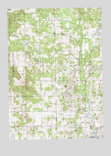
Reed City North, MI USGS Topographic Map
Click on map above to begin viewing in our Map Viewer.

This topographic map contains these locations and features:
Feature Name Type Latitude Longitude GNIS ID View Map
AshtonPopulated PlaceN43.9731°W85.5037°620279View Map
Ashton CemeteryCemeteryN43.9700°W85.5042°620280View Map
Ashton Post Office (historical)Post OfficeN43.9731°W85.5036°2514705View Map
Ashton Station (historical)LocaleN43.9736°W85.5058°2514703View Map
Burt CreekStreamN43.9456°W85.5301°622331View Map
Burt SchoolSchoolN43.9439°W85.5417°622335View Map
Church of the NazareneChurchN43.8925°W85.5225°2514643View Map
Congregational United ChurchChurchN43.8756°W85.5139°2514650View Map
Deer LakeLakeN43.9722°W85.5973°624473View Map
Deer Lake CemeteryCemeteryN43.9717°W85.5973°624492View Map
Deer Lake Post Office (historical)Post OfficeN43.9744°W85.5972°2513379View Map
East Branch Hersey CreekStreamN43.9433°W85.5273°625136View Map
German CemeteryCemeteryN43.9167°W85.5667°2513391View Map
Harvest Assembly of God ChurchChurchN43.8761°W85.5242°2514651View Map
Hersey CreekStreamN43.9433°W85.5276°628154View Map
Hewitt CreekStreamN43.8850°W85.5134°628173View Map
Hewitt SchoolSchoolN43.8881°W85.5428°628176View Map
House of PrayerChurchN43.9047°W85.5972°2513321View Map
Interchange 153CrossingN43.8875°W85.5297°2514771View Map
Interchange 159CrossingN43.9736°W85.5111°2514772View Map
Jewitt CreekStreamN43.9006°W85.5198°629281View Map
Johnson CreekStreamN43.8864°W85.5128°1620375View Map
Kissinger CreekStreamN43.9622°W85.5284°629772View Map
Lake No Sho MoLakeN43.8955°W85.5172°633439View Map
Lawrence CreekStreamN43.9092°W85.5167°630212View Map
Lincoln CreekStreamN43.9267°W85.5239°630445View Map
Lincoln Township HallBuildingN43.9450°W85.5014°2514654View Map
Lincoln Township Volunteer Fire DepartmentBuildingN43.9583°W85.5036°2626749View Map
Linear ParkParkN43.8814°W85.5125°2514634View Map
Maple Hill SchoolSchoolN43.9736°W85.5417°631470View Map
Mount Olivet CemeteryCemeteryN43.8883°W85.5373°632830View Map
Nartron FieldAirportN43.8997°W85.5157°1624117View Map
Old Rugged Cross MuseumBuildingN43.8842°W85.5183°2514656View Map
Oliver Post Office (historical)Post OfficeN43.8825°W85.5822°2513370View Map
Oliver SchoolSchoolN43.8878°W85.5831°634037View Map
OliversPopulated PlaceN43.8825°W85.5823°1617759View Map
Olivers Station (historical)LocaleN43.8822°W85.5822°2513355View Map
OronoPopulated PlaceN43.9444°W85.5194°2106970View Map
Orono Post Office (historical)Post OfficeN43.9444°W85.5197°2514675View Map
Orono Station (historical)LocaleN43.9447°W85.5197°2514667View Map
Osceola County CourthouseBuildingN43.8761°W85.5153°2514638View Map
Osceola County Emergency Medical ServicesBuildingN43.8791°W85.5225°2662110View Map
Osceola County Sheriff's OfficeBuildingN43.8757°W85.5146°2514639View Map
Pinora CemeteryCemeteryN43.9175°W85.5673°635024View Map
Rambadt Memorial ParkParkN43.8847°W85.5153°2514635View Map
Reed CityPopulated PlaceN43.8750°W85.5100°1621363View Map
Reed City Church of GodChurchN43.9519°W85.5028°2514655View Map
Reed City Post OfficePost OfficeN43.8761°W85.5128°2514637View Map
Reed City Public LibraryBuildingN43.8761°W85.5169°2514636View Map
Reed City Station (historical)LocaleN43.8758°W85.5069°2514641View Map
Rehkoff SchoolSchoolN43.9456°W85.5039°635779View Map
Roseburg SchoolSchoolN43.9161°W85.5820°636217View Map
Spears Grove SchoolSchoolN43.9083°W85.6231°638483View Map
Spectrum Health - Reed City CampusHospitalN43.8783°W85.5217°2514653View Map
Stowell LakeLakeN43.9501°W85.5834°638934View Map
Township of LincolnCivilN43.9449°W85.5029°1626625View Map
Township of PinoraCivilN43.9450°W85.6222°1626906View Map
Trinity Lutheran CemeteryCemeteryN43.9303°W85.5033°2514764View Map
United Methodist ChurchChurchN43.9736°W85.5003°2514704View Map
Westerburg Memorial ParkParkN43.8792°W85.5042°2514633View Map
Wilson CemeteryCemeteryN43.9228°W85.5434°1616555View Map
Wilson SchoolSchoolN43.9156°W85.5437°1616601View Map
Zion ChurchChurchN43.9450°W85.5634°1616954View Map

Note: Coordinates in the location and feature list above are referenced to NAD83 datum.


Copyright (C) 2008-2025 Ryan Niemi / Sunset Dynamics ... All Rights Reserved