TopoQuest Logo
Do you find TopoQuest useful?
Help keep TopoQuest running and adding new maps/features by donating!
Bitcoin:  19c7KJd3qBynnjoSw5npx9KScwjBe4ifkT
Litecoin:  LXs6TkuXGGXo1vDsWCkWVdjQX94eUKd6ui
Home View Maps Find Maps Find Places Resources & Links


Reedsville, Wisconsin Topographic Map

USGS Map Title: Reedsville, WI
USGS Map MRC: 44087B8
DRG (GeoTIFF) Download: o44087b8.tif


Neighboring USGS Topographic Map Quads:


  Greenleaf, WI  
44088C1
 

  Morrison, WI  
44087C8
 

  Denmark, WI  
44087C7
 

  Brillion, WI  
44088B1
 

  Reedsville, WI  
44087B8
 

  Whitelaw, WI  
44087B7
 

  Potter, WI  
44088A1
 

  Valders, WI  
44087A8
 

  Clarks Mills, WI  
44087A7


Map MRC Location:

N45°
W88°
N45°
W87°
H8 H7 H6 H5 H4 H3 H2 H1
G8 G7 G6 G5 G4 G3 G2 G1
F8 F7 F6 F5 F4 F3 F2 F1
E8 E7 E6 E5 E4 E3 E2 E1
D8 D7 D6 D5 D4 D3 D2 D1
C8 C7 C6 C5 C4 C3 C2 C1
B8 B7 B6 B5 B4 B3 B2 B1
A8 A7 A6 A5 A4 A3 A2 A1
N44°
W88°
N44°
W87°

Reedsville, WI USGS 1:24K Topographic Map Preview:
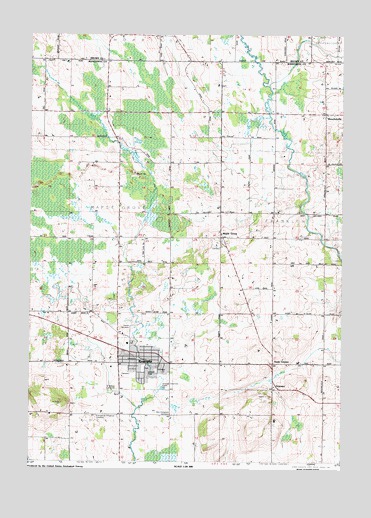
Reedsville, WI USGS Topographic Map
Click on map above to begin viewing in our Map Viewer.

This topographic map contains these locations and features:
Feature Name Type Latitude Longitude GNIS ID View Map
Baroun Century FarmLocaleN44.1994°W87.8808°2710292View Map
Brookside School (historical)SchoolN44.1680°W87.9743°1845986View Map
County Line Dairy FarmLocaleN44.2422°W87.9319°2710364View Map
Fenlon FarmLocaleN44.1631°W87.8850°2710353View Map
Frieden CemeteryCemeteryN44.1640°W87.9587°1565325View Map
Fritsch Lane DairyLocaleN44.1469°W87.8761°2710293View Map
GrimmsPopulated PlaceN44.1461°W87.9018°1577623View Map
Hamp Haven FarmsLocaleN44.1547°W87.8981°2710385View Map
Immanuel Church (historical)ChurchN44.1383°W87.9734°1846037View Map
Kocian DairyLocaleN44.2394°W87.9303°2710392View Map
L and S FarmsLocaleN44.1350°W87.9889°2710357View Map
Loppnow Dairy FarmLocaleN44.2339°W87.9578°2710355View Map
M and L FarmsLocaleN44.1394°W87.9828°2710356View Map
Maetz FarmsLocaleN44.2244°W87.9842°2710362View Map
Majestic Acres Dairy FarmLocaleN44.1253°W87.9700°2710386View Map
Maple GrovePopulated PlaceN44.1894°W87.9237°1568970View Map
Maple Rock School (historical)SchoolN44.1350°W87.9837°1846068View Map
Marquette School (historical)SchoolN44.2150°W87.9593°1846070View Map
MenchalvillePopulated PlaceN44.2258°W87.8823°1569333View Map
Menchalville Fire DepartmentBuildingN44.2250°W87.8884°2697708View Map
North GrimmsPopulated PlaceN44.1533°W87.9023°1577752View Map
Ohearn Dairy FarmLocaleN44.2122°W87.8808°2710359View Map
Reeds Vu Dairy FarmLocaleN44.1550°W87.9681°2710360View Map
ReedsvillePopulated PlaceN44.1536°W87.9568°1572174View Map
Reedsville Elementary SchoolSchoolN44.1485°W87.9529°1846088View Map
Reedsville Fire DepartmentBuildingN44.1529°W87.9451°2697707View Map
Reedsville High SchoolSchoolN44.1538°W87.9534°1846089View Map
Reedsville Middle SchoolSchoolN44.1482°W87.9529°2716516View Map
Reedsville Police DepartmentBuildingN44.1540°W87.9490°2759867View Map
Reedsville Post OfficePost OfficeN44.1543°W87.9450°2710281View Map
Rockland E U B CemeteryCemeteryN44.1383°W87.9734°1564724View Map
Russlers RanchLocaleN44.1725°W87.8806°2710393View Map
Saint John - Saint James Lutheran CemeteryCemeteryN44.1515°W87.9495°1846113View Map
Saint John - Saint James Lutheran SchoolSchoolN44.1528°W87.9499°1846143View Map
Saint John-Saint James Lutheran ChurchChurchN44.1530°W87.9493°1846114View Map
Saint Mary-Patrick SchoolSchoolN44.1544°W87.9612°1846125View Map
Saint Mary's CemeteryCemeteryN44.1465°W87.9644°1573292View Map
Saint Marys and Saint Patricks ChurchChurchN44.1539°W87.9607°1846126View Map
Sheahan FarmsLocaleN44.1953°W87.9253°2710352View Map
Town of Maple GroveCivilN44.1976°W87.9842°1583643View Map
Village of ReedsvilleCivilN44.1525°W87.9517°1584007View Map
Welsh FarmLocaleN44.1325°W87.9008°2710291View Map
Ziemer Dairy FarmLocaleN44.1772°W87.9761°2710354View Map
Zion Evergreen CemeteryCemeteryN44.1388°W87.9431°1577174View Map
Zion Lutheran School of WaysideSchoolN44.2488°W87.9501°1576362View Map
Zion United Methodist ChurchChurchN44.1536°W87.9637°1846177View Map

Note: Coordinates in the location and feature list above are referenced to NAD83 datum.


Copyright (C) 2008-2025 Ryan Niemi / Sunset Dynamics ... All Rights Reserved