TopoQuest Logo
Do you find TopoQuest useful?
Help keep TopoQuest running and adding new maps/features by donating!
Bitcoin:  19c7KJd3qBynnjoSw5npx9KScwjBe4ifkT
Litecoin:  LXs6TkuXGGXo1vDsWCkWVdjQX94eUKd6ui
Home View Maps Find Maps Find Places Resources & Links


Regina, Wisconsin Topographic Map

USGS Map Title: Regina, WI
USGS Map MRC: 44089H1
DRG (GeoTIFF) Download: o44089h1.tif


Neighboring USGS Topographic Map Quads:


  Aniwa, WI  
45089A2
 

  Mattoon, WI  
45089A1
 

  Zoar, WI  
45088A8
 

  Birnamwood, WI  
44089H2
 

  Regina, WI  
44089H1
 

  Burney Lake, WI  
44088H8
 

  Wittenberg, WI  
44089G2
 

  Shepley, WI  
44089G1
 

  Bowler, WI  
44088G8


Map MRC Location:

N45°
W90°
N45°
W89°
H8 H7 H6 H5 H4 H3 H2 H1
G8 G7 G6 G5 G4 G3 G2 G1
F8 F7 F6 F5 F4 F3 F2 F1
E8 E7 E6 E5 E4 E3 E2 E1
D8 D7 D6 D5 D4 D3 D2 D1
C8 C7 C6 C5 C4 C3 C2 C1
B8 B7 B6 B5 B4 B3 B2 B1
A8 A7 A6 A5 A4 A3 A2 A1
N44°
W90°
N44°
W89°

Regina, WI USGS 1:24K Topographic Map Preview:
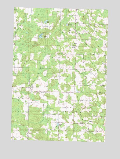
Regina, WI USGS Topographic Map
Click on map above to begin viewing in our Map Viewer.

This topographic map contains these locations and features:
Feature Name Type Latitude Longitude GNIS ID View Map
Baker LakeLakeN44.9736°W89.0887°1561103View Map
Camp Chin-Be-GotaLocaleN44.9733°W89.0854°1562649View Map
Cranberry LakeLakeN44.9872°W89.0825°1563483View Map
Hennig LakeLakeN44.8906°W89.0631°1566303View Map
Holy Family CemeteryCemeteryN44.9641°W89.0465°1566601View Map
Kolpack Lookout TowerTowerN44.9216°W89.0068°1581249View Map
Kolpack School (historical)SchoolN44.9211°W89.0015°1876635View Map
Leiskau CemeteryCemeteryN44.9202°W89.0829°1567957View Map
Leiskau School (historical)SchoolN44.9211°W89.0715°1876636View Map
Nazarene ChurchChurchN44.9677°W89.0412°1570123View Map
ReginaPopulated PlaceN44.8947°W89.0218°1572185View Map
Regina School (historical)SchoolN44.8844°W89.0218°1876643View Map
Riverside CemeteryCemeteryN44.8927°W89.0320°1572364View Map
Saint Pauls CemeteryCemeteryN44.9211°W89.0818°1573472View Map
Saint Paulus Church (historical)ChurchN44.9211°W89.0823°1876644View Map
Scandinavian ChurchChurchN44.9861°W89.0429°1573770View Map
Schroeder G770 DamDamN44.9466°W89.0051°1792543View Map
Sportsman LakeLakeN44.9211°W89.1205°2784266View Map
Town CemeteryCemeteryN44.8914°W89.0323°1575528View Map
Town of AlmonCivilN44.8999°W89.0427°1582681View Map
Town of HutchinsCivilN44.9853°W89.0418°1583428View Map
Woodlawn CemeteryCemeteryN44.9661°W89.0459°1577002View Map

Note: Coordinates in the location and feature list above are referenced to NAD83 datum.


Copyright (C) 2008-2024 Ryan Niemi / Sunset Dynamics ... All Rights Reserved