TopoQuest Logo
Do you find TopoQuest useful?
Help keep TopoQuest running and adding new maps/features by donating!
Bitcoin:  19c7KJd3qBynnjoSw5npx9KScwjBe4ifkT
Litecoin:  LXs6TkuXGGXo1vDsWCkWVdjQX94eUKd6ui
Home View Maps Find Maps Find Places Resources & Links


Reward, California Topographic Map

USGS Map Title: Reward, CA
USGS Map MRC: 35119C6
DRG (GeoTIFF) Download: o35119c6.tif


Neighboring USGS Topographic Map Quads:


  Carneros Rocks, CA  
35119D7
 

  Belridge, CA  
35119D6
 

  Lokern, CA  
35119D5
 

  McKittrick Summit, CA  
35119C7
 

  Reward, CA  
35119C6
 

  West Elk Hills, CA  
35119C5
 

  Painted Rock, CA  
35119B7
 

  Panorama Hills, CA  
35119B6
 

  Fellows, CA  
35119B5


Map MRC Location:

N36°
W120°
N36°
W119°
H8 H7 H6 H5 H4 H3 H2 H1
G8 G7 G6 G5 G4 G3 G2 G1
F8 F7 F6 F5 F4 F3 F2 F1
E8 E7 E6 E5 E4 E3 E2 E1
D8 D7 D6 D5 D4 D3 D2 D1
C8 C7 C6 C5 C4 C3 C2 C1
B8 B7 B6 B5 B4 B3 B2 B1
A8 A7 A6 A5 A4 A3 A2 A1
N35°
W120°
N35°
W119°

Reward, CA USGS 1:24K Topographic Map Preview:
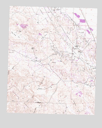
Reward, CA USGS Topographic Map
Click on map above to begin viewing in our Map Viewer.

This topographic map contains these locations and features:
Feature Name Type Latitude Longitude GNIS ID View Map
A M Cooper RanchLocaleN35.2836°W119.7218°1682816View Map
Browns CanyonValleyN35.2733°W119.7098°239730View Map
Cooper RanchLocaleN35.2789°W119.7065°240896View Map
Frazer SpringSpringN35.3455°W119.6951°242461View Map
Frazer ValleyValleyN35.3497°W119.6926°242462View Map
Little Santa Maria ValleyValleyN35.3089°W119.7107°1662281View Map
Maddux CanyonValleyN35.2783°W119.7160°1682820View Map
Maddux Ranch (historical)LocaleN35.3055°W119.6918°1839114View Map
Mama Pottinger CanyonValleyN35.2991°W119.7204°1682821View Map
McKittrick School (historical)SchoolN35.3014°W119.6265°1682822View Map
Old Cooper RanchLocaleN35.2580°W119.7318°1682824View Map
Olig (historical)Populated PlaceN35.3250°W119.6565°1839123View Map
Olig SchoolSchoolN35.3211°W119.6593°246869View Map
Pottinger CanyonValleyN35.3089°W119.7362°247747View Map
RewardPopulated PlaceN35.3225°W119.6793°1661304View Map
Standard OilOilfieldN35.3297°W119.6537°277423View Map
Sulphur SpringSpringN35.3108°W119.6840°250051View Map
Temblor ValleyValleyN35.3491°W119.6921°254330View Map
Tidewater Associated OilOilfieldN35.3275°W119.6590°277433View Map
Union OilOilfieldN35.3236°W119.6487°277435View Map
Welport OilOilfieldN35.3716°W119.6823°277440View Map
Willow SpringsSpringN35.3455°W119.7365°251658View Map
Willow Springs ValleyBasinN35.3422°W119.7410°251662View Map
Wood CanyonValleyN35.3202°W119.7401°251770View Map

Note: Coordinates in the location and feature list above are referenced to NAD83 datum.


Copyright (C) 2008-2024 Ryan Niemi / Sunset Dynamics ... All Rights Reserved