TopoQuest Logo
Do you find TopoQuest useful?
Help keep TopoQuest running and adding new maps/features by donating!
Bitcoin:  19c7KJd3qBynnjoSw5npx9KScwjBe4ifkT
Litecoin:  LXs6TkuXGGXo1vDsWCkWVdjQX94eUKd6ui
Home View Maps Find Maps Find Places Resources & Links


Rexford, Montana Topographic Map

USGS Map Title: Rexford, MT
USGS Map MRC: 48115H2
DRG (GeoTIFF) Download: o48115h2.tif


Neighboring USGS Topographic Map Quads:


  Red Mountain, MT  
48115H3
 

  Rexford, MT  
48115H2
 

  Eureka North, MT  
48115H1
 

  Webb Mountain, MT  
48115G3
 

  Beartrap Mountain, MT  
48115G2
 

  Eureka South, MT  
48115G1


Map MRC Location:

N49°
W116°
N49°
W115°
H8 H7 H6 H5 H4 H3 H2 H1
G8 G7 G6 G5 G4 G3 G2 G1
F8 F7 F6 F5 F4 F3 F2 F1
E8 E7 E6 E5 E4 E3 E2 E1
D8 D7 D6 D5 D4 D3 D2 D1
C8 C7 C6 C5 C4 C3 C2 C1
B8 B7 B6 B5 B4 B3 B2 B1
A8 A7 A6 A5 A4 A3 A2 A1
N48°
W116°
N48°
W115°

Rexford, MT USGS 1:24K Topographic Map Preview:
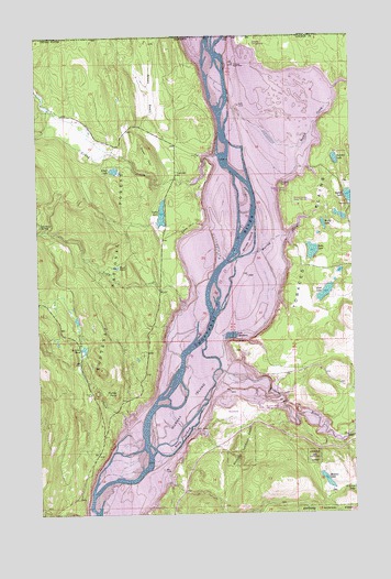
Rexford, MT USGS Topographic Map
Click on map above to begin viewing in our Map Viewer.

This topographic map contains these locations and features:
Feature Name Type Latitude Longitude GNIS ID View Map
36N28W01ADC_01 WellWellN48.9133°W115.1532°1637026View Map
36N28W11AADB01 WellWellN48.9030°W115.1729°1636985View Map
37N27W06CABA01 WellWellN48.9989°W115.1674°1637369View Map
37N27W06CB__01 WellWellN48.9977°W115.1693°1637360View Map
37N27W06CBAA01 WellWellN48.9991°W115.1691°1637371View Map
37N27W07CCD01_ WellWellN48.9769°W115.1696°1637266View Map
37N27W17CD__01 SpringSpringN48.9652°W115.1410°1637219View Map
37N27W21CBAB01 WellWellN48.9558°W115.1263°1637181View Map
37N27W28CBBB01 WellWellN48.9411°W115.1296°1637127View Map
37N28W13CABB01 WellWellN48.9694°W115.1885°1637235View Map
37N28W13CADB01 WellWellN48.9689°W115.1868°1637230View Map
Alkali LakeLakeN48.9649°W115.2201°778953View Map
Arnolds PondLakeN48.9182°W115.2330°779141View Map
Baney LakeLakeN48.9504°W115.1373°779324View Map
Cato (historical)LocaleN48.8972°W115.1593°1782220View Map
Dodge CreekStreamN48.9166°W115.1949°782429View Map
EZ-K RV ParkLocaleN48.8994°W115.1654°1782382View Map
Fourmile SpringSpringN48.9508°W115.2496°783652View Map
Gateway (historical)LocaleN48.9991°W115.1732°1782418View Map
Gateway (historical)Populated PlaceN48.9991°W115.1732°802106View Map
Gateway CampgroundLocaleN48.9977°W115.1652°794441View Map
Gateway Post Office (historical)Post OfficeN48.9991°W115.1732°1782311View Map
Gateway School (historical)SchoolN48.9991°W115.1732°1782417View Map
Green BasinBasinN48.9852°W115.2052°784266View Map
Grob LakeLakeN48.9325°W115.1369°784361View Map
Haydan (historical)LocaleN48.9347°W115.1671°1782420View Map
Hayden Post Office (historical)Post OfficeN48.9347°W115.1671°1782313View Map
Hayden School (historical)SchoolN48.9347°W115.1671°1782419View Map
Hoodoos Point of InterestLocaleN48.9094°W115.1546°794465View Map
Hunter PointSummitN48.9065°W115.2205°785170View Map
Kins Island (historical)IslandN48.8950°W115.1954°806301View Map
Kootenai FlatsFlatN48.9805°W115.1502°785840View Map
Kootenai Post (historical)LocaleN48.9680°W115.1802°1782424View Map
Lake Livermore (historical)LakeN48.9216°W115.1743°806303View Map
Madden LakeLakeN48.8834°W115.1373°786759View Map
Mariners HavenLocaleN48.8902°W115.1871°1782381View Map
Melvin DrawValleyN48.8772°W115.2091°787181View Map
Murray Creek (historical)StreamN48.9430°W115.1663°806305View Map
Murray Island (historical)IslandN48.9030°W115.1929°806306View Map
Murray Springs State Fish HatcheryLocaleN48.9555°W115.1468°807057View Map
O'Brien LakeLakeN48.8813°W115.1257°788360View Map
Olsen HillSummitN48.9705°W115.2074°788445View Map
Poverty CreekStreamN48.8808°W115.2305°789149View Map
RexfordPopulated PlaceN48.8994°W115.1721°806309View Map
Rexford Bench CampgroundLocaleN48.9022°W115.1618°807059View Map
Rexford Post OfficePost OfficeN48.8999°W115.1695°1782320View Map
Riverside (historical)Populated PlaceN48.9250°W115.1793°1781955View Map
Riverside Post Office (historical)Post OfficeN48.9250°W115.1793°1782322View Map
Rush LakeLakeN48.9395°W115.2196°789866View Map
Sales LakeLakeN48.9434°W115.1419°789962View Map
Sand HillSummitN48.9502°W115.1924°790001View Map
Sink CreekStreamN48.9700°W115.2228°790551View Map
Sophie CreekStreamN48.9730°W115.1749°790854View Map
Sophie lake Recreation SiteLocaleN48.9552°W115.1285°794464View Map
Sullivan CreekStreamN48.8752°W115.2296°791649View Map
Swisher LakeLakeN48.9674°W115.1323°791827View Map
Swisher Lake CampgroundLocaleN48.9697°W115.1335°794442View Map
Tobacco Plains Boat RampLocaleN48.9597°W115.1516°807058View Map
Tobacco RiverStreamN48.9127°W115.1796°792222View Map
Tooley LakeLakeN48.9533°W115.2013°792273View Map
Tooley Lake SchoolSchoolN48.9639°W115.1955°792274View Map
Town of RexfordCivilN48.8998°W115.1714°2412545View Map
West Kootenai Census Designated PlaceCensusN48.9653°W115.2213°2583864View Map
Whites Island (historical)IslandN48.9464°W115.1671°806315View Map
Whites Landing (historical)LocaleN48.9402°W115.1732°1782455View Map
Young CreekStreamN48.9691°W115.1788°793620View Map

Note: Coordinates in the location and feature list above are referenced to NAD83 datum.


Copyright (C) 2008-2024 Ryan Niemi / Sunset Dynamics ... All Rights Reserved