TopoQuest Logo
Do you find TopoQuest useful?
Help keep TopoQuest running and adding new maps/features by donating!
Bitcoin:  19c7KJd3qBynnjoSw5npx9KScwjBe4ifkT
Litecoin:  LXs6TkuXGGXo1vDsWCkWVdjQX94eUKd6ui
Home View Maps Find Maps Find Places Resources & Links


Ridgeville, Indiana Topographic Map

USGS Map Title: Ridgeville, IN
USGS Map MRC: 40085C1
DRG (GeoTIFF) Download: o40085c1.tif


Neighboring USGS Topographic Map Quads:


  Pennville, IN  
40085D2
 

  Blaine, IN  
40085D1
 

  Portland, IN  
40084D8
 

  Redkey, IN  
40085C2
 

  Ridgeville, IN  
40085C1
 

  Deerfield, IN  
40084C8
 

  Farmland, IN  
40085B2
 

  Maxville, IN  
40085B1
 

  Winchester, IN  
40084B8


Map MRC Location:

N41°
W86°
N41°
W85°
H8 H7 H6 H5 H4 H3 H2 H1
G8 G7 G6 G5 G4 G3 G2 G1
F8 F7 F6 F5 F4 F3 F2 F1
E8 E7 E6 E5 E4 E3 E2 E1
D8 D7 D6 D5 D4 D3 D2 D1
C8 C7 C6 C5 C4 C3 C2 C1
B8 B7 B6 B5 B4 B3 B2 B1
A8 A7 A6 A5 A4 A3 A2 A1
N40°
W86°
N40°
W85°

Ridgeville, IN USGS 1:24K Topographic Map Preview:
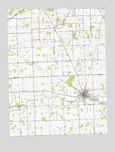
Ridgeville, IN USGS Topographic Map
Click on map above to begin viewing in our Map Viewer.

This topographic map contains these locations and features:
Feature Name Type Latitude Longitude GNIS ID View Map
Bear CreekStreamN40.2856°W85.0833°430631View Map
Bost CemeteryCemeteryN40.3642°W85.0280°431364View Map
Bost RunStreamN40.3631°W85.0330°431365View Map
Days CreekStreamN40.2895°W85.0661°433369View Map
De Armond DitchCanalN40.2956°W85.1177°433378View Map
Deer Ridge FarmLocaleN40.2731°W85.0156°2710737View Map
Deerfield Elementary SchoolSchoolN40.2875°W85.0252°447145View Map
Edwards FarmsLocaleN40.2653°W85.0861°2710735View Map
Emmetsville ChurchChurchN40.2939°W85.1064°434186View Map
Fetid CreekStreamN40.2837°W85.0277°434465View Map
Flesher CemeteryCemeteryN40.3445°W85.0841°452042View Map
Flesher CreekCanalN40.3020°W85.0597°452256View Map
Flower Point CemeteryCemeteryN40.3281°W85.0602°450920View Map
Friend RunStreamN40.2614°W85.1047°434841View Map
Great RunStreamN40.2856°W85.0922°435382View Map
Heuss DitchCanalN40.2795°W85.1236°449499View Map
Jeff RunStreamN40.3737°W85.0466°436956View Map
Mendenhall DitchCanalN40.3125°W85.0397°439009View Map
Miller DitchCanalN40.3339°W85.0589°439208View Map
Mississinewa ChurchChurchN40.2650°W85.1241°439288View Map
New Mount PleasantPopulated PlaceN40.3559°W85.0650°440088View Map
New Mount Pleasant CemeteryCemeteryN40.3578°W85.0702°440089View Map
Odd Fellows CemeteryCemeteryN40.2878°W85.0136°440507View Map
Pleasant Vale ChurchChurchN40.3206°W85.0936°441318View Map
Polar RunStreamN40.2762°W85.0708°441398View Map
Potent RunStreamN40.2862°W85.0583°441500View Map
PowersPopulated PlaceN40.3220°W85.0925°441523View Map
Powers CemeteryCemeteryN40.3228°W85.0875°441524View Map
Randolph ChurchChurchN40.2575°W85.0355°441764View Map
Rank RunStreamN40.2817°W85.0058°441766View Map
Red Key Sow FarmLocaleN40.3081°W85.1150°2710741View Map
Retter FarmsLocaleN40.3092°W85.1064°2710740View Map
Ridge RunStreamN40.2842°W85.0344°441993View Map
RidgevillePopulated PlaceN40.2892°W85.0289°442000View Map
Ridgeville ElevatorLocaleN40.2983°W85.0275°2710738View Map
Ridgeville Fire DepartmentBuildingN40.2914°W85.0288°2626397View Map
Ridgeville Police DepartmentBuildingN40.2887°W85.0293°2758229View Map
Riverside CemeteryCemeteryN40.2869°W85.0243°442090View Map
Smithson FarmsLocaleN40.2661°W85.0542°2710736View Map
Stevens DitchCanalN40.2617°W85.1044°449531View Map
Town of RidgevilleCivilN40.2920°W85.0284°2396878View Map
Township of FranklinCivilN40.2651°W85.0548°453313View Map
Township of JeffersonCivilN40.3513°W85.0742°453488View Map
Uphaus DitchCanalN40.2906°W85.1091°445156View Map
Vale RunStreamN40.3162°W85.1175°445186View Map
Veterans CemeteryCemeteryN40.2888°W85.0307°445269View Map
Ville RunStreamN40.2823°W85.0375°445299View Map
Virile RunStreamN40.2887°W85.0808°445312View Map
Wentz CemeteryCemeteryN40.3459°W85.0400°445678View Map
WILO-AM (New Albany)TowerN40.2778°W85.0522°448436View Map
Windy P Ridge Airport (historical)AirportN40.3403°W85.0180°449314View Map

Note: Coordinates in the location and feature list above are referenced to NAD83 datum.


Copyright (C) 2008-2025 Ryan Niemi / Sunset Dynamics ... All Rights Reserved