TopoQuest Logo
Do you find TopoQuest useful?
Help keep TopoQuest running and adding new maps/features by donating!
Bitcoin:  19c7KJd3qBynnjoSw5npx9KScwjBe4ifkT
Litecoin:  LXs6TkuXGGXo1vDsWCkWVdjQX94eUKd6ui
Home View Maps Find Maps Find Places Resources & Links


Riesel, Texas Topographic Map

USGS Map Title: Riesel, TX
USGS Map MRC: 31096D8
DRG (GeoTIFF) Download: o31096d8.tif


Neighboring USGS Topographic Map Quads:


  Waco East, TX  
31097E1
 

  Elk, TX  
31096E8
 

  Mart, TX  
31096E7
 

  Robinson, TX  
31097D1
 

  Riesel, TX  
31096D8
 

  Otto, TX  
31096D7
 

  Chilton, TX  
31097C1
 

  Marlin, TX  
31096C8
 

  McClanahan, TX  
31096C7


Map MRC Location:

N32°
W97°
N32°
W96°
H8 H7 H6 H5 H4 H3 H2 H1
G8 G7 G6 G5 G4 G3 G2 G1
F8 F7 F6 F5 F4 F3 F2 F1
E8 E7 E6 E5 E4 E3 E2 E1
D8 D7 D6 D5 D4 D3 D2 D1
C8 C7 C6 C5 C4 C3 C2 C1
B8 B7 B6 B5 B4 B3 B2 B1
A8 A7 A6 A5 A4 A3 A2 A1
N31°
W97°
N31°
W96°

Riesel, TX USGS 1:24K Topographic Map Preview:
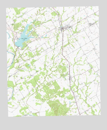
Riesel, TX USGS Topographic Map
Click on map above to begin viewing in our Map Viewer.

This topographic map contains these locations and features:
Feature Name Type Latitude Longitude GNIS ID View Map
Able LakeReservoirN31.4107°W96.9423°1864109View Map
Able Lake DamDamN31.4102°W96.9436°1864108View Map
BlacklandPopulated PlaceN31.4791°W96.8864°1379427View Map
City of RieselCivilN31.4763°W96.9304°2410946View Map
Friedens CemeteryCemeteryN31.4854°W96.8939°1357736View Map
Hebron SchoolSchoolN31.4224°W96.9167°1358989View Map
Hesse LakeReservoirN31.4674°W96.9469°1862253View Map
Hesse Lake DamDamN31.4668°W96.9469°1862252View Map
Holict "Private" AirportAirportN31.4269°W96.9796°2676571View Map
Lake Creek DamDamN31.4568°W96.9869°1862250View Map
Lake Creek LakeReservoirN31.4646°W96.9784°1360846View Map
Mann LakeReservoirN31.4308°W96.9684°1864107View Map
Mann Lake DamDamN31.4302°W96.9703°1864106View Map
Manos CreekStreamN31.4460°W96.9894°1362145View Map
Meier Settlement United Methodist ChurchChurchN31.4932°W96.9069°2022257View Map
Nazare CemeteryCemeteryN31.4218°W96.9250°1363615View Map
Nazare ChurchChurchN31.4302°W96.9169°1363616View Map
New Zion ChurchChurchN31.4254°W96.9603°1363832View Map
PerryPopulated PlaceN31.4180°W96.9153°1365073View Map
Perry ChurchChurchN31.4349°W96.8908°1365078View Map
RieselPopulated PlaceN31.4749°W96.9233°1366451View Map
Riesel City HallBuildingN31.4755°W96.9249°2753590View Map
Riesel Post OfficePost OfficeN31.4739°W96.9234°2731837View Map
Riesel SchoolSchoolN31.4779°W96.9155°2007639View Map
Riesel Volunteer Fire DepartmentBuildingN31.4767°W96.9187°2552358View Map
Saint Pauls ChurchChurchN31.3802°W96.8939°1367307View Map
Springhill ChurchChurchN31.4804°W96.9931°1369042View Map
Sunset CemeteryCemeteryN31.4210°W96.9878°1369412View Map
Sunset ChurchChurchN31.4188°W96.9808°1369414View Map
Sunset SchoolSchoolN31.4213°W96.9675°1369418View Map
Texas No Name Number 11 DamDamN31.4418°W96.9719°1864118View Map
Trinity ChurchChurchN31.4510°W96.8819°1370122View Map

Note: Coordinates in the location and feature list above are referenced to NAD83 datum.


Copyright (C) 2008-2025 Ryan Niemi / Sunset Dynamics ... All Rights Reserved