TopoQuest Logo
Do you find TopoQuest useful?
Help keep TopoQuest running and adding new maps/features by donating!
Bitcoin:  19c7KJd3qBynnjoSw5npx9KScwjBe4ifkT
Litecoin:  LXs6TkuXGGXo1vDsWCkWVdjQX94eUKd6ui
Home View Maps Find Maps Find Places Resources & Links


Rincon, New Mexico Topographic Map

USGS Map Title: Rincon, NM
USGS Map MRC: 32107F1
DRG (GeoTIFF) Download: o32107f1.tif


Neighboring USGS Topographic Map Quads:


  McLeod Tank, NM  
32107G2
 

  Alivio, NM  
32107G1
 

  Upham Hills, NM  
32106G8
 

  Hatch, NM  
32107F2
 

  Rincon, NM  
32107F1


  Souse Springs, NM  
32107E2
 

  Sierra Alta, NM  
32107E1


Map MRC Location:

N33°
W108°
N33°
W107°
H8 H7 H6 H5 H4 H3 H2 H1
G8 G7 G6 G5 G4 G3 G2 G1
F8 F7 F6 F5 F4 F3 F2 F1
E8 E7 E6 E5 E4 E3 E2 E1
D8 D7 D6 D5 D4 D3 D2 D1
C8 C7 C6 C5 C4 C3 C2 C1
B8 B7 B6 B5 B4 B3 B2 B1
A8 A7 A6 A5 A4 A3 A2 A1
N32°
W108°
N32°
W107°

Rincon, NM USGS 1:24K Topographic Map Preview:
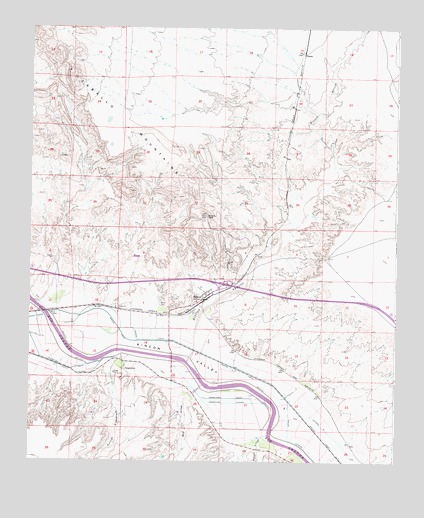
Rincon, NM USGS Topographic Map
Click on map above to begin viewing in our Map Viewer.

This topographic map contains these locations and features:
Feature Name Type Latitude Longitude GNIS ID View Map
10015 Water WellWellN32.6679°W107.1178°918905View Map
10060 Water WellWellN32.6384°W107.0364°918904View Map
32-Upham InterchangeCrossingN32.6701°W107.0106°929314View Map
35-Rincon InterchangeCrossingN32.6759°W107.0606°929263View Map
AngosturaPopulated PlaceN32.6520°W107.0931°899502View Map
Angostura DrainCanalN32.6434°W107.0642°885756View Map
Angostura LateralCanalN32.6542°W107.0936°885757View Map
Arroyo AngosturaStreamN32.6562°W107.0967°897615View Map
Barbee DrawValleyN32.7487°W107.0128°886042View Map
Bignell ArroyoStreamN32.6329°W107.0436°886376View Map
Cagles Historic SiteLocaleN32.6729°W107.0647°935187View Map
Cook Placer ClaimsMineN32.6848°W107.0689°916880View Map
GramaPopulated PlaceN32.7429°W107.0322°920604View Map
Hatch DivisionCivilN32.6389°W107.1162°1937537View Map
Hatch Valley Arroyos Site Four DamDamN32.6834°W107.0889°923987View Map
Jornado del Muerto Historical MarkerParkN32.6729°W107.0647°932404View Map
Jornado del Muerto on the Camino Real Historical MarkerParkN32.6729°W107.0647°932243View Map
KVLC-FM (Las Cruces)TowerN32.6931°W107.0689°938671View Map
KWQQ-FM (Hatch)TowerN32.6912°W107.0631°938663View Map
Last ChanceMineN32.7126°W107.0906°916676View Map
Last Chance GroupMineN32.7123°W107.0800°916437View Map
Lateral MCanalN32.6370°W107.0272°890974View Map
Morgan MineMineN32.6862°W107.0745°939901View Map
Mormon Battalion Historical MarkerParkN32.6729°W107.0647°932214View Map
Porter Whisenhunt Arroyo Retard DamDamN32.6501°W107.1172°924060View Map
Reed ArroyoStreamN32.6473°W107.0658°893842View Map
RinconPopulated PlaceN32.6729°W107.0647°920673View Map
Rincon ArroyoStreamN32.6540°W107.0711°898416View Map
Rincon ArroyoMineN32.6723°W107.0536°916564View Map
Rincon CanalCanalN32.6595°W107.0792°893924View Map
Rincon CemeteryCemeteryN32.6716°W107.0808°893928View Map
Rincon Census Designated PlaceCensusN32.6729°W107.0763°2409169View Map
Rincon DrainCanalN32.6401°W107.0336°893933View Map
Rincon Fire StationBuildingN32.6750°W107.0640°2657811View Map
Rincon LateralCanalN32.6251°W107.0292°893943View Map
Rincon MineMineN32.6862°W107.0800°916438View Map
Rincon Post OfficePost OfficeN32.6725°W107.0656°2781539View Map
Rincon Post Office (historical)Post OfficeN32.6729°W107.0647°937282View Map
Rincon SiphonCanalN32.6673°W107.1192°893950View Map
Rincon WellMineN32.6767°W107.0536°916145View Map
United States Bureau of Reclamation 4 Water WellWellN32.6642°W107.0764°918749View Map
United States Bureau of Reclamation 5 Water WellWellN32.6429°W107.0458°918745View Map
USBR 7 Water WellWellN32.6642°W107.0764°918748View Map

Note: Coordinates in the location and feature list above are referenced to NAD83 datum.


Copyright (C) 2008-2024 Ryan Niemi / Sunset Dynamics ... All Rights Reserved