TopoQuest Logo
Do you find TopoQuest useful?
Help keep TopoQuest running and adding new maps/features by donating!
Bitcoin:  19c7KJd3qBynnjoSw5npx9KScwjBe4ifkT
Litecoin:  LXs6TkuXGGXo1vDsWCkWVdjQX94eUKd6ui
Home View Maps Find Maps Find Places Resources & Links


Ringle, Wisconsin Topographic Map

USGS Map Title: Ringle, WI
USGS Map MRC: 44089H4
DRG (GeoTIFF) Download: o44089h4.tif


Neighboring USGS Topographic Map Quads:


  Nutterville, WI  
45089A5
 

  Kalinke, WI  
45089A4
 

  Hogarty, WI  
45089A3
 

  Wausau East, WI  
44089H5
 

  Ringle, WI  
44089H4
 

  Hatley, WI  
44089H3
 

  Peplin, WI  
44089G5
 

  Bevent, WI  
44089G4
 

  Mission Lake, WI  
44089G3


Map MRC Location:

N45°
W90°
N45°
W89°
H8 H7 H6 H5 H4 H3 H2 H1
G8 G7 G6 G5 G4 G3 G2 G1
F8 F7 F6 F5 F4 F3 F2 F1
E8 E7 E6 E5 E4 E3 E2 E1
D8 D7 D6 D5 D4 D3 D2 D1
C8 C7 C6 C5 C4 C3 C2 C1
B8 B7 B6 B5 B4 B3 B2 B1
A8 A7 A6 A5 A4 A3 A2 A1
N44°
W90°
N44°
W89°

Ringle, WI USGS 1:24K Topographic Map Preview:
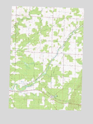
Ringle, WI USGS Topographic Map
Click on map above to begin viewing in our Map Viewer.

This topographic map contains these locations and features:
Feature Name Type Latitude Longitude GNIS ID View Map
Barstow School (historical)SchoolN44.9672°W89.4696°1876669View Map
Carpenter School (historical)SchoolN44.9291°W89.3876°1876675View Map
Clay PondLakeN44.8918°W89.4191°1577347View Map
Dewey School (historical)SchoolN44.9869°W89.3785°1876681View Map
East Branch Big Sandy CreekStreamN44.9914°W89.4662°1564284View Map
Easton Center School (historical)SchoolN44.9658°W89.4293°1876685View Map
Easton Elementary SchoolSchoolN44.9897°W89.4290°1564396View Map
Easton Volunteer Fire DepartmentBuildingN44.9881°W89.4293°2696968View Map
Faith Christian AcademySchoolN44.9481°W89.4907°2713181View Map
Flying 'O' AirportAirportN44.9257°W89.4023°1581054View Map
Forestville CemeteryCemeteryN44.9441°W89.4109°1565147View Map
Forestville School (historical)SchoolN44.9580°W89.3773°1876690View Map
Marathon County LandfillLocaleN44.8922°W89.3842°2635555View Map
Mole BrookStreamN44.9164°W89.4429°1569641View Map
New Hope ChurchChurchN44.9483°W89.4910°1845213View Map
RinglePopulated PlaceN44.8911°W89.4257°1572328View Map
Ringle Fire DepartmentBuildingN44.8925°W89.4255°2696928View Map
Riverside Elementary SchoolSchoolN44.9056°W89.4696°1845235View Map
Saint John Lutheran SchoolSchoolN44.9884°W89.4891°1845254View Map
Stam FarmsLocaleN44.9936°W89.4933°2723410View Map
Town of EastonCivilN44.9877°W89.4193°1583118View Map
Town of RingleCivilN44.9009°W89.4191°1584037View Map

Note: Coordinates in the location and feature list above are referenced to NAD83 datum.


Copyright (C) 2008-2025 Ryan Niemi / Sunset Dynamics ... All Rights Reserved