TopoQuest Logo
Do you find TopoQuest useful?
Help keep TopoQuest running and adding new maps/features by donating!
Bitcoin:  19c7KJd3qBynnjoSw5npx9KScwjBe4ifkT
Litecoin:  LXs6TkuXGGXo1vDsWCkWVdjQX94eUKd6ui
Home View Maps Find Maps Find Places Resources & Links


Riomar, Florida Topographic Map

USGS Map Title: Riomar, FL
USGS Map MRC: 27080F3
DRG (GeoTIFF) Download: o27080f3.tif


Neighboring USGS Topographic Map Quads:


  Sebastian, FL  
27080G4


  Vero Beach, FL  
27080F4
 

  Riomar, FL  
27080F3


  Oslo, FL  
27080E4
 

  Indrio, FL  
27080E3


Map MRC Location:

N28°
W81°
N28°
W80°
H8 H7 H6 H5 H4 H3 H2 H1
G8 G7 G6 G5 G4 G3 G2 G1
F8 F7 F6 F5 F4 F3 F2 F1
E8 E7 E6 E5 E4 E3 E2 E1
D8 D7 D6 D5 D4 D3 D2 D1
C8 C7 C6 C5 C4 C3 C2 C1
B8 B7 B6 B5 B4 B3 B2 B1
A8 A7 A6 A5 A4 A3 A2 A1
N27°
W81°
N27°
W80°

Riomar, FL USGS 1:24K Topographic Map Preview:
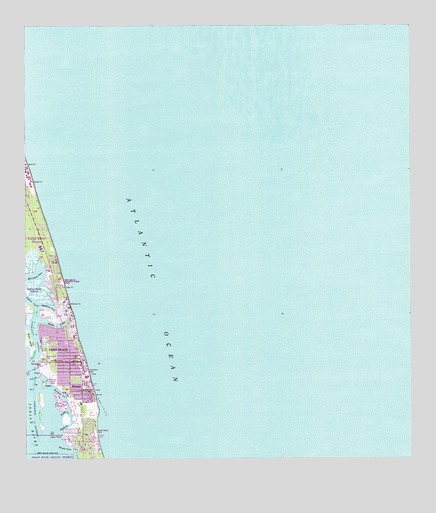
Riomar, FL USGS Topographic Map
Click on map above to begin viewing in our Map Viewer.

This topographic map contains these locations and features:
Feature Name Type Latitude Longitude GNIS ID View Map
Beachland Elementary SchoolSchoolN27.6542°W80.3653°298480View Map
Bethel CreekStreamN27.6656°W80.3703°278552View Map
Christ United Methodist Church By-The-SeaChurchN27.6586°W80.3609°303161View Map
Dark PointCapeN27.6317°W80.3631°281295View Map
Erwin CoveBayN27.6287°W80.3605°282248View Map
Farley IslandIslandN27.6470°W80.3687°282383View Map
First Church of the NazareneChurchN27.6503°W80.3623°303179View Map
Fritz IslandIslandN27.6592°W80.3739°282838View Map
Gifford CutChannelN27.6703°W80.3737°283064View Map
Humiston ParkParkN27.6509°W80.3559°302702View Map
Indian River County Fire Rescue Station 2BuildingN27.6529°W80.3701°2331393View Map
Indian River Shores Department of Public SafetyBuildingN27.6918°W80.3730°2331168View Map
Indian River Shores Police DepartmentBuildingN27.6917°W80.3729°2331490View Map
Jandrew CoveBayN27.6695°W80.3679°284720View Map
McCullers CoveBayN27.6787°W80.3724°286595View Map
Merril P Barber BridgeBridgeN27.6517°W80.3734°303586View Map
North CreekStreamN27.6378°W80.3639°287800View Map
RiomarPopulated PlaceN27.6450°W80.3562°289718View Map
Riomar Country ClubLocaleN27.6395°W80.3559°289719View Map
Riomar CreekStreamN27.6450°W80.3662°289720View Map
South Beach ParkParkN27.6336°W80.3526°302703View Map
South CreekStreamN27.6339°W80.3642°291363View Map
Vero Beach Finance Post OfficePost OfficeN27.6527°W80.3573°2768179View Map

Note: Coordinates in the location and feature list above are referenced to NAD83 datum.


Copyright (C) 2008-2024 Ryan Niemi / Sunset Dynamics ... All Rights Reserved