TopoQuest Logo
Do you find TopoQuest useful?
Help keep TopoQuest running and adding new maps/features by donating!
Bitcoin:  19c7KJd3qBynnjoSw5npx9KScwjBe4ifkT
Litecoin:  LXs6TkuXGGXo1vDsWCkWVdjQX94eUKd6ui
Home View Maps Find Maps Find Places Resources & Links


Risue Canyon, Nevada Topographic Map

USGS Map Title: Risue Canyon, NV
USGS Map MRC: 38119E4
DRG (GeoTIFF) Download: o38119e4.tif


Neighboring USGS Topographic Map Quads:


  Topaz Lake, NV  
38119F5
 

  Long Dry Canyon, NV  
38119F4
 

  Desert Creek Ranch, NV  
38119F3
 

  Coleville, CA  
38119E5
 

  Risue Canyon, NV  
38119E4
 

  Desert Creek Peak, NV  
38119E3
 

  Lost Cannon Peak, CA  
38119D5
 

  Chris Flat, CA  
38119D4
 

  Mount Patterson, CA  
38119D3


Map MRC Location:

N39°
W120°
N39°
W119°
H8 H7 H6 H5 H4 H3 H2 H1
G8 G7 G6 G5 G4 G3 G2 G1
F8 F7 F6 F5 F4 F3 F2 F1
E8 E7 E6 E5 E4 E3 E2 E1
D8 D7 D6 D5 D4 D3 D2 D1
C8 C7 C6 C5 C4 C3 C2 C1
B8 B7 B6 B5 B4 B3 B2 B1
A8 A7 A6 A5 A4 A3 A2 A1
N38°
W120°
N38°
W119°

Risue Canyon, NV USGS 1:24K Topographic Map Preview:
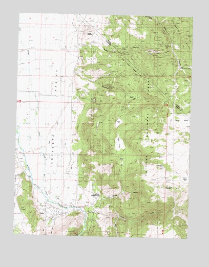
Risue Canyon, NV USGS Topographic Map
Click on map above to begin viewing in our Map Viewer.

This topographic map contains these locations and features:
Feature Name Type Latitude Longitude GNIS ID View Map
Antelope Valley Volunteer Fire DepartmentBuildingN38.5143°W119.4798°2624226View Map
Arrowhead MineMineN38.6085°W119.3963°838511View Map
Big SloughStreamN38.5377°W119.4802°219257View Map
Blackwell CanyonValleyN38.5882°W119.4563°219428View Map
Camp AntelopeLocaleN38.5244°W119.4427°220439View Map
Highline DitchCanalN38.5966°W119.4635°853446View Map
Highline DitchCanalN38.5874°W119.4649°225309View Map
Indian FlatFlatN38.5630°W119.4302°225876View Map
Indian SpringSpringN38.6060°W119.4243°841271View Map
Indian ValleyFlatN38.5527°W119.4285°225914View Map
Lilly MineMineN38.5849°W119.4332°227092View Map
Lone Company DitchCanalN38.5466°W119.4649°227504View Map
Main CanalCanalN38.5274°W119.4721°227962View Map
Mill CanyonValleyN38.5155°W119.4721°266354View Map
Mill CreekStreamN38.5169°W119.4735°263600View Map
Mono County Paramedics Station 1BuildingN38.5149°W119.4805°2662229View Map
Rickey CanyonValleyN38.6080°W119.4574°843216View Map
Rickey CanyonValleyN38.6069°W119.4421°231561View Map
Risue Canyon SpringSpringN38.6235°W119.4052°848631View Map
Risue Mining DistrictCivilN38.6227°W119.4082°856732View Map
Rock CreekStreamN38.5130°W119.4491°265484View Map
Round MountainSummitN38.6144°W119.4529°231961View Map
Salmon FlatFlatN38.5441°W119.4249°232284View Map
South Fork Rock CreekStreamN38.5105°W119.4266°267495View Map
Spring CanyonValleyN38.5205°W119.4382°235231View Map
Spring CreekStreamN38.5216°W119.4402°274784View Map
Taylor CanyonValleyN38.5169°W119.4735°268097View Map
Taylor ValleyBasinN38.5677°W119.3777°251929View Map
Upper Risue Canyon SpringSpringN38.5960°W119.3854°854981View Map
WalkerPopulated PlaceN38.5149°W119.4768°251928View Map
Walker Census Designated PlaceCensusN38.5341°W119.4582°2583180View Map
Wild Horse MountainSummitN38.5277°W119.3932°237757View Map
Wild Horse SpringSpringN38.5407°W119.3957°237763View Map

Note: Coordinates in the location and feature list above are referenced to NAD83 datum.


Copyright (C) 2008-2025 Ryan Niemi / Sunset Dynamics ... All Rights Reserved