TopoQuest Logo
Do you find TopoQuest useful?
Help keep TopoQuest running and adding new maps/features by donating!
Bitcoin:  19c7KJd3qBynnjoSw5npx9KScwjBe4ifkT
Litecoin:  LXs6TkuXGGXo1vDsWCkWVdjQX94eUKd6ui
Home View Maps Find Maps Find Places Resources & Links


Roberts, Montana Topographic Map

USGS Map Title: Roberts, MT
USGS Map MRC: 45109C2
DRG (GeoTIFF) Download: o45109c2.tif


Neighboring USGS Topographic Map Quads:


  Roscoe NE, MT  
45109D3
 

  Cooney Reservoir, MT  
45109D2
 

  Boyd, MT  
45109D1
 

  Castagne, MT  
45109C3
 

  Roberts, MT  
45109C2
 

  The Big Slide, MT  
45109C1
 

  Red Lodge West, MT  
45109B3
 

  Red Lodge East, MT  
45109B2
 

  Belfry, MT  
45109B1


Map MRC Location:

N46°
W110°
N46°
W109°
H8 H7 H6 H5 H4 H3 H2 H1
G8 G7 G6 G5 G4 G3 G2 G1
F8 F7 F6 F5 F4 F3 F2 F1
E8 E7 E6 E5 E4 E3 E2 E1
D8 D7 D6 D5 D4 D3 D2 D1
C8 C7 C6 C5 C4 C3 C2 C1
B8 B7 B6 B5 B4 B3 B2 B1
A8 A7 A6 A5 A4 A3 A2 A1
N45°
W110°
N45°
W109°

Roberts, MT USGS 1:24K Topographic Map Preview:
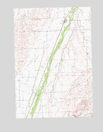
Roberts, MT USGS Topographic Map
Click on map above to begin viewing in our Map Viewer.

This topographic map contains these locations and features:
Feature Name Type Latitude Longitude GNIS ID View Map
05S21E29DBCB01 WellWellN45.3691°W109.1577°809135View Map
Bailey DitchCanalN45.2577°W109.2121°779255View Map
Beartooth Grain and Feed ElevatorLocaleN45.2769°W109.2171°1726577View Map
Beartooth Grain and Feed ElevatorLocaleN45.3597°W109.1677°1726578View Map
Beaver Lodge Fishing Access SiteLocaleN45.2647°W109.2193°1744545View Map
Bodair GraveCemeteryN45.3190°W109.1428°1726643View Map
Bull Springs Fishing Access SiteLocaleN45.2780°W109.2113°1744543View Map
Clear Creek DitchCanalN45.2752°W109.2032°781360View Map
Coulee Creek (historical)LocaleN45.3583°W109.1577°1726658View Map
Crockett DitchCanalN45.3336°W109.1671°770305View Map
DeVries DitchCanalN45.3686°W109.1449°770498View Map
Dry Creek BasinBasinN45.2569°W109.1307°770800View Map
East BenchBenchN45.2841°W109.1971°782780View Map
Feeley DitchCanalN45.2858°W109.2299°771322View Map
Finn DitchCanalN45.3433°W109.2068°771358View Map
Finnish HallLocaleN45.2786°W109.2193°771364View Map
FoxPopulated PlaceN45.2769°W109.2171°771584View Map
Fox (historical)LocaleN45.2783°W109.2196°1726806View Map
Fox School (historical)SchoolN45.2824°W109.2218°771594View Map
Harney DitchCanalN45.3611°W109.2429°772158View Map
Hunter-Northy DitchCanalN45.2880°W109.2307°772635View Map
Jeffrey DitchCanalN45.2547°W109.1849°785448View Map
Kivikangas DitchCanalN45.2916°W109.2165°773094View Map
Plainview School (historical)SchoolN45.3097°W109.1777°1726838View Map
Reserve (historical)LocaleN45.2699°W109.2215°1726782View Map
RobertsPopulated PlaceN45.3597°W109.1677°775824View Map
Roberts (historical)LocaleN45.3577°W109.1688°1726779View Map
Roberts CemeteryCemeteryN45.3605°W109.1543°775825View Map
Roberts Census Designated PlaceCensusN45.3436°W109.1818°2583838View Map
Roberts Post OfficePost OfficeN45.3589°W109.1678°1726778View Map
Roberts Rural Fire District 6BuildingN45.3582°W109.1681°2546656View Map
Roberts SchoolSchoolN45.3613°W109.1653°1726843View Map
Roberts United Methodist ChurchChurchN45.3597°W109.1677°1726613View Map
Rock Creek BridgeBridgeN45.3611°W109.1582°1726634View Map
Saint Thomas ChurchChurchN45.3572°W109.1699°777141View Map
Sigel FarmLocaleN45.3213°W109.1329°776541View Map
Sparr DitchCanalN45.2622°W109.2102°791135View Map
Tuck-Crockett DitchCanalN45.3024°W109.1877°777792View Map
Water Birch Fishing Access SiteLocaleN45.3097°W109.1943°1744542View Map
Wentworth DitchCanalN45.3333°W109.2213°778183View Map
West BenchBenchN45.3044°W109.2213°792948View Map

Note: Coordinates in the location and feature list above are referenced to NAD83 datum.


Copyright (C) 2008-2024 Ryan Niemi / Sunset Dynamics ... All Rights Reserved