TopoQuest Logo
Do you find TopoQuest useful?
Help keep TopoQuest running and adding new maps/features by donating!
Bitcoin:  19c7KJd3qBynnjoSw5npx9KScwjBe4ifkT
Litecoin:  LXs6TkuXGGXo1vDsWCkWVdjQX94eUKd6ui
Home View Maps Find Maps Find Places Resources & Links


Rock City, Montana Topographic Map

USGS Map Title: Rock City, MT
USGS Map MRC: 48112D3
DRG (GeoTIFF) Download: o48112d3.tif


Neighboring USGS Topographic Map Quads:


  Squaw Buttes, MT  
48112E4
 

  Cut Bank SE, MT  
48112E3
 

  Boru Spring, MT  
48112E2
 

  Flag Butte, MT  
48112D4
 

  Rock City, MT  
48112D3
 

  Abbott Lake, MT  
48112D2
 

  Kuka Crossing, MT  
48112C4
 

  Valier West, MT  
48112C3
 

  Valier East, MT  
48112C2


Map MRC Location:

N49°
W113°
N49°
W112°
H8 H7 H6 H5 H4 H3 H2 H1
G8 G7 G6 G5 G4 G3 G2 G1
F8 F7 F6 F5 F4 F3 F2 F1
E8 E7 E6 E5 E4 E3 E2 E1
D8 D7 D6 D5 D4 D3 D2 D1
C8 C7 C6 C5 C4 C3 C2 C1
B8 B7 B6 B5 B4 B3 B2 B1
A8 A7 A6 A5 A4 A3 A2 A1
N48°
W113°
N48°
W112°

Rock City, MT USGS 1:24K Topographic Map Preview:
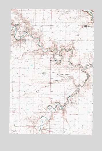
Rock City, MT USGS Topographic Map
Click on map above to begin viewing in our Map Viewer.

This topographic map contains these locations and features:
Feature Name Type Latitude Longitude GNIS ID View Map
31N05W34CCCC01 WellWellN48.3961°W112.2500°1635296View Map
AN Six CanalCanalN48.3830°W112.2514°806130View Map
Birch CreekStreamN48.4428°W112.2612°779931View Map
Blair CrossingPopulated PlaceN48.4033°W112.2914°769016View Map
Blair MineMineN48.4036°W112.2942°769017View Map
Buffalo RidgeRidgeN48.4464°W112.3381°769357View Map
K CanalCanalN48.3880°W112.3687°801732View Map
Kennedy MineMineN48.4147°W112.2700°772989View Map
Kingston MineMineN48.4153°W112.2750°773060View Map
Lenoir RanchLocaleN48.4316°W112.2895°773300View Map
Lookout ButteSummitN48.4755°W112.2764°773667View Map
Nineteen K CanalCanalN48.4072°W112.3334°801731View Map
Pioneer FarmLocaleN48.3789°W112.3725°775262View Map
Rock CityLocaleN48.4439°W112.2573°805919View Map
Rocky Ridge CouleeValleyN48.4236°W112.2720°775904View Map
Shields CrossingPopulated PlaceN48.4722°W112.3584°776487View Map
Slezak MineMineN48.4097°W112.2864°776637View Map
Two M CanalCanalN48.4166°W112.3687°805921View Map
Uleberg School (historical)SchoolN48.4369°W112.3714°777903View Map

Note: Coordinates in the location and feature list above are referenced to NAD83 datum.


Copyright (C) 2008-2025 Ryan Niemi / Sunset Dynamics ... All Rights Reserved