TopoQuest Logo
Do you find TopoQuest useful?
Help keep TopoQuest running and adding new maps/features by donating!
Bitcoin:  19c7KJd3qBynnjoSw5npx9KScwjBe4ifkT
Litecoin:  LXs6TkuXGGXo1vDsWCkWVdjQX94eUKd6ui
Home View Maps Find Maps Find Places Resources & Links


Rockinstraw Mountain, Arizona Topographic Map

USGS Map Title: Rockinstraw Mountain, AZ
USGS Map MRC: 33110E7
DRG (GeoTIFF) Download: o33110e7.tif


Neighboring USGS Topographic Map Quads:


  Meddler Wash, AZ  
33110F8
 

  Dagger Peak, AZ  
33110F7
 

  Haystack Butte, AZ  
33110F6
 

  Salt River Peak, AZ  
33110E8
 

  Rockinstraw Mountain, AZ  
33110E7
 

  Chrome Butte, AZ  
33110E6
 

  Inspiration, AZ  
33110D8
 

  Globe, AZ  
33110D7
 

  Cammerman Wash, AZ  
33110D6


Map MRC Location:

N34°
W111°
N34°
W110°
H8 H7 H6 H5 H4 H3 H2 H1
G8 G7 G6 G5 G4 G3 G2 G1
F8 F7 F6 F5 F4 F3 F2 F1
E8 E7 E6 E5 E4 E3 E2 E1
D8 D7 D6 D5 D4 D3 D2 D1
C8 C7 C6 C5 C4 C3 C2 C1
B8 B7 B6 B5 B4 B3 B2 B1
A8 A7 A6 A5 A4 A3 A2 A1
N33°
W111°
N33°
W110°

Rockinstraw Mountain, AZ USGS 1:24K Topographic Map Preview:
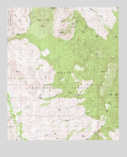
Rockinstraw Mountain, AZ USGS Topographic Map
Click on map above to begin viewing in our Map Viewer.

This topographic map contains these locations and features:
Feature Name Type Latitude Longitude GNIS ID View Map
Alamo Ranger StationLocaleN33.5017°W110.8584°25562View Map
Apache TankReservoirN33.5534°W110.7707°39229View Map
Apache Tank Number TwoReservoirN33.5578°W110.7651°39230View Map
Ash SpringSpringN33.5065°W110.8229°39237View Map
Big Pasture WellWellN33.5223°W110.8334°39257View Map
Big Pond TankReservoirN33.5731°W110.8520°39258View Map
Bixby WellWellN33.5292°W110.8071°39265View Map
Brewster WellWellN33.5312°W110.7521°39290View Map
Brewster WellWellN33.5306°W110.7504°39291View Map
Brush SpringWellN33.5981°W110.7737°39295View Map
Brushy SpringSpringN33.5976°W110.7743°26840View Map
Cement SpringSpringN33.5278°W110.8173°39331View Map
Cherry Horizontal SpringSpringN33.5420°W110.7551°2062273View Map
Cherry SpringSpringN33.5432°W110.7610°39345View Map
Cold Water SeepSpringN33.6129°W110.8416°39367View Map
Cottonwood SpringSpringN33.5038°W110.7887°39382View Map
Dry Weather Ford TankReservoirN33.5167°W110.8623°39425View Map
Ginn SpringSpringN33.5127°W110.7683°39457View Map
Globe Division (historical)CensusN33.5495°W110.7528°2764882View Map
Globe-Miami DivisionCivilN33.5327°W110.8156°1934946View Map
Granite PeakSummitN33.6067°W110.8343°29487View Map
Granite SpringSpringN33.6132°W110.8312°39470View Map
Granite SpringSpringN33.5973°W110.7546°2062271View Map
Grapevine SpringSpringN33.6230°W110.7797°39474View Map
Hackberry SpringSpringN33.5137°W110.8090°39484View Map
Hicks WashStreamN33.5239°W110.8665°29929View Map
Horse SpringSpringN33.5810°W110.7767°39521View Map
Horseshoe Bend WashStreamN33.5248°W110.8657°30186View Map
Jackson TankReservoirN33.5773°W110.8415°39543View Map
Jump-off SpringSpringN33.6101°W110.8012°2062272View Map
Jump-off SpringSpringN33.6003°W110.8649°39550View Map
Kyles TankReservoirN33.5423°W110.8646°39557View Map
Little Brewster SpringSpringN33.5630°W110.7712°39565View Map
Little Mud WellWellN33.5917°W110.7890°39568View Map
Lower Mud SpringSpringN33.6071°W110.7982°32105View Map
Lower WellWellN33.5528°W110.8326°39586View Map
Mint SpringSpringN33.5274°W110.7628°39633View Map
Murray WashStreamN33.5139°W110.8640°32209View Map
Negro WashStreamN33.5014°W110.8604°32277View Map
Negro WellWellN33.5181°W110.8062°39655View Map
New Water WellWellN33.5589°W110.7837°39658View Map
Nugget MesaSummitN33.5198°W110.7734°32407View Map
Nugget Wash SpringSpringN33.5012°W110.7846°39661View Map
Price TankReservoirN33.5939°W110.8257°39712View Map
Procopio SpringSpringN33.5426°W110.7955°39716View Map
Rays TankReservoirN33.5730°W110.8452°39726View Map
Redmond MountainSummitN33.6053°W110.8582°33536View Map
Redmond TankReservoirN33.6139°W110.8534°39729View Map
Redmond WellWellN33.6189°W110.8340°39730View Map
Richmond BasinBasinN33.5328°W110.7590°33605View Map
Riley WellWellN33.5242°W110.7896°39739View Map
Rockinstraw MountainSummitN33.6014°W110.8173°33757View Map
Rockinstraw TankReservoirN33.6192°W110.8173°39755View Map
Rockinstraw Tank Number TwoReservoirN33.6217°W110.8168°39756View Map
Rocky TankReservoirN33.5467°W110.8326°39757View Map
Rough Canyon TankReservoirN33.5014°W110.7632°39761View Map
Shute Road Number 2 TankReservoirN33.5781°W110.8618°39791View Map
Shute Road WellWellN33.5901°W110.8346°39790View Map
Squaw PeakSummitN33.5645°W110.8629°34778View Map
Summit TankReservoirN33.5769°W110.8183°39819View Map
Summit WellWellN33.5737°W110.8190°39820View Map
Sycamore WellWellN33.5931°W110.7862°39828View Map
Tom Camp SpringSpringN33.5073°W110.7790°39838View Map
Upper WellWellN33.5548°W110.7971°39861View Map
Wood Road WellWellN33.5159°W110.7918°39893View Map
Wood SpringSpringN33.5399°W110.8396°36368View Map
Wood Springs WashStreamN33.5392°W110.8418°36369View Map

Note: Coordinates in the location and feature list above are referenced to NAD83 datum.


Copyright (C) 2008-2024 Ryan Niemi / Sunset Dynamics ... All Rights Reserved