TopoQuest Logo
Do you find TopoQuest useful?
Help keep TopoQuest running and adding new maps/features by donating!
Bitcoin:  19c7KJd3qBynnjoSw5npx9KScwjBe4ifkT
Litecoin:  LXs6TkuXGGXo1vDsWCkWVdjQX94eUKd6ui
Home View Maps Find Maps Find Places Resources & Links


Rogers, Minnesota Topographic Map

USGS Map Title: Rogers, MN
USGS Map MRC: 45093B5
DRG (GeoTIFF) Download: o45093b5.tif


Neighboring USGS Topographic Map Quads:


  Big Lake, MN  
45093C6
 

  Elk River, MN  
45093C5
 

  Nowthen, MN  
45093C4
 

  Saint Michael, MN  
45093B6
 

  Rogers, MN  
45093B5
 

  Anoka, MN  
45093B4
 

  Rockford, MN  
45093A6
 

  Hamel, MN  
45093A5
 

  Osseo, MN  
45093A4


Map MRC Location:

N46°
W94°
N46°
W93°
H8 H7 H6 H5 H4 H3 H2 H1
G8 G7 G6 G5 G4 G3 G2 G1
F8 F7 F6 F5 F4 F3 F2 F1
E8 E7 E6 E5 E4 E3 E2 E1
D8 D7 D6 D5 D4 D3 D2 D1
C8 C7 C6 C5 C4 C3 C2 C1
B8 B7 B6 B5 B4 B3 B2 B1
A8 A7 A6 A5 A4 A3 A2 A1
N45°
W94°
N45°
W93°

Rogers, MN USGS 1:24K Topographic Map Preview:
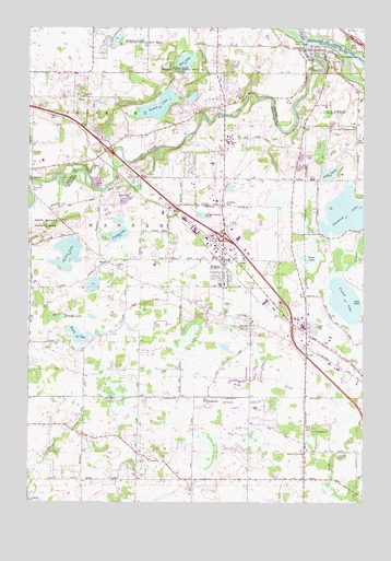
Rogers, MN USGS Topographic Map
Click on map above to begin viewing in our Map Viewer.

This topographic map contains these locations and features:
Feature Name Type Latitude Longitude GNIS ID View Map
Berning MillPopulated PlaceN45.2069°W93.6244°654602View Map
Big Woods Elementary SchoolSchoolN45.2236°W93.6177°2432879View Map
Brookdale SchoolSchoolN45.1280°W93.5647°640506View Map
Champlin Heights ParkParkN45.1919°W93.5742°2104057View Map
City of RogersCivilN45.1865°W93.5783°2396415View Map
Cowley LakeLakeN45.1955°W93.5914°642409View Map
Crow RiverStreamN45.2458°W93.5225°642502View Map
Crow-Hassan County ParkParkN45.1986°W93.6189°659559View Map
DaytonPopulated PlaceN45.2439°W93.5150°642665View Map
Dayton Fire Department Station 1BuildingN45.2428°W93.5160°2666563View Map
Diamond LakeLakeN45.2015°W93.5053°642804View Map
Ellingson Car MuseumBuildingN45.1944°W93.5481°2104095View Map
FletcherPopulated PlaceN45.1725°W93.5413°643740View Map
Fletcher CemeteryCemeteryN45.1738°W93.5428°2100883View Map
Fletcher Post Office (historical)Post OfficeN45.1725°W93.5411°2101170View Map
Foster LakeLakeN45.2293°W93.5769°643837View Map
Fox Hollow Golf CourseLocaleN45.2194°W93.5903°2067469View Map
French LakeLakeN45.1783°W93.5071°643939View Map
French Lake Open Golf CourseLocaleN45.1653°W93.5039°2104106View Map
Goodin IslandIslandN45.2391°W93.5030°644220View Map
Grass LakeLakeN45.1892°W93.5219°644368View Map
Henry LakeLakeN45.1685°W93.6068°644885View Map
Hope Community ChurchChurchN45.1444°W93.5417°2104101View Map
Immanuel CemeteryCemeteryN45.1381°W93.5098°645351View Map
Immanuel ChurchChurchN45.1375°W93.5230°645374View Map
Itasca Village (historical)Populated PlaceN45.2460°W93.5042°2723877View Map
Lake LauraLakeN45.2120°W93.5130°646525View Map
Maple Grove ChurchChurchN45.1380°W93.5225°659556View Map
Mary Queen of Peace Catholic SchoolSchoolN45.1885°W93.5503°2433251View Map
Meadow LakeLakeN45.1738°W93.6127°647718View Map
New Saint John the Baptist CemeteryCemeteryN45.2430°W93.5130°659561View Map
North Memorial Ambulance Service RogersBuildingN45.1872°W93.5506°2721340View Map
Northwest Family PhysiciansHospitalN45.1917°W93.5500°2104093View Map
Oakdale SchoolSchoolN45.1436°W93.6041°648866View Map
Old Saint John the Baptist CemeteryCemeteryN45.2244°W93.5024°659560View Map
Old Saint Walburga CemeteryCemeteryN45.1526°W93.5590°659557View Map
Otsego State Wildlife Management AreaParkN45.2411°W93.5702°1815380View Map
Pheasant Run Golf CourseLocaleN45.1514°W93.5500°2104103View Map
Rice LakeLakeN45.2409°W93.5672°649989View Map
RogersPopulated PlaceN45.1889°W93.5530°650221View Map
RogersLocaleN45.1889°W93.5556°2104088View Map
Rogers City HallBuildingN45.1892°W93.5528°2104098View Map
Rogers Elementary SchoolSchoolN45.1823°W93.5539°2104089View Map
Rogers Fire Department Station 1BuildingN45.1872°W93.5507°2666376View Map
Rogers Fire Department Station 2BuildingN45.2007°W93.5637°2666361View Map
Rogers LibraryBuildingN45.1903°W93.5475°2104092View Map
Rogers Middle SchoolSchoolN45.2089°W93.5441°2433205View Map
Rogers Police DepartmentBuildingN45.1894°W93.5529°2104099View Map
Rogers Post OfficePost OfficeN45.1892°W93.5475°2104091View Map
Russell SchoolSchoolN45.1536°W93.5572°650426View Map
Saint John ChurchChurchN45.1872°W93.5922°650643View Map
Saint John the Baptist Catholic ChurchChurchN45.2428°W93.5150°2104102View Map
Saint John the Evangelist Episcopal CemeteryCemeteryN45.1875°W93.5919°2100891View Map
Saint Martin CemeteryCemeteryN45.2033°W93.5516°650823View Map
Saint Martin's Catholic ChurchChurchN45.1892°W93.5500°2104096View Map
Saint Martin's Church SchoolSchoolN45.1886°W93.5500°2104097View Map
Saint Michael - Albertville Middle SchoolSchoolN45.2223°W93.6222°2067506View Map
Saint Walburga SchoolSchoolN45.1733°W93.5425°659558View Map
Saint Walburga's Catholic ChurchChurchN45.1728°W93.5414°2104100View Map
South Fork Rush CreekStreamN45.1472°W93.5058°652302View Map
Sylvan LakeLakeN45.1905°W93.6105°652963View Map
Township of Hassan (historical)CivilN45.1855°W93.5808°664409View Map
Word of Peace Lutheran ChurchChurchN45.1853°W93.5517°2104090View Map

Note: Coordinates in the location and feature list above are referenced to NAD83 datum.


Copyright (C) 2008-2024 Ryan Niemi / Sunset Dynamics ... All Rights Reserved