TopoQuest Logo
Do you find TopoQuest useful?
Help keep TopoQuest running and adding new maps/features by donating!
Bitcoin:  19c7KJd3qBynnjoSw5npx9KScwjBe4ifkT
Litecoin:  LXs6TkuXGGXo1vDsWCkWVdjQX94eUKd6ui
Home View Maps Find Maps Find Places Resources & Links


Ronan, Montana Topographic Map

USGS Map Title: Ronan, MT
USGS Map MRC: 47114E1
DRG (GeoTIFF) Download: o47114e1.tif


Neighboring USGS Topographic Map Quads:


  Polson, MT  
47114F2
 

  East Bay, MT  
47114F1
 

  Cedar Lake, MT  
47113F8
 

  Lower Crow Reservoir, MT  
47114E2
 

  Ronan, MT  
47114E1
 

  Piper-Crow Pass, MT  
47113E8
 

  Charlo, MT  
47114D2
 

  Fort Connah, MT  
47114D1
 

  Mount Calowahcan, MT  
47113D8


Map MRC Location:

N48°
W115°
N48°
W114°
H8 H7 H6 H5 H4 H3 H2 H1
G8 G7 G6 G5 G4 G3 G2 G1
F8 F7 F6 F5 F4 F3 F2 F1
E8 E7 E6 E5 E4 E3 E2 E1
D8 D7 D6 D5 D4 D3 D2 D1
C8 C7 C6 C5 C4 C3 C2 C1
B8 B7 B6 B5 B4 B3 B2 B1
A8 A7 A6 A5 A4 A3 A2 A1
N47°
W115°
N47°
W114°

Ronan, MT USGS 1:24K Topographic Map Preview:
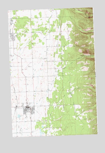
Ronan, MT USGS Topographic Map
Click on map above to begin viewing in our Map Viewer.

This topographic map contains these locations and features:
Feature Name Type Latitude Longitude GNIS ID View Map
20N19W04BBA_01 WellWellN47.5285°W114.0251°823618View Map
20N19W04DCBA01 WellWellN47.5180°W114.0204°823557View Map
20N19W05DDA_01 WellWellN47.5194°W114.0334°823563View Map
20N19W06CDBC01 WellWellN47.5177°W114.0690°823553View Map
20N19W07DBB_01 WellWellN47.5069°W114.0637°823464View Map
20N20W02AAC_01 WellWellN47.5274°W114.0996°823614View Map
20N20W02BAB_01 WellWellN47.5285°W114.1118°823619View Map
20N20W02BBA_01 WellWellN47.5283°W114.1096°823616View Map
20N20W10ADA_01 WellWellN47.5113°W114.1187°823494View Map
20N20W11CCBD01 WellWellN47.5035°W114.1146°823452View Map
20N20W12ADD_01 WellWellN47.5091°W114.0768°823479View Map
21N19W05AABA01 WellWellN47.6163°W114.0526°824087View Map
21N19W05BCD_01 WellWellN47.6119°W114.0671°824051View Map
21N19W06CBC_01 WellWellN47.6083°W114.0909°824034View Map
21N19W07DCDD01 WellWellN47.5880°W114.0771°823918View Map
21N19W16BCDB01 WellWellN47.5819°W114.0448°823879View Map
21N19W18ABA_01 WellWellN47.5847°W114.0723°823894View Map
21N19W19BCB_01 WellWellN47.5702°W114.0909°823816View Map
21N19W20BBB_01 WellWellN47.5738°W114.0696°823831View Map
21N19W20CABB01 WellWellN47.5658°W114.0771°823798View Map
21N19W28DBBB01 WellWellN47.5597°W114.0384°823772View Map
21N19W30CCC_01 WellWellN47.5466°W114.0884°823715View Map
21N19W33BBA_01 WellWellN47.5447°W114.0457°823701View Map
21N20W01BAAD01 WellWellN47.6155°W114.1034°824074View Map
21N20W01DDC_01 WellWellN47.6033°W114.0965°824010View Map
21N20W02AB__02 WellWellN47.6141°W114.1207°824062View Map
21N20W02ABD_01 WellWellN47.6141°W114.1207°824061View Map
21N20W11ACC_01 WellWellN47.5960°W114.1232°823962View Map
21N20W11DAD_01 WellWellN47.5922°W114.1151°823939View Map
21N20W14ACB_01 WellWellN47.5833°W114.1232°823890View Map
21N20W24CAA_01 WellWellN47.5652°W114.1046°823794View Map
21N20W24CAAA02 WellWellN47.5652°W114.1046°823795View Map
21N20W24DDD_01 WellWellN47.5588°W114.0918°823764View Map
21N20W25ADD_01 WellWellN47.5516°W114.0934°823733View Map
21N20W25DBAA01 WellWellN47.5508°W114.0973°823730View Map
21N20W25DBAD01 WellWellN47.5505°W114.0982°823729View Map
21N20W25DBAD02 WellWellN47.5499°W114.0982°823726View Map
21N20W25DBAD03 WellWellN47.5502°W114.0982°823728View Map
21N20W25DDDC01 WellWellN47.5444°W114.0937°823697View Map
21N20W26DCA_01 WellWellN47.5469°W114.1207°823717View Map
21N20W35DAAB01 WellWellN47.5358°W114.1143°823659View Map
21N20W36DAD_01 WellWellN47.5344°W114.0937°823649View Map
22N20W35ADCC01 WellWellN47.6244°W114.1179°824121View Map
A LateralCanalN47.5177°W114.0759°768099View Map
A Six LateralCanalN47.5169°W114.0973°768411View Map
Assembly of God ChurchChurchN47.5249°W114.0959°1796966View Map
Christian Church - PabloChurchN47.6002°W114.1190°1796974View Map
Christian/Missionary Alliance ChurchChurchN47.5297°W114.0904°1796971View Map
Church of the NazareneChurchN47.6002°W114.1190°1796972View Map
City of RonanCivilN47.5287°W114.1005°2410990View Map
Community FellowshipChurchN47.5288°W114.1015°1796961View Map
Courville CreekStreamN47.6172°W114.0348°781762View Map
Diamond 'S' RV ParkLocaleN47.5374°W114.1023°1797019View Map
DunhamPopulated PlaceN47.6119°W114.1209°770903View Map
Faith Lutheran ChurchChurchN47.5258°W114.1043°1796964View Map
First Baptist ChurchChurchN47.5235°W114.1009°1796967View Map
Full Gospel ChurchChurchN47.6002°W114.1190°1796975View Map
Garden of the Rockies MuseumBuildingN47.5299°W114.1037°1797046View Map
Glacier View Seventh-day Adventist Christian SchoolSchoolN47.5703°W114.1205°1796858View Map
Hoversland AirportAirportN47.5920°W114.0525°806512View Map
K William Harvey ElementarySchoolN47.5322°W114.1044°1796863View Map
Kicking Horse Job CorpsSchoolN47.5277°W114.0926°1796808View Map
Lost CreekStreamN47.5188°W114.0293°786584View Map
Middle Crow CreekStreamN47.5149°W114.0651°787236View Map
Mission Meadow CampgroundLocaleN47.5735°W114.1079°1797017View Map
Mission Meadows Trailer ParkPopulated PlaceN47.5735°W114.1079°1797018View Map
Mission Mountain MedicineHospitalN47.5283°W114.1059°1796994View Map
Mission Valley Christian AcademySchoolN47.5299°W114.1040°1796859View Map
Mud Creek BridgeBridgeN47.5805°W114.1143°1797052View Map
Mud Creek FallsFallsN47.6160°W114.0059°774458View Map
North Crow Community HouseLocaleN47.5763°W114.0704°774694View Map
North Crow Creek CampgroundLocaleN47.5777°W114.0162°774695View Map
North Crow Creek CanyonValleyN47.5647°W114.0468°788083View Map
PabloPopulated PlaceN47.6002°W114.1190°775026View Map
PabloLocaleN47.6013°W114.1223°1796845View Map
Pablo Baptist ChurchChurchN47.6002°W114.1190°1796973View Map
Pablo Census Designated PlaceCensusN47.6035°W114.1059°2409011View Map
Pablo ElementarySchoolN47.6015°W114.1167°1796864View Map
Pablo Feeder CanalCanalN47.6008°W114.0509°775044View Map
Pablo Post OfficePost OfficeN47.6029°W114.1195°1796844View Map
Pablo Tribal Police DepartmentBuildingN47.5954°W114.1143°2548941View Map
Peoples CenterBuildingN47.6194°W114.1140°1797045View Map
Rock CreekStreamN47.5880°W114.0468°775843View Map
RonanPopulated PlaceN47.5288°W114.1015°775919View Map
RonanLocaleN47.5277°W114.1187°1796828View Map
Ronan A CanalCanalN47.5480°W114.0676°775920View Map
Ronan AirportAirportN47.5674°W114.1033°806511View Map
Ronan Ambulance ServiceBuildingN47.5300°W114.1086°2637900View Map
Ronan B CanalCanalN47.5685°W114.0857°775922View Map
Ronan CemeteryCemeteryN47.5377°W114.0715°775923View Map
Ronan Christian ChurchChurchN47.5280°W114.1021°1796969View Map
Ronan City LibraryBuildingN47.5285°W114.1009°1797006View Map
Ronan High SchoolSchoolN47.5314°W114.1007°1796861View Map
Ronan Medical ClinicHospitalN47.5283°W114.1087°1796993View Map
Ronan Middle SchoolSchoolN47.5302°W114.1007°1796862View Map
Ronan Police StationBuildingN47.5285°W114.1004°1796810View Map
Ronan Post OfficePost OfficeN47.5279°W114.1012°1796829View Map
Ronan Tribal Health ClinicHospitalN47.5302°W114.0976°1796992View Map
Ronan Volunteer Fire DepartmentBuildingN47.5280°W114.1008°1796809View Map
Ronan Volunteer Fire Department Satellite StationBuildingN47.6020°W114.1195°2546643View Map
Ronan Water IntakeBuildingN47.5460°W114.0268°775924View Map
Sacred Heart Catholic ChurchChurchN47.5297°W114.1029°1796968View Map
Saint Luke Community HospitalHospitalN47.5287°W114.1069°1796996View Map
Saint Luke Community Nursing HomeHospitalN47.5283°W114.1071°1796997View Map
Saint Paul Lutheran ChurchChurchN47.5297°W114.0909°1796970View Map
Salish Kootenai CollegeSchoolN47.5985°W114.1115°1796866View Map
Seventh Day Adventist ChurchChurchN47.5233°W114.0993°1796962View Map
Spring Creek Fishing Access SiteLocaleN47.5969°W114.0937°1744327View Map
The Church of Jesus Christ of Latter day SaintsChurchN47.5230°W114.0918°1796965View Map
Two Eagle River SchoolSchoolN47.6003°W114.1117°1796860View Map
United Methodist ChurchChurchN47.5277°W114.1032°1796963View Map
West Side Rest HomeHospitalN47.5283°W114.1112°1796995View Map
Willow Wynn Trailer ParkPopulated PlaceN47.6002°W114.1190°1797060View Map

Note: Coordinates in the location and feature list above are referenced to NAD83 datum.


Copyright (C) 2008-2024 Ryan Niemi / Sunset Dynamics ... All Rights Reserved