TopoQuest Logo
Do you find TopoQuest useful?
Help keep TopoQuest running and adding new maps/features by donating!
Bitcoin:  19c7KJd3qBynnjoSw5npx9KScwjBe4ifkT
Litecoin:  LXs6TkuXGGXo1vDsWCkWVdjQX94eUKd6ui
Home View Maps Find Maps Find Places Resources & Links


Rosebush, Michigan Topographic Map

USGS Map Title: Rosebush, MI
USGS Map MRC: 43084F7
DRG (GeoTIFF) Download: o43084f7.tif


Neighboring USGS Topographic Map Quads:


  Loomis, MI  
43084G6
 

  Weidman, MI  
43084F8
 

  Rosebush, MI  
43084F7
 

  Leaton, MI  
43084F6
 

  Winn, MI  
43084E8
 

  Mount Pleasant, MI  
43084E7
 

  Shepherd, MI  
43084E6


Map MRC Location:

N44°
W85°
N44°
W84°
H8 H7 H6 H5 H4 H3 H2 H1
G8 G7 G6 G5 G4 G3 G2 G1
F8 F7 F6 F5 F4 F3 F2 F1
E8 E7 E6 E5 E4 E3 E2 E1
D8 D7 D6 D5 D4 D3 D2 D1
C8 C7 C6 C5 C4 C3 C2 C1
B8 B7 B6 B5 B4 B3 B2 B1
A8 A7 A6 A5 A4 A3 A2 A1
N43°
W85°
N43°
W84°

Rosebush, MI USGS 1:24K Topographic Map Preview:
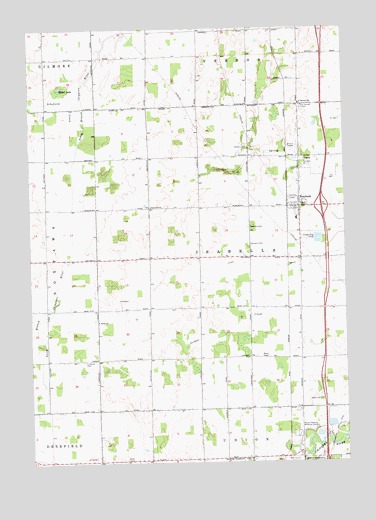
Rosebush, MI USGS Topographic Map
Click on map above to begin viewing in our Map Viewer.

This topographic map contains these locations and features:
Feature Name Type Latitude Longitude GNIS ID View Map
Baseline Indian CemeteryCemeteryN43.6428°W84.7600°628957View Map
Bible Baptist Church of RosebushChurchN43.6986°W84.7692°2544030View Map
Country Place ParkPopulated PlaceN43.6550°W84.7572°2543937View Map
Indian ChurchChurchN43.6659°W84.8484°628961View Map
Interchange 149CrossingN43.6986°W84.7589°2544062View Map
Isabella CountyCivilN43.6406°W84.8468°1622979View Map
Isabella County FairgroundsLocaleN43.6458°W84.7639°2543969View Map
Isabella Northeast Fire DepartmentBuildingN43.7018°W84.7685°2626930View Map
Isabella ReservationCivilN43.6747°W84.7718°1616981View Map
Isabella Township LibraryBuildingN43.6989°W84.7667°2544031View Map
Isabella Township ParkParkN43.7006°W84.7700°2544032View Map
Lewis DrainCanalN43.6839°W84.7597°630347View Map
Longwood Post Office (historical)Post OfficeN43.6264°W84.7722°2543896View Map
Mabel LakeLakeN43.7331°W84.8631°631259View Map
Mount Pleasant MeadowsLocaleN43.6472°W84.7639°2543956View Map
Mount Pleasant Memorial GardensCemeteryN43.6320°W84.7699°632840View Map
Oakview Mobile Home EstatesPopulated PlaceN43.6556°W84.8111°2543938View Map
RosebushPopulated PlaceN43.6992°W84.7678°636218View Map
Rosebush ChurchChurchN43.6989°W84.8270°636219View Map
Rosebush Elementary SchoolSchoolN43.6950°W84.7689°2544029View Map
Rosebush Post OfficePost OfficeN43.6989°W84.7683°2544025View Map
Rosebush Presbyterian ChurchChurchN43.6972°W84.7675°2544028View Map
Rosebush StationLocaleN43.6989°W84.7725°2544008View Map
Saint Henry's ChurchChurchN43.7278°W84.7661°2544027View Map
Saint Henrys Catholic Church CemeteryCemeteryN43.7274°W84.7670°636670View Map
Saint Henrys SchoolSchoolN43.7284°W84.7675°636671View Map
Schofield CreekStreamN43.7217°W84.8534°637358View Map
Township of IsabellaCivilN43.6841°W84.7882°1626531View Map
Village of RosebushCivilN43.6998°W84.7657°2399120View Map
WCFX-FM (Clare)TowerN43.7448°W84.8025°1625367View Map
WCZY-FM (Mount Pleasant)TowerN43.6261°W84.8378°1625440View Map
Westwinds Mobile Home ParkPopulated PlaceN43.6983°W84.7683°2544026View Map
Whiteville Post Office (historical)Post OfficeN43.6556°W84.8278°2543385View Map
Woodland CemeteryCemeteryN43.6919°W84.7881°2544050View Map
Woodland CemeteryCemeteryN43.6882°W84.7881°2544051View Map
Zion Lutheran CemeteryCemeteryN43.6545°W84.8540°2544053View Map

Note: Coordinates in the location and feature list above are referenced to NAD83 datum.


Copyright (C) 2008-2025 Ryan Niemi / Sunset Dynamics ... All Rights Reserved