TopoQuest Logo
Do you find TopoQuest useful?
Help keep TopoQuest running and adding new maps/features by donating!
Bitcoin:  19c7KJd3qBynnjoSw5npx9KScwjBe4ifkT
Litecoin:  LXs6TkuXGGXo1vDsWCkWVdjQX94eUKd6ui
Home View Maps Find Maps Find Places Resources & Links


Rosette, Utah Topographic Map

USGS Map Title: Rosette, UT
USGS Map MRC: 41113G4
DRG (GeoTIFF) Download: o41113g4.tif


Neighboring USGS Topographic Map Quads:


  Yost, UT  
41113H5
 

  Standrod, UT  
41113H4
 

  Rosevere Point, UT  
41113H3
 

  Dennis Hill, UT  
41113G5
 

  Rosette, UT  
41113G4
 

  Park Valley, UT  
41113G3
 

  Warm Spring Hills, UT  
41113F5
 

  Runswick Wash, UT  
41113F4
 

  Russian Knoll, UT  
41113F3


Map MRC Location:

N42°
W114°
N42°
W113°
H8 H7 H6 H5 H4 H3 H2 H1
G8 G7 G6 G5 G4 G3 G2 G1
F8 F7 F6 F5 F4 F3 F2 F1
E8 E7 E6 E5 E4 E3 E2 E1
D8 D7 D6 D5 D4 D3 D2 D1
C8 C7 C6 C5 C4 C3 C2 C1
B8 B7 B6 B5 B4 B3 B2 B1
A8 A7 A6 A5 A4 A3 A2 A1
N41°
W114°
N41°
W113°

Rosette, UT USGS 1:24K Topographic Map Preview:
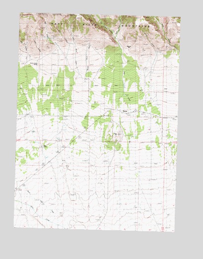
Rosette, UT USGS Topographic Map
Click on map above to begin viewing in our Map Viewer.

This topographic map contains these locations and features:
Feature Name Type Latitude Longitude GNIS ID View Map
Big HollowValleyN41.8571°W113.4714°1438689View Map
Bills CanyonValleyN41.8558°W113.4614°1448048View Map
Black Hills CreekStreamN41.7510°W113.4611°1438849View Map
Cedar HillSummitN41.8096°W113.4225°1439569View Map
Dane SpringSpringN41.7977°W113.4798°1440252View Map
Dipping VatLocaleN41.8569°W113.4128°1440470View Map
Dixie HollowValleyN41.8513°W113.4817°1448047View Map
Docken Corral SpringSpringN41.8455°W113.4856°1440485View Map
Duncan CanyonValleyN41.8471°W113.3933°1440713View Map
Kunzlers RanchLocaleN41.7616°W113.4942°1448558View Map
Left Hand Fork Pine CreekStreamN41.8608°W113.4250°1442551View Map
Long Birch CreekStreamN41.8380°W113.4497°1442890View Map
Morris RanchLocaleN41.8249°W113.4572°1448691View Map
Palmer RanchLocaleN41.8291°W113.4461°1448795View Map
Park ValleyAreaN41.8210°W113.4008°1451323View Map
Pine CreekStreamN41.8044°W113.4108°1444369View Map
Right Hand Fork Pine CreekStreamN41.8610°W113.4250°1444977View Map
Rock CanyonValleyN41.8552°W113.3756°1445050View Map
RosettePopulated PlaceN41.8185°W113.4131°1445146View Map
Rosevere CanyonValleyN41.7888°W113.4303°1451345View Map
Round Birch CreekStreamN41.8388°W113.4442°1445159View Map
Twin CanyonValleyN41.8558°W113.4958°1446777View Map

Note: Coordinates in the location and feature list above are referenced to NAD83 datum.


Copyright (C) 2008-2025 Ryan Niemi / Sunset Dynamics ... All Rights Reserved