TopoQuest Logo
Do you find TopoQuest useful?
Help keep TopoQuest running and adding new maps/features by donating!
Bitcoin:  19c7KJd3qBynnjoSw5npx9KScwjBe4ifkT
Litecoin:  LXs6TkuXGGXo1vDsWCkWVdjQX94eUKd6ui
Home View Maps Find Maps Find Places Resources & Links


Rosman, North Carolina Topographic Map

USGS Map Title: Rosman, NC
USGS Map MRC: 35082B7
DRG (GeoTIFF) Download: o35082b7.tif


Neighboring USGS Topographic Map Quads:


  Sam Knob, NC  
35082C8
 

  Shining Rock, NC  
35082C7
 

  Pisgah Forest, NC  
35082C6
 

  Lake Toxaway, NC  
35082B8
 

  Rosman, NC  
35082B7
 

  Brevard, NC  
35082B6
 

  Reid, NC  
35082A8
 

  Eastatoe Gap, NC  
35082A7
 

  Table Rock, SC  
35082A6


Map MRC Location:

N36°
W83°
N36°
W82°
H8 H7 H6 H5 H4 H3 H2 H1
G8 G7 G6 G5 G4 G3 G2 G1
F8 F7 F6 F5 F4 F3 F2 F1
E8 E7 E6 E5 E4 E3 E2 E1
D8 D7 D6 D5 D4 D3 D2 D1
C8 C7 C6 C5 C4 C3 C2 C1
B8 B7 B6 B5 B4 B3 B2 B1
A8 A7 A6 A5 A4 A3 A2 A1
N35°
W83°
N35°
W82°

Rosman, NC USGS 1:24K Topographic Map Preview:
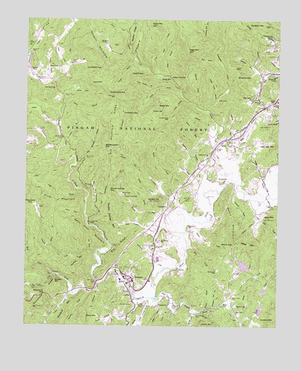
Rosman, NC USGS Topographic Map
Click on map above to begin viewing in our Map Viewer.

This topographic map contains these locations and features:
Feature Name Type Latitude Longitude GNIS ID View Map
Adams BranchStreamN35.1779°W82.7537°1008654View Map
Aiken Mill CreekStreamN35.1759°W82.7596°1008662View Map
Aiken MountainSummitN35.1693°W82.7543°1018777View Map
Arthur LakeReservoirN35.2176°W82.7803°1008782View Map
Ash CoveValleyN35.1557°W82.8434°1008789View Map
Balsam GrovePopulated PlaceN35.2296°W82.8737°1018945View Map
Balsam Grove Post OfficePost OfficeN35.2252°W82.8653°2774208View Map
Balsam Grove Volunteer Fire DepartmentBuildingN35.2298°W82.8732°2638710View Map
Barberry HeightsPopulated PlaceN35.1901°W82.7635°1017719View Map
Bart BranchStreamN35.2315°W82.8551°1008946View Map
Beasley BranchStreamN35.1790°W82.8051°1009060View Map
Big Bearwallow CreekStreamN35.1696°W82.8443°1009255View Map
Big Mountain BranchStreamN35.1907°W82.8501°1009339View Map
Big Mountain GapGapN35.1987°W82.8360°1009341View Map
Big Mountain RidgeRidgeN35.2054°W82.8340°1009342View Map
Big RidgeRidgeN35.1576°W82.8279°1009358View Map
Bird Rock FallsFallsN35.2215°W82.8610°1009423View Map
Blue Ridge BranchStreamN35.1271°W82.8343°1009491View Map
Boring CreekStreamN35.1307°W82.7874°1009547View Map
Brackens CreekStreamN35.2273°W82.7554°1009568View Map
Brevard Music Center LakeReservoirN35.2415°W82.7533°1005559View Map
Browns Mill CreekStreamN35.1354°W82.8182°1009669View Map
Brushy KnobSummitN35.2409°W82.8387°1019332View Map
Brushy RidgeRidgeN35.2446°W82.8221°1009698View Map
Brushy Ridge BranchStreamN35.2348°W82.8221°1009704View Map
Buffeys BranchStreamN35.1323°W82.7849°1009797View Map
Bunker HillSummitN35.1846°W82.7771°1019406View Map
Bynum BranchStreamN35.1573°W82.8618°1009872View Map
CalvertPopulated PlaceN35.1571°W82.8107°1019478View Map
Camp CherryfieldLocaleN35.1782°W82.8260°1009947View Map
Camp IllaheeLocaleN35.2093°W82.7504°1009965View Map
Cantrell CreekStreamN35.1809°W82.7699°1010028View Map
Carson CreekStreamN35.1776°W82.7507°1010063View Map
Catheys CreekStreamN35.1865°W82.7696°1010104View Map
Catheys Creek ChurchChurchN35.1948°W82.7860°1010105View Map
Catheys Creek EstatesPopulated PlaceN35.2023°W82.7860°1017720View Map
Catheys Creek FallsFallsN35.2265°W82.8035°1010106View Map
Cedar Rock CreekStreamN35.2271°W82.8090°1010135View Map
Charles CreekStreamN35.2496°W82.8229°1010172View Map
CherryfieldPopulated PlaceN35.1737°W82.8046°1019621View Map
Cherryfield CreekStreamN35.1709°W82.7999°1010221View Map
Chestnut GapGapN35.2276°W82.7707°1010248View Map
Connestee Fire Rescue SubstationBuildingN35.1532°W82.7704°2639525View Map
Cove HollowValleyN35.1289°W82.8297°1010511View Map
Crawford MountainSummitN35.1282°W82.7507°1019851View Map
Crow BranchStreamN35.1721°W82.8157°1010596View Map
Cycleham GapGapN35.2121°W82.8199°1010633View Map
Daves CoveValleyN35.2211°W82.8518°1010670View Map
Daves RockSummitN35.2240°W82.8421°1019913View Map
Deep Woods DamDamN35.1618°W82.7515°1017061View Map
Deep Woods LakeReservoirN35.1625°W82.7509°1017062View Map
Diamond CreekStreamN35.1543°W82.8399°1010800View Map
Double Springs GapGapN35.1801°W82.8332°1010885View Map
Double Springs MountainSummitN35.1740°W82.8349°1020012View Map
Dunns CreekStreamN35.2454°W82.8254°1010945View Map
East ForkPopulated PlaceN35.1307°W82.7701°1020079View Map
East Fork French Broad RiverStreamN35.1362°W82.8112°1010987View Map
Flat CreekStreamN35.1459°W82.8607°1011255View Map
Ford LakeReservoirN35.1514°W82.7721°1017049View Map
Ford Lake DamDamN35.1518°W82.7715°1017048View Map
Frozen CreekStreamN35.1373°W82.8507°1011403View Map
Gads CoveValleyN35.1339°W82.8089°1011419View Map
Galloway CreekStreamN35.1484°W82.8062°1011428View Map
Gaylors BranchStreamN35.2240°W82.8629°1011458View Map
Gerren CreekStreamN35.1304°W82.7921°1011472View Map
Gillespie CemeteryCemeteryN35.1329°W82.8001°1011491View Map
Glady BranchStreamN35.1987°W82.7710°1011513View Map
Glady ForkStreamN35.2362°W82.8240°1011517View Map
Grassy GapGapN35.2129°W82.8079°1011634View Map
Graveyard HillSummitN35.1651°W82.7946°1020528View Map
Henry MountainSummitN35.1623°W82.7732°1020685View Map
Hickory Mountain BranchStreamN35.2437°W82.7868°1012012View Map
High Loaf MountainSummitN35.1990°W82.7518°1020747View Map
Illahee HillsPopulated PlaceN35.2109°W82.7548°1017740View Map
Indian Camp BranchStreamN35.2168°W82.7810°1012332View Map
Indian CreekStreamN35.2359°W82.8729°1012336View Map
Jason BranchStreamN35.2012°W82.8565°1012443View Map
Joshua BranchStreamN35.1326°W82.8029°1012567View Map
Kagle BranchStreamN35.2268°W82.8040°1012593View Map
Kagle MountainSummitN35.2373°W82.7954°1012594View Map
Kaiser LakeReservoirN35.1789°W82.8270°1012595View Map
Kelley BranchStreamN35.1709°W82.7840°1012607View Map
Kelley MountainSummitN35.1576°W82.7626°1021022View Map
Keystone CampLocaleN35.2273°W82.7521°1012615View Map
King MountainSummitN35.2251°W82.8093°1021045View Map
Kuykendall CreekStreamN35.2132°W82.7854°1012651View Map
Kuykendall Recreation SiteLocaleN35.2201°W82.7782°1023776View Map
Lake WanteskaReservoirN35.1499°W82.7665°1017045View Map
Lake Wanteska DamDamN35.1484°W82.7682°1017044View Map
Lamance CreekStreamN35.1962°W82.8590°1012663View Map
Laurel BranchStreamN35.2132°W82.8571°1012699View Map
Laurel FallsPopulated PlaceN35.2343°W82.7646°1017742View Map
Laurel Falls LakeReservoirN35.2340°W82.7612°1017743View Map
Laurel LakeReservoirN35.2318°W82.7632°1017096View Map
Laurel Lake DamDamN35.2318°W82.7632°1017095View Map
Limekiln BranchStreamN35.1823°W82.7765°1012872View Map
Little Bearwallow CreekStreamN35.1723°W82.8390°1012911View Map
Little EgyptLocaleN35.1751°W82.7935°1017721View Map
Little Tarkiln BranchStreamN35.2221°W82.8118°1013035View Map
Long BranchStreamN35.1768°W82.8454°1013099View Map
Long HollowValleyN35.2183°W82.7971°1013155View Map
Long Hollow GapGapN35.2101°W82.8043°1013157View Map
Lora Young DamDamN35.1301°W82.7582°1017019View Map
Lora Young LakeReservoirN35.1316°W82.7587°1017020View Map
Low Notch GapGapN35.2301°W82.8379°1013231View Map
Lower CreekStreamN35.1346°W82.7751°1013238View Map
Mason CreekStreamN35.1787°W82.8018°1013357View Map
Matheys BranchStreamN35.2043°W82.7807°1013369View Map
McFarland LakeReservoirN35.1479°W82.7796°1013424View Map
Middle CreekStreamN35.1321°W82.7718°1013488View Map
Middle Fork French Broad RiverStreamN35.1362°W82.8135°1013500View Map
Mill CreekStreamN35.1579°W82.7946°1013550View Map
Mitchums LakeReservoirN35.2391°W82.7522°1017744View Map
Morgan HillSummitN35.1768°W82.8085°1021531View Map
Morgan Mill CreekStreamN35.1709°W82.7999°1013701View Map
Mount Moriah ChurchChurchN35.1601°W82.8082°1013751View Map
Mountain Tea BranchStreamN35.1329°W82.7810°1013802View Map
North Fork French Broad RiverStreamN35.1429°W82.8390°1013999View Map
Panther MountainSummitN35.1507°W82.8482°1021800View Map
Patterson CreekStreamN35.1798°W82.7860°1014259View Map
Paxton CreekStreamN35.1676°W82.7893°1014268View Map
Peter Weaver CreekStreamN35.1654°W82.8062°1014352View Map
Pine Grove GapGapN35.1740°W82.8735°1018165View Map
Piney MountainSummitN35.1765°W82.8657°1021957View Map
Piney WoodsPopulated PlaceN35.1373°W82.7743°1017727View Map
PowelltownPopulated PlaceN35.1329°W82.8099°1022071View Map
Quebec MountainSummitN35.1432°W82.8601°1022122View Map
Rainbow LakeReservoirN35.1331°W82.7710°1014720View Map
Revels MountainSummitN35.2151°W82.8101°1021613View Map
Revels ProngStreamN35.2213°W82.7988°1013897View Map
Rich CoveValleyN35.2336°W82.7811°1014853View Map
Rocky HillPopulated PlaceN35.2159°W82.7543°1022345View Map
Rocky MountainSummitN35.1290°W82.8443°1022370View Map
RosmanPopulated PlaceN35.1437°W82.8212°1022400View Map
Rosman Elementary SchoolSchoolN35.1412°W82.8271°1017758View Map
Rosman Fire / RescueBuildingN35.1450°W82.8228°2638852View Map
Rosman High SchoolSchoolN35.1440°W82.8210°1017759View Map
Rosman Post OfficePost OfficeN35.1422°W82.8232°2773850View Map
Rover ChurchChurchN35.1998°W82.7749°1015119View Map
Sawmill CreekStreamN35.1896°W82.8168°1015299View Map
Schoolpath BranchStreamN35.1398°W82.8407°1015328View Map
Sega LakePopulated PlaceN35.2190°W82.7629°1022537View Map
SelicaPopulated PlaceN35.2001°W82.7782°1022538View Map
Shearin DamDamN35.1384°W82.7582°1017034View Map
Shearin PondReservoirN35.1395°W82.7558°1017035View Map
Shoal CreekStreamN35.2234°W82.8612°1015453View Map
Shoal Creek ChurchChurchN35.2307°W82.8582°1015457View Map
Southern MountainSummitN35.2484°W82.7573°1022721View Map
Spanish Oak BranchStreamN35.1932°W82.7718°1015718View Map
Spice CoveValleyN35.1710°W82.8459°1015726View Map
Spice Cove MountainSummitN35.1671°W82.8501°1022736View Map
Stone MountainSummitN35.2476°W82.8137°1015856View Map
Tarkiln BranchStreamN35.2340°W82.8207°1016026View Map
Tarkiln MountainSummitN35.2276°W82.8229°1022888View Map
Three Forks MountainSummitN35.2196°W82.8321°1016132View Map
Town of RosmanCivilN35.1458°W82.8202°2407248View Map
Township of Catheys CreekCivilN35.2013°W82.7985°1027230View Map
Transylvania CountyCivilN35.2022°W82.7983°1008589View Map
Transylvania School CampLocaleN35.2426°W82.7535°1016220View Map
Tucker CreekStreamN35.2073°W82.8599°1016253View Map
Upper CreekStreamN35.1254°W82.7674°1016330View Map
Walker MountainSummitN35.1259°W82.7871°1023097View Map
Walnut CoveValleyN35.2165°W82.7913°1016419View Map
Walnut GapGapN35.1587°W82.7718°1016426View Map
Walnut HollowValleyN35.1691°W82.7604°1016431View Map
West Fork French Broad RiverStreamN35.1429°W82.8390°1016536View Map
Whetstone GapGapN35.1382°W82.8649°1016569View Map
Whetstone RidgeRidgeN35.1371°W82.8649°1018166View Map
Whitmire CemeteryCemeteryN35.1334°W82.8218°1016638View Map
Wilson Mill CreekStreamN35.1909°W82.7696°1016732View Map
Wolfpen CoveValleyN35.2313°W82.7629°1016795View Map
Woodruff BranchStreamN35.1387°W82.8429°1016815View Map
Woodruff MountainSummitN35.1273°W82.8565°1023317View Map
Zion ChurchChurchN35.1376°W82.8226°1016889View Map

Note: Coordinates in the location and feature list above are referenced to NAD83 datum.


Copyright (C) 2008-2025 Ryan Niemi / Sunset Dynamics ... All Rights Reserved