TopoQuest Logo
Do you find TopoQuest useful?
Help keep TopoQuest running and adding new maps/features by donating!
Bitcoin:  19c7KJd3qBynnjoSw5npx9KScwjBe4ifkT
Litecoin:  LXs6TkuXGGXo1vDsWCkWVdjQX94eUKd6ui
Home View Maps Find Maps Find Places Resources & Links


Round Mountain, New Mexico Topographic Map

USGS Map Title: Round Mountain, NM
USGS Map MRC: 33104H7
DRG (GeoTIFF) Download: o33104h7.tif


Neighboring USGS Topographic Map Quads:


  Ramon SW, NM  
34104A8
 

  Wire Lake, NM  
34104A7
 

  Devils Well, NM  
34104A6
 

  Chivata Canyon, NM  
33104H8
 

  Round Mountain, NM  
33104H7
 

  Mesa, NM  
33104H6
 

  North Lake, NM  
33104G8
 

  Round Mountain SE, NM  
33104G7
 

  Mesa SW, NM  
33104G6


Map MRC Location:

N34°
W105°
N34°
W104°
H8 H7 H6 H5 H4 H3 H2 H1
G8 G7 G6 G5 G4 G3 G2 G1
F8 F7 F6 F5 F4 F3 F2 F1
E8 E7 E6 E5 E4 E3 E2 E1
D8 D7 D6 D5 D4 D3 D2 D1
C8 C7 C6 C5 C4 C3 C2 C1
B8 B7 B6 B5 B4 B3 B2 B1
A8 A7 A6 A5 A4 A3 A2 A1
N33°
W105°
N33°
W104°

Round Mountain, NM USGS 1:24K Topographic Map Preview:
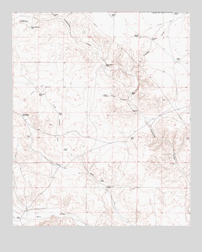
Round Mountain, NM USGS Topographic Map
Click on map above to begin viewing in our Map Viewer.

This topographic map contains these locations and features:
Feature Name Type Latitude Longitude GNIS ID View Map
Akins TankReservoirN33.9719°W104.7603°885605View Map
Boswell WindmillLocaleN33.8973°W104.8089°886656View Map
Boulder TankReservoirN33.9982°W104.8056°886662View Map
Broom TankReservoirN33.9862°W104.7865°886756View Map
Cistern CanyonValleyN33.9467°W104.7914°887625View Map
Cistern TankReservoirN33.9512°W104.8083°887626View Map
Corn TankReservoirN33.9015°W104.8134°887854View Map
Cowboy WellWellN33.9270°W104.8630°887990View Map
Fifteenmile WindmillLocaleN33.9423°W104.7875°889024View Map
Government TankReservoirN33.9691°W104.8100°889514View Map
Government Water HoleLakeN33.9402°W104.8689°889516View Map
Little Cowboy DrawValleyN33.9095°W104.8319°891124View Map
Mikes TankReservoirN33.9526°W104.7917°892036View Map
North TankReservoirN33.9521°W104.8542°892676View Map
North WellWellN33.9562°W104.8519°892702View Map
Pacheco TankReservoirN33.9993°W104.7614°897163View Map
Price TankReservoirN33.9411°W104.8429°893481View Map
Round MountainSummitN33.9948°W104.8689°894181View Map
Round Mountain TankReservoirN33.9909°W104.8624°894185View Map
South TankReservoirN33.9197°W104.8393°895136View Map
Threadgill CanyonValleyN33.9551°W104.7889°897253View Map
Threadgill TankReservoirN33.9843°W104.7777°895645View Map
TJ TankReservoirN33.9111°W104.7607°895478View Map
Yoder RanchLocaleN33.8795°W104.8700°896825View Map
Yoder TankReservoirN33.9267°W104.7925°896826View Map

Note: Coordinates in the location and feature list above are referenced to NAD83 datum.


Copyright (C) 2008-2024 Ryan Niemi / Sunset Dynamics ... All Rights Reserved