TopoQuest Logo
Do you find TopoQuest useful?
Help keep TopoQuest running and adding new maps/features by donating!
Bitcoin:  19c7KJd3qBynnjoSw5npx9KScwjBe4ifkT
Litecoin:  LXs6TkuXGGXo1vDsWCkWVdjQX94eUKd6ui
Home View Maps Find Maps Find Places Resources & Links


Round Mountain, Maine Topographic Map

USGS Map Title: Round Mountain, ME
USGS Map MRC: 46068E7
DRG (GeoTIFF) Download: o46068e7.tif


Neighboring USGS Topographic Map Quads:


  Farrar Pond, ME  
46068F8
 

  Big Machias Lake, ME  
46068F7
 

  Greenlaw Pond, ME  
46068F6
 

  Mooseleuk Lake, ME  
46068E8
 

  Round Mountain, ME  
46068E7
 

  Jack Mountain, ME  
46068E6
 

  Mooseleuk Mountain, ME  
46068D8
 

  Middle Brook Mountain, ME  
46068D7
 

  Chandler Mountain, ME  
46068D6


Map MRC Location:

N47°
W69°
N47°
W68°
H8 H7 H6 H5 H4 H3 H2 H1
G8 G7 G6 G5 G4 G3 G2 G1
F8 F7 F6 F5 F4 F3 F2 F1
E8 E7 E6 E5 E4 E3 E2 E1
D8 D7 D6 D5 D4 D3 D2 D1
C8 C7 C6 C5 C4 C3 C2 C1
B8 B7 B6 B5 B4 B3 B2 B1
A8 A7 A6 A5 A4 A3 A2 A1
N46°
W69°
N46°
W68°

Round Mountain, ME USGS 1:24K Topographic Map Preview:
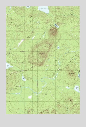
Round Mountain, ME USGS Topographic Map
Click on map above to begin viewing in our Map Viewer.

This topographic map contains these locations and features:
Feature Name Type Latitude Longitude GNIS ID View Map
Bartlett MountainSummitN46.5351°W68.8749°561671View Map
Bartlett PondLakeN46.5552°W68.8717°561676View Map
Center MountainSummitN46.5158°W68.7667°563762View Map
Center PondLakeN46.5288°W68.7543°563767View Map
Conners BrookStreamN46.6206°W68.8173°564294View Map
Leonard PondLakeN46.5412°W68.8450°569483View Map
Lost PondLakeN46.5303°W68.7698°570420View Map
Lovejoy BrookStreamN46.6164°W68.8042°570437View Map
Lovejoy RidgeRidgeN46.5923°W68.8309°570446View Map
Middle MountainSummitN46.5798°W68.8040°571257View Map
Moose RidgeRidgeN46.6098°W68.8367°571633View Map
Peaked MountainSummitN46.5699°W68.8140°573101View Map
Round MountainPopulated PlaceN46.5945°W68.7945°579666View Map
Round Mountain PondLakeN46.6021°W68.7887°574486View Map
Rowe LakeLakeN46.6237°W68.8102°574549View Map
Spectacle MountainSummitN46.5466°W68.7653°576009View Map
T10 R8 WELSCivilN46.5335°W68.7585°1987160View Map
T11 R8 WELSCivilN46.6224°W68.7588°1987163View Map
Weeks PondLakeN46.5771°W68.7858°577975View Map

Note: Coordinates in the location and feature list above are referenced to NAD83 datum.


Copyright (C) 2008-2024 Ryan Niemi / Sunset Dynamics ... All Rights Reserved