TopoQuest Logo
Do you find TopoQuest useful?
Help keep TopoQuest running and adding new maps/features by donating!
Bitcoin:  19c7KJd3qBynnjoSw5npx9KScwjBe4ifkT
Litecoin:  LXs6TkuXGGXo1vDsWCkWVdjQX94eUKd6ui
Home View Maps Find Maps Find Places Resources & Links


Round Mountain, Arizona Topographic Map

USGS Map Title: Round Mountain, AZ
USGS Map MRC: 32109E1
DRG (GeoTIFF) Download: o32109e1.tif


Neighboring USGS Topographic Map Quads:


  Hot Well, AZ  
32109F2
 

  Duncan, AZ  
32109F1
 

  Canador Peak, NM  
32108F8
 

  Whitlock Peak, AZ  
32109E2
 

  Round Mountain, AZ  
32109E1
 

  Rock Tank Draw, NM  
32108E8
 

  Orange Butte, AZ  
32109D2
 

  Engine Mountain, AZ  
32109D1
 

  Summit, NM  
32108D8


Map MRC Location:

N33°
W110°
N33°
W109°
H8 H7 H6 H5 H4 H3 H2 H1
G8 G7 G6 G5 G4 G3 G2 G1
F8 F7 F6 F5 F4 F3 F2 F1
E8 E7 E6 E5 E4 E3 E2 E1
D8 D7 D6 D5 D4 D3 D2 D1
C8 C7 C6 C5 C4 C3 C2 C1
B8 B7 B6 B5 B4 B3 B2 B1
A8 A7 A6 A5 A4 A3 A2 A1
N32°
W110°
N32°
W109°

Round Mountain, AZ USGS 1:24K Topographic Map Preview:
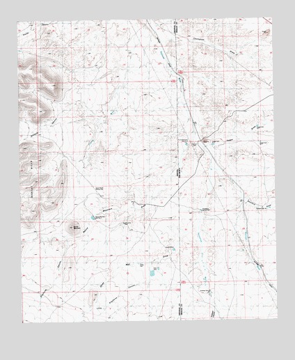
Round Mountain, AZ USGS Topographic Map
Click on map above to begin viewing in our Map Viewer.

This topographic map contains these locations and features:
Feature Name Type Latitude Longitude GNIS ID View Map
Antelope CanyonValleyN32.5079°W109.0362°665View Map
Antelope DamDamN32.5120°W109.0345°885770View Map
Antelope Draw Dention DamDamN32.5117°W109.0339°923879View Map
Dagger Dam Number 1DamN32.5726°W109.0309°897916View Map
Dagger Dam Number 2DamN32.5794°W109.0096°897917View Map
Dagger Dam Number 3DamN32.5734°W109.0084°897918View Map
Dagger DrawValleyN32.5717°W109.0339°888172View Map
Day RanchLocaleN32.5487°W109.0712°3741View Map
Gillispie CanyonValleyN32.5787°W109.1148°5043View Map
Grayhorse CanyonValleyN32.5320°W109.1026°412View Map
Grayhorse DamDamN32.5409°W109.0751°5334View Map
Horseshoe Terrace DamDamN32.5459°W109.0370°890199View Map
Horseshoe Terrace Detention DamDamN32.5434°W109.0373°923885View Map
Horseshoe WashStreamN32.5642°W109.0320°890200View Map
Lazy B Ranch Airstrip (historical)AirportN32.5551°W109.0901°22725View Map
Little Grayhorse CanyonValleyN32.5217°W109.0620°7117View Map
Olney DamDamN32.5223°W109.0689°43200View Map
Olney Well DrawValleyN32.5404°W109.0392°8984View Map
Olney Well DrawValleyN32.5404°W109.0401°892911View Map
Railroad WellWellN32.5737°W109.0398°893621View Map
Round MountainSummitN32.5390°W109.0998°10530View Map
Round Mountain Dam Number 3DamN32.5742°W109.0442°898121View Map
Round Mountain Dam Number TwoDamN32.5429°W109.0889°10533View Map
Round Mountain DrawValleyN32.5781°W109.0401°10534View Map
Stanford Dam Number 1DamN32.5465°W109.0042°898132View Map
Stanford DrawValleyN32.5626°W109.0295°895301View Map
Starvation TankLocaleN32.5431°W109.1048°22241View Map
Stateline DamDamN32.5295°W109.0501°11803View Map
Thompson DrawValleyN32.6173°W109.0562°895631View Map
Thompson DrawValleyN32.6184°W109.0564°12398View Map
Twin DamDamN32.5223°W109.0584°12940View Map

Note: Coordinates in the location and feature list above are referenced to NAD83 datum.


Copyright (C) 2008-2025 Ryan Niemi / Sunset Dynamics ... All Rights Reserved