TopoQuest Logo
Do you find TopoQuest useful?
Help keep TopoQuest running and adding new maps/features by donating!
Bitcoin:  19c7KJd3qBynnjoSw5npx9KScwjBe4ifkT
Litecoin:  LXs6TkuXGGXo1vDsWCkWVdjQX94eUKd6ui
Home View Maps Find Maps Find Places Resources & Links


Rozetta, Illinois Topographic Map

USGS Map Title: Rozetta, IL
USGS Map MRC: 40090H7
DRG (GeoTIFF) Download: o40090h7.tif


Neighboring USGS Topographic Map Quads:


  Keithsburg, IL  
41090A8
 

  Seaton, IL  
41090A7
 

  Little York, IL  
41090A6
 

  Oquawka, IL  
40090H8
 

  Rozetta, IL  
40090H7
 

  Monmouth, IL  
40090H6
 

  Gladstone, IL  
40090G8
 

  Kirkwood West, IL  
40090G7
 

  Kirkwood East, IL  
40090G6


Map MRC Location:

N41°
W91°
N41°
W90°
H8 H7 H6 H5 H4 H3 H2 H1
G8 G7 G6 G5 G4 G3 G2 G1
F8 F7 F6 F5 F4 F3 F2 F1
E8 E7 E6 E5 E4 E3 E2 E1
D8 D7 D6 D5 D4 D3 D2 D1
C8 C7 C6 C5 C4 C3 C2 C1
B8 B7 B6 B5 B4 B3 B2 B1
A8 A7 A6 A5 A4 A3 A2 A1
N40°
W91°
N40°
W90°

Rozetta, IL USGS 1:24K Topographic Map Preview:
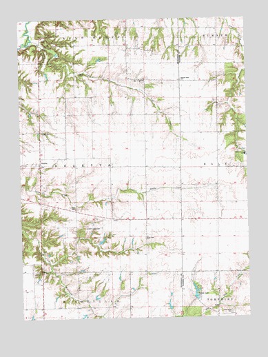
Rozetta, IL USGS Topographic Map
Click on map above to begin viewing in our Map Viewer.

This topographic map contains these locations and features:
Feature Name Type Latitude Longitude GNIS ID View Map
Aurora School (historical)SchoolN40.9600°W90.8363°403735View Map
Barr School (historical)SchoolN40.9225°W90.7662°403925View Map
Carner LakeReservoirN40.9072°W90.8306°1692583View Map
Carner Lake DamDamN40.9067°W90.8335°1692582View Map
Carner Landing Strip (historical)AirportN40.9131°W90.8354°1719522View Map
Cedar Ridge School (historical)SchoolN40.9161°W90.8068°405762View Map
Center Grove CemeteryCemeteryN40.8770°W90.7599°1719336View Map
Center Grove School (historical)SchoolN40.8936°W90.7585°405792View Map
Clyde Young LakeReservoirN40.8834°W90.7785°1692001View Map
Clyde Young Lake DamDamN40.8834°W90.7785°1692000View Map
Coghill CemeteryCemeteryN40.9770°W90.8418°406333View Map
Cumberland Presbyterian CemeteryCemeteryN40.8934°W90.8665°1968245View Map
Fairview School (historical)SchoolN40.8798°W90.8154°408225View Map
Fall CreekStreamN40.9898°W90.8699°408248View Map
Fall Creek ChurchChurchN40.9739°W90.8096°408251View Map
Hazel Dell School (historical)SchoolN40.9198°W90.8446°409982View Map
Johnson IslandIslandN40.9986°W90.7963°457972View Map
Junkins School (historical)SchoolN40.9520°W90.7665°411284View Map
Maple Grove School (historical)SchoolN40.9373°W90.8051°412947View Map
Old Number 1 School (historical)SchoolN40.9886°W90.8151°425276View Map
Pleasant Green CemeteryCemeteryN40.9746°W90.7860°1719339View Map
Pleasant Green School (historical)SchoolN40.9742°W90.7860°415777View Map
Record School (historical)SchoolN40.8795°W90.8685°416443View Map
Reed CemeteryCemeteryN40.9211°W90.8454°1719553View Map
ReedsPopulated PlaceN40.9173°W90.8254°423106View Map
RozettaPopulated PlaceN40.9417°W90.8638°423138View Map
Rozetta CemeteryCemeteryN40.9392°W90.8646°1968258View Map
Smith Creek CemeteryCemeteryN40.9086°W90.8068°1719557View Map
Stockton CemeteryCemeteryN40.9528°W90.8635°1719568View Map
Township of RozettaCivilN40.9383°W90.8446°429680View Map
Yorkwood Elementary SchoolSchoolN40.9431°W90.7515°1719342View Map
Young-Gibson LakeReservoirN40.8799°W90.7940°1691463View Map
Young-Gibson Lake DamDamN40.8784°W90.7918°1691462View Map
Youngs LakeReservoirN40.8856°W90.7794°1719343View Map

Note: Coordinates in the location and feature list above are referenced to NAD83 datum.


Copyright (C) 2008-2025 Ryan Niemi / Sunset Dynamics ... All Rights Reserved