TopoQuest Logo
Do you find TopoQuest useful?
Help keep TopoQuest running and adding new maps/features by donating!
Bitcoin:  19c7KJd3qBynnjoSw5npx9KScwjBe4ifkT
Litecoin:  LXs6TkuXGGXo1vDsWCkWVdjQX94eUKd6ui
Home View Maps Find Maps Find Places Resources & Links


Ruby Valley School, Nevada Topographic Map

USGS Map Title: Ruby Valley School, NV
USGS Map MRC: 40115E3
DRG (GeoTIFF) Download: o40115e3.tif


Neighboring USGS Topographic Map Quads:


  Lamoille, NV  
40115F4
 

  Verdi Peak, NV  
40115F3
 

  Ruby City Creek, NV  
40115F2
 

  Ruby Dome, NV  
40115E4
 

  Ruby Valley School, NV  
40115E3
 

  Smith Well, NV  
40115E2
 

  Franklin Lake NW, NV  
40115D4
 

  Franklin Lake NE, NV  
40115D3
 

  West of Delcer Buttes, NV  
40115D2


Map MRC Location:

N41°
W116°
N41°
W115°
H8 H7 H6 H5 H4 H3 H2 H1
G8 G7 G6 G5 G4 G3 G2 G1
F8 F7 F6 F5 F4 F3 F2 F1
E8 E7 E6 E5 E4 E3 E2 E1
D8 D7 D6 D5 D4 D3 D2 D1
C8 C7 C6 C5 C4 C3 C2 C1
B8 B7 B6 B5 B4 B3 B2 B1
A8 A7 A6 A5 A4 A3 A2 A1
N40°
W116°
N40°
W115°

Ruby Valley School, NV USGS 1:24K Topographic Map Preview:
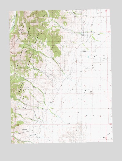
Ruby Valley School, NV USGS Topographic Map
Click on map above to begin viewing in our Map Viewer.

This topographic map contains these locations and features:
Feature Name Type Latitude Longitude GNIS ID View Map
Baxter CreekStreamN40.6210°W115.2706°858837View Map
Big MeadowFlatN40.5027°W115.2570°858897View Map
Birch CreekStreamN40.5496°W115.3131°858921View Map
Carter CreekStreamN40.5188°W115.3209°859162View Map
Chokecherry CreekStreamN40.5091°W115.3453°859246View Map
Fair Play (historical)Populated PlaceN40.6110°W115.2714°862965View Map
Fair Play Post Office (historical)Post OfficeN40.6110°W115.2714°864365View Map
Gardner RanchLocaleN40.5610°W115.3059°862746View Map
Gedney CreekStreamN40.5146°W115.3331°859777View Map
Llama Ranch AirportAirportN40.5855°W115.2980°2443857View Map
Lutts CreekStreamN40.5899°W115.2620°860443View Map
Meyers RanchLocaleN40.5944°W115.2967°862734View Map
Mose CreekStreamN40.5538°W115.3050°860650View Map
Richards RanchLocaleN40.5519°W115.3153°862743View Map
Ruby Valley School (historical)SchoolN40.5383°W115.3253°861203View Map
Schley (historical)Populated PlaceN40.5596°W115.3078°862756View Map
Schley Post Office (historical)Post OfficeN40.5596°W115.3078°864257View Map
Smith RanchLocaleN40.6030°W115.2728°862733View Map
Smith RanchLocaleN40.5196°W115.3384°862745View Map
Spring CreekStreamN40.5077°W115.3453°861541View Map
Springview School (historical)SchoolN40.5846°W115.2992°862855View Map
Sulphur Hot SpringsSpringN40.5863°W115.2859°861626View Map
Thompson CreekStreamN40.5605°W115.3064°861721View Map
Watermelon SpringSpringN40.5919°W115.3201°861924View Map
Wines CreekStreamN40.5296°W115.3267°862083View Map
Wines RanchLocaleN40.5213°W115.3373°862744View Map

Note: Coordinates in the location and feature list above are referenced to NAD83 datum.


Copyright (C) 2008-2024 Ryan Niemi / Sunset Dynamics ... All Rights Reserved