TopoQuest Logo
Do you find TopoQuest useful?
Help keep TopoQuest running and adding new maps/features by donating!
Bitcoin:  19c7KJd3qBynnjoSw5npx9KScwjBe4ifkT
Litecoin:  LXs6TkuXGGXo1vDsWCkWVdjQX94eUKd6ui
Home View Maps Find Maps Find Places Resources & Links


Ruleton, Kansas Topographic Map

USGS Map Title: Ruleton, KS
USGS Map MRC: 39101C8
DRG (GeoTIFF) Download: o39101c8.tif


Neighboring USGS Topographic Map Quads:


  Kanorado NE, KS  
39102D1
 

  Ruleton NW, KS  
39101D8
 

  Ruleton NE, KS  
39101D7
 

  Kanorado, KS  
39102C1
 

  Ruleton, KS  
39101C8
 

  Ruleton SE, KS  
39101C7
 

  Mount Sunflower NE, CO  
39102B1
 

  Horsethief Draw NW, KS  
39101B8
 

  Horsethief Draw NE, KS  
39101B7


Map MRC Location:

N40°
W102°
N40°
W101°
H8 H7 H6 H5 H4 H3 H2 H1
G8 G7 G6 G5 G4 G3 G2 G1
F8 F7 F6 F5 F4 F3 F2 F1
E8 E7 E6 E5 E4 E3 E2 E1
D8 D7 D6 D5 D4 D3 D2 D1
C8 C7 C6 C5 C4 C3 C2 C1
B8 B7 B6 B5 B4 B3 B2 B1
A8 A7 A6 A5 A4 A3 A2 A1
N39°
W102°
N39°
W101°

Ruleton, KS USGS 1:24K Topographic Map Preview:
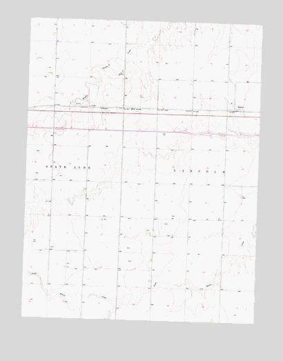
Ruleton, KS USGS Topographic Map
Click on map above to begin viewing in our Map Viewer.

This topographic map contains these locations and features:
Feature Name Type Latitude Longitude GNIS ID View Map
Frontier Agricultural Grain Elevator Number 10LocaleN39.3382°W101.8833°2695350View Map
Kansas Department of Transportation Sherman County Rest AreaLocaleN39.3286°W101.9099°2692535View Map
RuletonPopulated PlaceN39.3394°W101.8893°471240View Map
Sappa CreekStreamN39.2578°W101.9499°480388View Map
Stockholm Grain Elevator Number 1LocaleN39.3388°W101.8872°2695348View Map
Township of LincolnCivilN39.3074°W101.8934°471179View Map
Township of StatelineCivilN39.3076°W101.9989°471177View Map

Note: Coordinates in the location and feature list above are referenced to NAD83 datum.


Copyright (C) 2008-2025 Ryan Niemi / Sunset Dynamics ... All Rights Reserved