TopoQuest Logo
Do you find TopoQuest useful?
Help keep TopoQuest running and adding new maps/features by donating!
Bitcoin:  19c7KJd3qBynnjoSw5npx9KScwjBe4ifkT
Litecoin:  LXs6TkuXGGXo1vDsWCkWVdjQX94eUKd6ui
Home View Maps Find Maps Find Places Resources & Links


Rump Mountain, Maine Topographic Map

USGS Map Title: Rump Mountain, ME
USGS Map MRC: 45071B1
DRG (GeoTIFF) Download: o45071b1.tif


Neighboring USGS Topographic Map Quads:


  Prospect Hill, NH  
45071C2
 

  Moose Bog, ME  
45071C1
 

  Twin Peaks, ME  
45070C8
 

  Second Connecticut Lake, NH  
45071B2
 

  Rump Mountain, ME  
45071B1
 

  Parmachenee Lake, ME  
45070B8
 

  Magalloway Mountain, NH  
45071A2
 

  Bosebuck Mountain, ME  
45071A1
 

  Lincoln Pond, ME  
45070A8


Map MRC Location:

N46°
W72°
N46°
W71°
H8 H7 H6 H5 H4 H3 H2 H1
G8 G7 G6 G5 G4 G3 G2 G1
F8 F7 F6 F5 F4 F3 F2 F1
E8 E7 E6 E5 E4 E3 E2 E1
D8 D7 D6 D5 D4 D3 D2 D1
C8 C7 C6 C5 C4 C3 C2 C1
B8 B7 B6 B5 B4 B3 B2 B1
A8 A7 A6 A5 A4 A3 A2 A1
N45°
W72°
N45°
W71°

Rump Mountain, ME USGS 1:24K Topographic Map Preview:
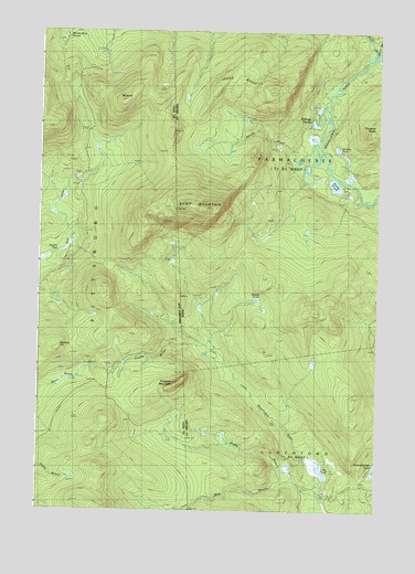
Rump Mountain, ME USGS Topographic Map
Click on map above to begin viewing in our Map Viewer.

This topographic map contains these locations and features:
Feature Name Type Latitude Longitude GNIS ID View Map
Beaman HillSummitN45.1659°W71.1212°865424View Map
Beaver PondLakeN45.1801°W71.0449°561947View Map
Bereau BrookStreamN45.2203°W71.0248°562074View Map
Billings PondsLakeN45.2260°W71.0238°562273View Map
Camp Number 32 (historical)LocaleN45.1417°W71.0712°871104View Map
Camp Number 36 (historical)LocaleN45.1645°W71.0940°871105View Map
Camp Number Thirty-Four (historical)LocaleN45.1834°W71.0731°579059View Map
Camp Number Thirty-Two (historical)LocaleN45.1412°W71.0706°579058View Map
Caribou PondLakeN45.2194°W71.0149°563536View Map
Depot Camp (historical)LocaleN45.1323°W71.0198°579060View Map
Ledge RidgeRidgeN45.2367°W71.0562°569450View Map
Long PondLakeN45.1355°W71.0199°570285View Map
Middle Branch Little Magalloway RiverStreamN45.1287°W71.0195°571215View Map
Mount KentSummitN45.2309°W71.0987°868596View Map
Norton PoolLakeN45.1922°W71.1183°868837View Map
Prospect MountainSummitN45.1579°W71.0734°869379View Map
Rump MountainSummitN45.2036°W71.0635°574587View Map
Rump PondLakeN45.2100°W71.0159°574588View Map
Second East Branch Magalloway RiverStreamN45.2434°W71.0045°575191View Map
Trestle BrookStreamN45.1673°W71.0612°577304View Map
West Branch Little Magalloway RiverStreamN45.1334°W71.0298°578060View Map

Note: Coordinates in the location and feature list above are referenced to NAD83 datum.


Copyright (C) 2008-2025 Ryan Niemi / Sunset Dynamics ... All Rights Reserved