TopoQuest Logo
Do you find TopoQuest useful?
Help keep TopoQuest running and adding new maps/features by donating!
Bitcoin:  19c7KJd3qBynnjoSw5npx9KScwjBe4ifkT
Litecoin:  LXs6TkuXGGXo1vDsWCkWVdjQX94eUKd6ui
Home View Maps Find Maps Find Places Resources & Links


Rushville, Nebraska Topographic Map

USGS Map Title: Rushville, NE
USGS Map MRC: 42102F4
DRG (GeoTIFF) Download: o42102f4.tif


Neighboring USGS Topographic Map Quads:


  Whiteclay SE, NE  
42102G5
 

  Clinton SW, NE  
42102G4
 

  Clinton, NE  
42102G3
 

  Hay Springs NE, NE  
42102F5
 

  Rushville, NE  
42102F4
 

  Rushville NE, NE  
42102F3
 

  Hay Springs SE, NE  
42102E5
 

  Rushville SW, NE  
42102E4
 

  Rushville SE, NE  
42102E3


Map MRC Location:

N43°
W103°
N43°
W102°
H8 H7 H6 H5 H4 H3 H2 H1
G8 G7 G6 G5 G4 G3 G2 G1
F8 F7 F6 F5 F4 F3 F2 F1
E8 E7 E6 E5 E4 E3 E2 E1
D8 D7 D6 D5 D4 D3 D2 D1
C8 C7 C6 C5 C4 C3 C2 C1
B8 B7 B6 B5 B4 B3 B2 B1
A8 A7 A6 A5 A4 A3 A2 A1
N42°
W103°
N42°
W102°

Rushville, NE USGS 1:24K Topographic Map Preview:
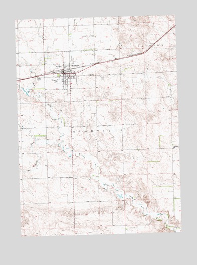
Rushville, NE USGS Topographic Map
Click on map above to begin viewing in our Map Viewer.

This topographic map contains these locations and features:
Feature Name Type Latitude Longitude GNIS ID View Map
Benschoter Memorial LibraryBuildingN42.7186°W102.4563°1832226View Map
City of RushvilleCivilN42.7134°W102.4666°2396454View Map
Fairview CemeteryCemeteryN42.7155°W102.4330°829235View Map
Farmers Co-op Elevator Company ElevatorLocaleN42.7180°W102.4685°1832231View Map
Immaculate Conception ChurchChurchN42.7183°W102.4641°1832229View Map
Lockmon RV Trailer ParkLocaleN42.7183°W102.4641°1832218View Map
Modisett AirportAirportN42.7360°W102.4416°837698View Map
Parkview Lodge Nursing HomeHospitalN42.7158°W102.4671°1832232View Map
Prairie View SchoolSchoolN42.6586°W102.4591°832381View Map
RushvilleLocaleN42.7200°W102.4635°1832234View Map
RushvillePopulated PlaceN42.7183°W102.4641°832788View Map
Rushville ClinicHospitalN42.7183°W102.4641°1832230View Map
Rushville Elementary SchoolSchoolN42.7147°W102.4613°1832224View Map
Rushville High SchoolSchoolN42.7155°W102.4599°1832223View Map
Rushville Historical MarkerParkN42.7183°W102.4641°1832219View Map
Rushville Junior High SchoolSchoolN42.7155°W102.4599°1832222View Map
Rushville Police DepartmentBuildingN42.7183°W102.4641°1832215View Map
Rushville Post OfficePost OfficeN42.7180°W102.4629°1832233View Map
Rushville Public LibraryBuildingN42.7175°W102.4610°1832220View Map
Rushville Volunteer Fire and RescueBuildingN42.7179°W102.4655°1832216View Map
Saint Marys CemeteryCemeteryN42.7171°W102.4433°833002View Map
Saint Pauls Lutheran ChurchChurchN42.7136°W102.4643°1832227View Map
Sand Ridge Golf CourseLocaleN42.7153°W102.4782°1832221View Map
Sandy Knoll SchoolSchoolN42.6739°W102.3799°833211View Map
Sheridan County CourthouseBuildingN42.7178°W102.4607°1832235View Map
Sheridan County Historical MuseumBuildingN42.7186°W102.4563°1832225View Map
Sheridan County Sheriff's OfficeBuildingN42.7178°W102.4605°1832217View Map
South Rushville Election PrecinctCivilN42.6705°W102.4192°1929297View Map
United Methodist ChurchChurchN42.7180°W102.4613°1832228View Map

Note: Coordinates in the location and feature list above are referenced to NAD83 datum.


Copyright (C) 2008-2025 Ryan Niemi / Sunset Dynamics ... All Rights Reserved