TopoQuest Logo
Do you find TopoQuest useful?
Help keep TopoQuest running and adding new maps/features by donating!
Bitcoin:  19c7KJd3qBynnjoSw5npx9KScwjBe4ifkT
Litecoin:  LXs6TkuXGGXo1vDsWCkWVdjQX94eUKd6ui
Home View Maps Find Maps Find Places Resources & Links


Bighorn Basin, California Topographic Map

USGS Map Title: Bighorn Basin, CA
USGS Map MRC: 34115G6
DRG (GeoTIFF) Download: o34115g6.tif


Neighboring USGS Topographic Map Quads:


  Glasgow, CA  
34115H7
 

  Kelso Dunes, CA  
34115H6
 

  Fountain Peak, CA  
34115H5
 

  Budweiser Wash, CA  
34115G7
 

  Bighorn Basin, CA  
34115G6
 

  Van Winkle Spring, CA  
34115G5
 

  East of Siberia, CA  
34115F7
 

  Brown Buttes, CA  
34115F6
 

  Van Winkle Wash, CA  
34115F5


Map MRC Location:

N35°
W116°
N35°
W115°
H8 H7 H6 H5 H4 H3 H2 H1
G8 G7 G6 G5 G4 G3 G2 G1
F8 F7 F6 F5 F4 F3 F2 F1
E8 E7 E6 E5 E4 E3 E2 E1
D8 D7 D6 D5 D4 D3 D2 D1
C8 C7 C6 C5 C4 C3 C2 C1
B8 B7 B6 B5 B4 B3 B2 B1
A8 A7 A6 A5 A4 A3 A2 A1
N34°
W116°
N34°
W115°

Bighorn Basin, CA USGS 1:24K Topographic Map Preview:
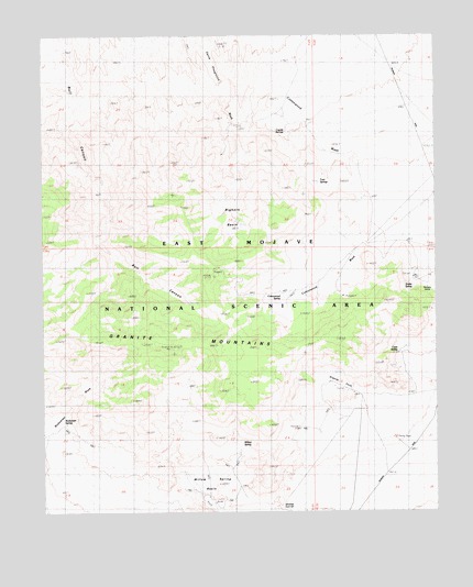
Bighorn Basin, CA USGS Topographic Map
Click on map above to begin viewing in our Map Viewer.

This topographic map contains these locations and features:
Feature Name Type Latitude Longitude GNIS ID View Map
Bighorn BasinBasinN34.8272°W115.6897°239323View Map
Budweiser SpringSpringN34.7730°W115.7443°239785View Map
Cottonwood SpringSpringN34.8056°W115.6731°240997View Map
Cove SpringSpringN34.7942°W115.6364°241011View Map
Coyote SpringsSpringN34.8499°W115.6733°241057View Map
Dorners CampLocaleN34.8086°W115.6280°241568View Map
Granite CoveValleyN34.7812°W115.6493°242909View Map
Granite MountainsRangeN34.8136°W115.7193°242916View Map
Granite PeakSummitN34.7936°W115.6953°251982View Map
Granite Peak PlateauSummitN34.7841°W115.6848°251981View Map
Silver PeakSummitN34.8105°W115.6978°251980View Map
Snake SpringSpringN34.8089°W115.6329°249617View Map
Twin SpringsSpringN34.8365°W115.6628°250752View Map
White FangSummitN34.7827°W115.6398°251979View Map
Willow SpringSpringN34.7679°W115.6875°1667111View Map
Willow Spring BasinBasinN34.7569°W115.6958°251652View Map

Note: Coordinates in the location and feature list above are referenced to NAD83 datum.


Copyright (C) 2008-2025 Ryan Niemi / Sunset Dynamics ... All Rights Reserved