TopoQuest Logo
Do you find TopoQuest useful?
Help keep TopoQuest running and adding new maps/features by donating!
Bitcoin:  19c7KJd3qBynnjoSw5npx9KScwjBe4ifkT
Litecoin:  LXs6TkuXGGXo1vDsWCkWVdjQX94eUKd6ui
Home View Maps Find Maps Find Places Resources & Links


Ryegate West, Montana Topographic Map

USGS Map Title: Ryegate West, MT
USGS Map MRC: 46109C3
DRG (GeoTIFF) Download: o46109c3.tif


Neighboring USGS Topographic Map Quads:


  Halbert Creek South, MT  
46109D4
 

  Wallum, MT  
46109D3
 

  Cushman NW, MT  
46109D2
 

  Deadmans Basin Reservoir, MT  
46109C4
 

  Ryegate West, MT  
46109C3
 

  Ryegate East, MT  
46109C2
 

  O'Brien Hill, MT  
46109B4
 

  Locomotive Butte, MT  
46109B3
 

  Mount Sinai, MT  
46109B2


Map MRC Location:

N47°
W110°
N47°
W109°
H8 H7 H6 H5 H4 H3 H2 H1
G8 G7 G6 G5 G4 G3 G2 G1
F8 F7 F6 F5 F4 F3 F2 F1
E8 E7 E6 E5 E4 E3 E2 E1
D8 D7 D6 D5 D4 D3 D2 D1
C8 C7 C6 C5 C4 C3 C2 C1
B8 B7 B6 B5 B4 B3 B2 B1
A8 A7 A6 A5 A4 A3 A2 A1
N46°
W110°
N46°
W109°

Ryegate West, MT USGS 1:24K Topographic Map Preview:
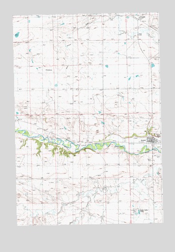
Ryegate West, MT USGS Topographic Map
Click on map above to begin viewing in our Map Viewer.

This topographic map contains these locations and features:
Feature Name Type Latitude Longitude GNIS ID View Map
06N19E01BCCC01 WellWellN46.3050°W109.2966°815281View Map
06N19E23BCDB01 WellWellN46.2572°W109.3138°814857View Map
06N20E05DA__01 WellWellN46.3000°W109.2535°815242View Map
06N20E06ADA_01 WellWellN46.3027°W109.2549°815259View Map
06N20E20BBC_01 WellWellN46.2591°W109.2541°814878View Map
Deadmans Basin Outlet CanalCanalN46.3397°W109.3338°805757View Map
Dodgeton Post Office (historical)Post OfficeN46.3069°W109.3613°1723001View Map
Dodgetown (historical)Populated PlaceN46.3069°W109.3613°1723002View Map
Farmers Elevator (historical)LocaleN46.3716°W109.2677°1723060View Map
First Golden Valley Baptist ChurchChurchN46.2972°W109.2588°1723015View Map
FranklinLocaleN46.3716°W109.2677°1722997View Map
FranklinPopulated PlaceN46.3716°W109.2677°771608View Map
Franklin Post Office (historical)Post OfficeN46.3716°W109.2680°1722996View Map
Franklin School (historical)SchoolN46.3716°W109.2677°1723024View Map
Golden Valley ColonyPopulated PlaceN46.2575°W109.2743°805756View Map
Golden Valley Colony SchoolSchoolN46.2575°W109.2743°1723070View Map
Golden Valley County Sheriff's OfficeBuildingN46.2981°W109.2581°1723019View Map
Golden Valley Court HouseBuildingN46.2983°W109.2580°1723021View Map
Rock CreekStreamN46.2661°W109.3146°775847View Map
Rocky Mountain Elevator (historical)LocaleN46.3716°W109.2677°1723061View Map
RyegatePopulated PlaceN46.2972°W109.2588°776044View Map
Ryegate (historical)LocaleN46.2972°W109.2577°1722981View Map
Ryegate AirportAirportN46.2903°W109.2528°806516View Map
Ryegate AmbulanceBuildingN46.2979°W109.2586°2637904View Map
Ryegate Assembly of God ChurchChurchN46.2972°W109.2588°1723013View Map
Ryegate CemeteryCemeteryN46.2875°W109.2568°1723022View Map
Ryegate City ParkParkN46.2977°W109.2574°1723018View Map
Ryegate Methodist ChurchChurchN46.2972°W109.2588°1723014View Map
Ryegate Police DepartmentBuildingN46.2983°W109.2580°1723020View Map
Ryegate Post OfficePost OfficeN46.2983°W109.2560°1722982View Map
Ryegate Public SchoolsSchoolN46.2961°W109.2585°1723017View Map
Ryegate Volunteer Fire DepartmentBuildingN46.2979°W109.2582°1723012View Map
Saint Mathias Catholic ChurchChurchN46.2972°W109.2588°1723016View Map
Schaffs RV CourtLocaleN46.2972°W109.2588°1722520View Map
Stella Number 1 DamDamN46.3516°W109.2924°797817View Map
Town of RyegateCivilN46.2984°W109.2537°2412589View Map

Note: Coordinates in the location and feature list above are referenced to NAD83 datum.


Copyright (C) 2008-2025 Ryan Niemi / Sunset Dynamics ... All Rights Reserved