TopoQuest Logo
Do you find TopoQuest useful?
Help keep TopoQuest running and adding new maps/features by donating!
Bitcoin:  19c7KJd3qBynnjoSw5npx9KScwjBe4ifkT
Litecoin:  LXs6TkuXGGXo1vDsWCkWVdjQX94eUKd6ui
Home View Maps Find Maps Find Places Resources & Links


Saint Ansgar, Iowa Topographic Map

USGS Map Title: Saint Ansgar, IA
USGS Map MRC: 43092D8
DRG (GeoTIFF) Download: o43092d8.tif


Neighboring USGS Topographic Map Quads:


  London, MN  
43093E1
 

  Lyle, MN  
43092E8
 

  Rose Creek, MN  
43092E7
 

  Carpenter, IA  
43093D1
 

  Saint Ansgar, IA  
43092D8
 

  Stacyville, IA  
43092D7
 

  Grafton, IA  
43093C1
 

  Osage SW, IA  
43092C8
 

  Osage, IA  
43092C7


Map MRC Location:

N44°
W93°
N44°
W92°
H8 H7 H6 H5 H4 H3 H2 H1
G8 G7 G6 G5 G4 G3 G2 G1
F8 F7 F6 F5 F4 F3 F2 F1
E8 E7 E6 E5 E4 E3 E2 E1
D8 D7 D6 D5 D4 D3 D2 D1
C8 C7 C6 C5 C4 C3 C2 C1
B8 B7 B6 B5 B4 B3 B2 B1
A8 A7 A6 A5 A4 A3 A2 A1
N43°
W93°
N43°
W92°

Saint Ansgar, IA USGS 1:24K Topographic Map Preview:
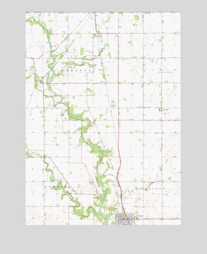
Saint Ansgar, IA USGS Topographic Map
Click on map above to begin viewing in our Map Viewer.

This topographic map contains these locations and features:
Feature Name Type Latitude Longitude GNIS ID View Map
Acorn Park Golf and RecreationLocaleN43.3889°W92.9405°1944898View Map
Advance Chiropractic ClinicHospitalN43.3786°W92.9235°1944901View Map
Cedar Block Wildlife AreaParkN43.4514°W92.9752°1944855View Map
City of Saint AnsgarCivilN43.3798°W92.9178°2396470View Map
Clausen City ParkParkN43.3800°W92.9235°1944897View Map
Deer CreekStreamN43.3811°W92.9399°455860View Map
Farley CemeteryCemeteryN43.4825°W92.9404°456540View Map
First Lutheran CemeteryCemeteryN43.3841°W92.9196°1944900View Map
First Lutheran ChurchChurchN43.3800°W92.9258°1944904View Map
Hamlin Garland Wildlife AreaParkN43.4000°W92.9238°1944854View Map
Hustad Post Office (historical)Post OfficeN43.4877°W92.9419°1944838View Map
Immanuel Lutheran ChurchChurchN43.3772°W92.9219°1944905View Map
McKinley CemeteryCemeteryN43.3777°W92.9335°1944939View Map
Mitchell County Health CenterHospitalN43.3783°W92.9227°1944902View Map
MonaPopulated PlaceN43.4872°W92.9413°459167View Map
MonaLocaleN43.4877°W92.9427°1944837View Map
Mona Census Designated PlaceCensusN43.4833°W92.9501°2583489View Map
Nelson Paradise Wildlife AreaParkN43.4722°W92.9585°1944856View Map
NewburgLocaleN43.3897°W92.9433°463977View Map
Newburgh Post Office (historical)Post OfficeN43.3897°W92.9433°1944828View Map
Nissen Public LibraryBuildingN43.3777°W92.9205°1944891View Map
Ogden CemeteryCemeteryN43.4367°W92.9679°459807View Map
OtrantoLocaleN43.4589°W92.9919°1944956View Map
OtrantoPopulated PlaceN43.4583°W92.9858°459920View Map
Otranto BridgeBridgeN43.4583°W92.9816°1944955View Map
Otranto Census Designated PlaceCensusN43.4609°W92.9862°2583491View Map
Otranto ParkParkN43.4597°W92.9810°459921View Map
Otranto Post Office (historical)Post OfficeN43.4586°W92.9919°1944825View Map
Otter CreekStreamN43.4625°W92.9763°649044View Map
Pleasant Hill CemeteryCemeteryN43.4769°W92.9469°460259View Map
Priem CemeteryCemeteryN43.3869°W92.9749°460448View Map
Rustad CemeteryCemeteryN43.4586°W92.9402°460865View Map
Saint AnsgarLocaleN43.3758°W92.9169°1944896View Map
Saint AnsgarPopulated PlaceN43.3783°W92.9188°460929View Map
Saint Ansgar Baptist ChurchChurchN43.3816°W92.9163°1944908View Map
Saint Ansgar Catholic ChurchChurchN43.3780°W92.9269°1944907View Map
Saint Ansgar CemeteryCemeteryN43.3776°W92.9095°1944899View Map
Saint Ansgar City HallBuildingN43.3780°W92.9213°1944894View Map
Saint Ansgar City Police DepartmentBuildingN43.3783°W92.9214°1944893View Map
Saint Ansgar Elementary SchoolSchoolN43.3772°W92.9233°1944909View Map
Saint Ansgar Fire DepartmentBuildingN43.3787°W92.9192°1944895View Map
Saint Ansgar Good Samaritan CenterHospitalN43.3791°W92.9099°1944903View Map
Saint Ansgar Post OfficePost OfficeN43.3780°W92.9213°1944892View Map
Saint Ansgar Rescue ServiceBuildingN43.3787°W92.9197°2599754View Map
Saint Peter CemeteryCemeteryN43.4404°W92.8900°461314View Map
Saint Peter Lutheran ChurchChurchN43.4422°W92.8905°1944920View Map
Stacyville JunctionPopulated PlaceN43.4458°W92.9327°464757View Map
ToetervilleLocaleN43.4433°W92.8919°1944919View Map
ToetervillePopulated PlaceN43.4422°W92.8905°462270View Map
Toeterville Census Designated PlaceCensusN43.4401°W92.8880°2583494View Map
Toeterville Post Office (historical)Post OfficeN43.4422°W92.8905°1944921View Map
Township of NewburgCivilN43.3835°W92.9791°468430View Map
Township of OtrantoCivilN43.4644°W92.9649°468483View Map
Township of Saint AnsgarCivilN43.3961°W92.8808°468651View Map
Turtle CreekStreamN43.3791°W92.9344°462388View Map
United Methodist ChurchChurchN43.3780°W92.9244°1944906View Map

Note: Coordinates in the location and feature list above are referenced to NAD83 datum.


Copyright (C) 2008-2024 Ryan Niemi / Sunset Dynamics ... All Rights Reserved